
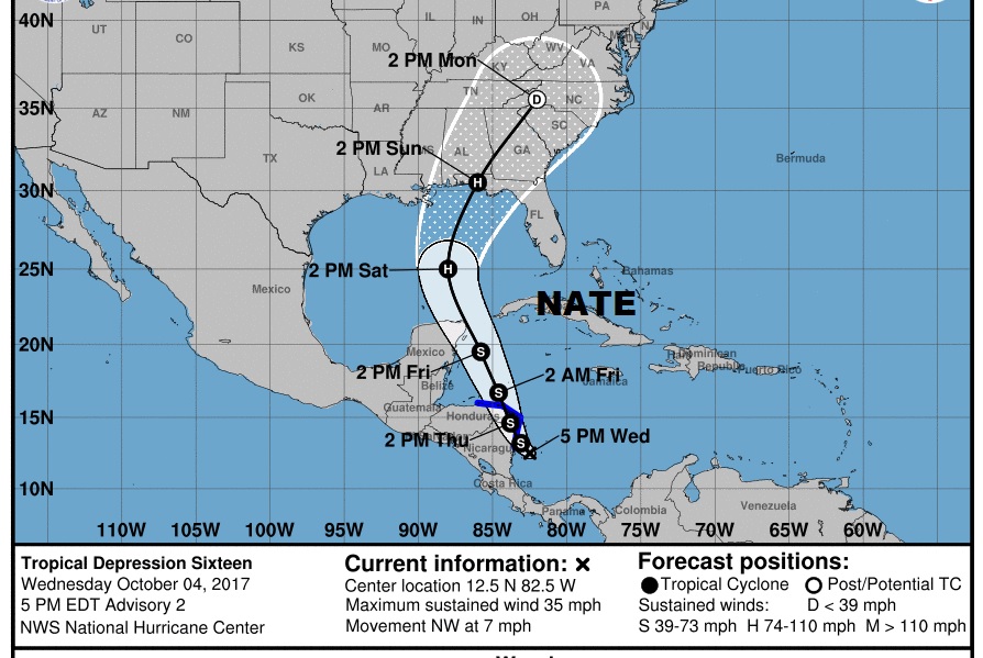
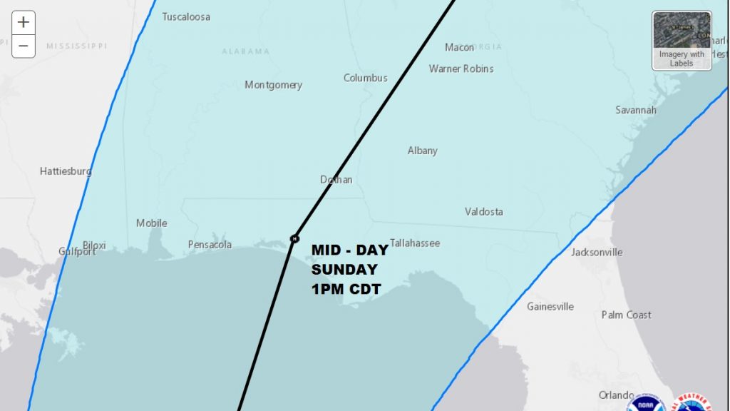
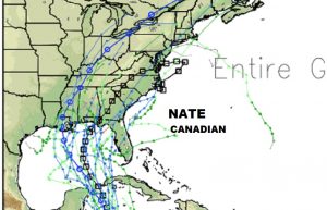
New NHC advisory keeps Tropical Depression 16 just below tropical storm strength. The system will become Nate probably later this evening. It is likely to eventually become a hurricane, and the current forecast has Nate coming shore, perhaps mid-day Sunday as a Cat 1 or Cat 2 hurricane along the NW Florida coast, then cut across SE Alabama into Georgia. It’s important to note that nearly all of Alabama is in the cone of uncertainty and there is a very good chance that we will be dealing with a significant impact from Nate over the weekend especially Sunday into Sunday evening, before the storm rapidly accelerates into Georgia and northeast. These October systems move quickly. You may want to reconsider or adjust your plans for the weekend accordingly. Here’s the latest NHC Forecast Cone.
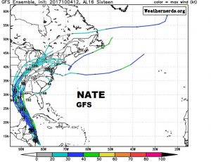
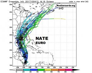
MODEL DIFFERENCES: Significant differences continue with the major models, as the models grasp to get a handle of the system’s future track and timing. Here’s the main spaghetti model page. It shows a large model spread from west to east, but with Alabama kind of in the middle.
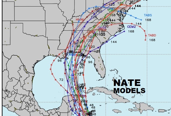
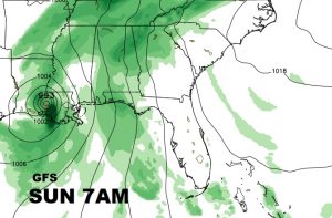
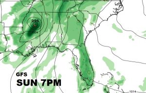
The farthest west global model is the GFS, which takes Nate into Louisiana Sunday morning, then rapidly northeast to NE Mississippi on Sunday evening.
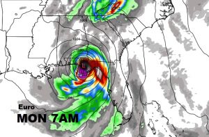
The farthest east model is the Euro. The Euro is the model, which, hands down, has had the best track record this year. It takes the system to northwest Florida, near Panama City, but slower than the other models, on Monday morning. The, the Euro takes Nate to near Dothan at 1PM and into west central Georgia Monday evening.

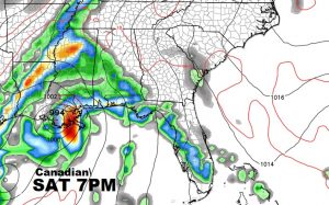
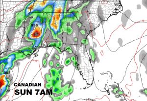
The other global model, is the Canadian. It’s track is just a little east of the GFS, but it has a faster timetable, taking the system to the LA coast Saturday night, then rapidly northeast.
The models should start coming together much closer when Recon data is ingested into futu model runs. We should see more of a consensus perhaps bu the 00Z model run this evening/tonight.
I will have another complete update on your morning video tomorrow morning, which should be posted by 4:45AM. Stay in touch with the latest.
–Rich