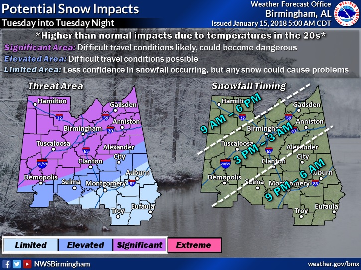
UPDATE ON TUESDAY SNOWFALL POTENTIAL:
Helpful graphic from NWS on the timing aspect and possible impacts of the light snow in Alabama tomorrow and tomorrow night. Although accumulation is expected to be very limited, especially in central AL, even a little but could have an impact on travel #alwx
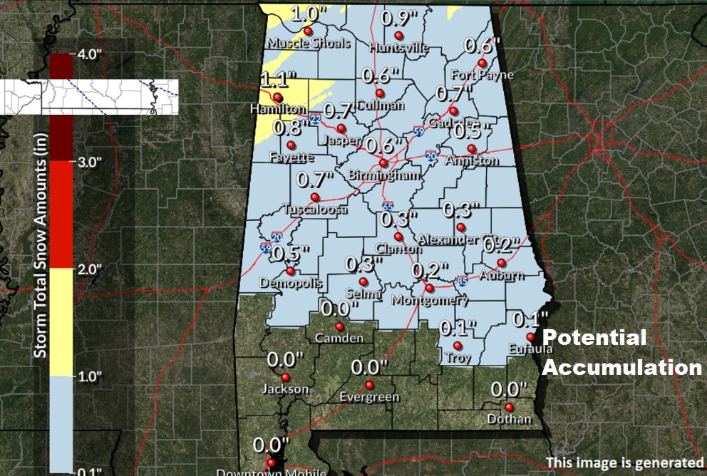
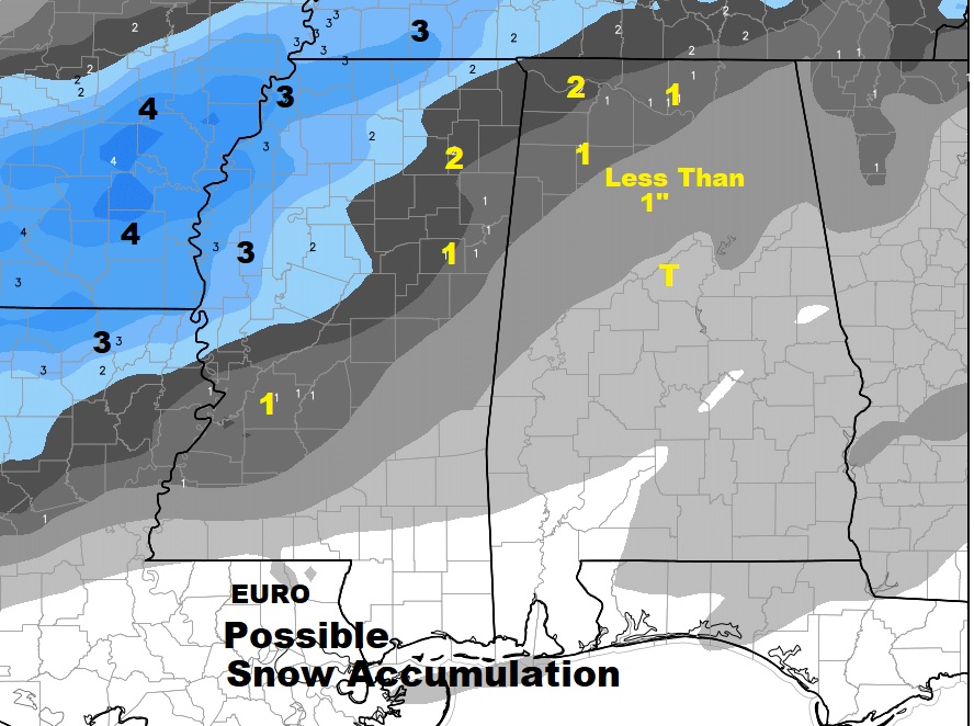
This map could change with new model data, but here’s a “guestamation” on potential snow accumulation in Alabama tomorrow and tomorrow evening from perhaps an inch in the NW counties, to barely a trace in south central Alabama. (subject to be updated)
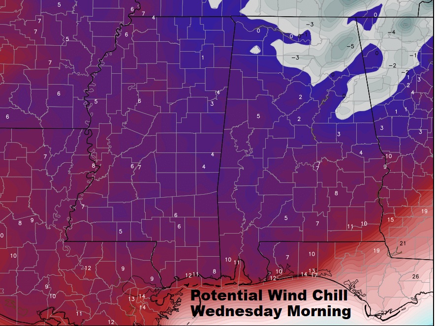
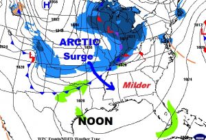
With a new surge Arctic Air heading southward into the state, one of the big stories, besides the light snow threat is the cold. With lows in the upper teens by Wednesday morning, potential wind chills will drop to single digits even deep into south Alabama. #alwx
Now..here’s the rest of the previous update from this morning:
—-
Good morning! Enjoy a slightly milder day today, on this MLK holiday. Another Arctic surge is on the way, with brutally cold air, headed in our direction. Parts of our state are under a Winter Storm Watch. But, will there be any snowflakes into central & south Alabama? I’ll show you more than one computer model, as we try to nail down a difficult forecast. Plus, who’s ready for a January Thaw? We had a “teaser” last week. I’ll show you a Thaw that may have some lasting effects. Lots of good information on this Monday morning edition of your personal weather briefing.
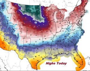
Today will be briefly milder, with highs in the lower 50’s, before more arctic air arrives tomorrow.
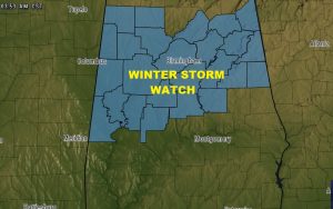
Tomorrow morning the Arctic Front enters north Alabama and heads southward. There is snow behind the front. Parts of north and north central Alabama is under a Winter Storm Watch for now, just as a precaution.
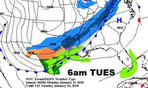
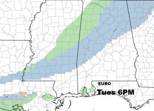
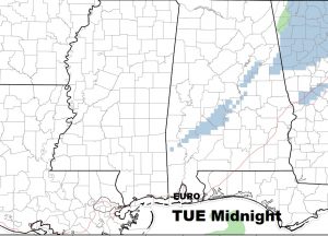
The chances of many of us in south central Alabama seeing snow is rather small.. Most shows the band of light snow falling apart once it gets closer to the I-85 corridor.
There is certainly a possibility that parts of north Alabama could see a minor snow accumulation on Tuesday. For moist of the state accumulation would be little or none.
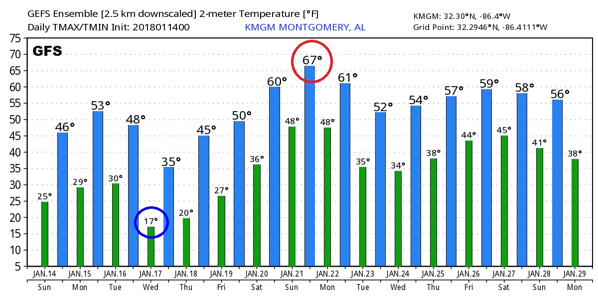
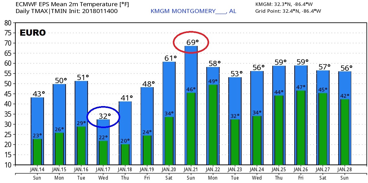
The Coldest day will be Wednesday. The coldest morning, in the teens, will be Wednesday and Thursday. A warming trend begins Friday through Sunday.
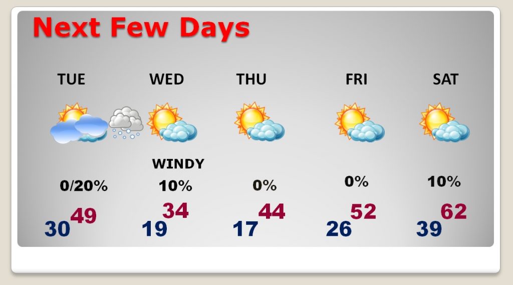
Next decent chance of rain arrives Sunday night.
—
The Global models continue to suggest an extended period of milder weather begins this week and could stick around from several days, through the end of January and even spilling into February.