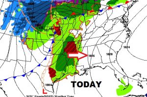
All eyes on that formidable storm system which will be affecting Alabama starting tomorrow. Unfortunately, there are still many remaining questions on how the severe weather threat will unfold, including questions of timing and strength, with mush disagreement among the models…still. I’ll do my best to sort it out for you on this video. I’ll update how much rain could fall, and look at the new drought monitor map. Are you ready for another drastic cool-down behind the storm system? Here we go again. Lots of good information on your Friday morning personal weather briefing.
The big storm system is out to the west of us today, but we are quiet, with a breezy warm day ahead.
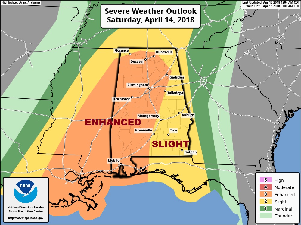
Local NWS office in BHM highlights the ENHANCED risk area from Dempolis and Clanton and Alex City southward. This where the greatest threat of tornadoes will exist. As you see on the timelines, there is much uncertainty, thus the incredibly long severe weather windows. It could, indeed, be a very long day and night in Alabama tomorrow.
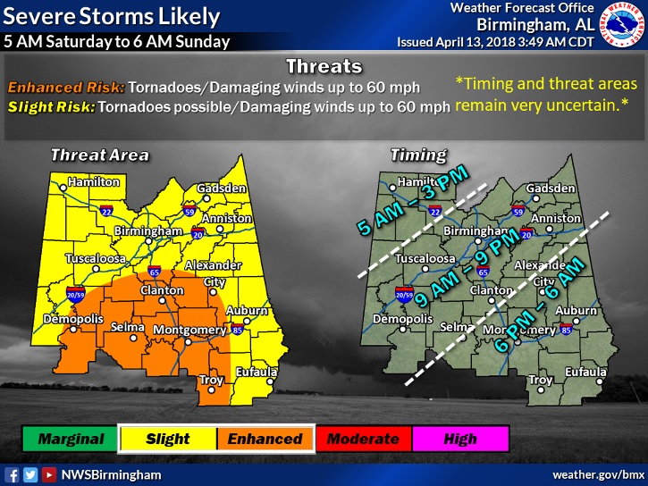
The Storm Prediction Center likes the idea of the ENHANCED risk area centered on west Alabama, generally west of I-65.
After the storm system, once again, much cooler air funnels into Alabama with a couple of very cool days, and very chilly nights.
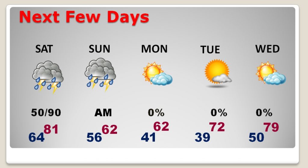
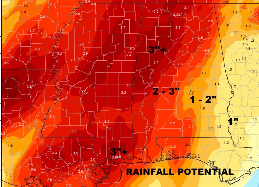
Some very beneficial rain is possible.