
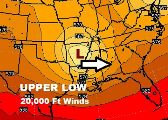
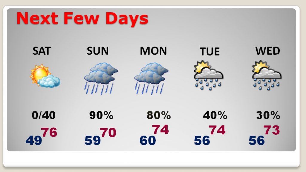
Enjoy today. It’ll the last dry day for several days. A slow-moving “Upper Low” will migrate eastward tomorrow and Monday, with a lot of rain and perhaps a few thunderstorms. Rainfall amounts could significant, as you will see further down on this blog update.
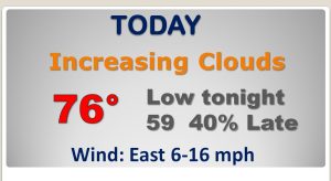
TODAY: A nice Saturday is in store, for many, many festivals & events today. Partly sunny. But, clouds will be increasing during the day. Comfortable. High near 76. Cloudy tonight, but if you have evening plans, we will be dry. Showers hold off until the wee hours of Sunday morning. Mild tonight. Overnight low 59.
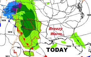
SUNDAY STORM SET-UP: Complex set-up, involving an upper level “closed low”. Meanwhile, at the surface, low pressure and two fronts will affect Alabama. First, a northward moving warm front, followed by a low pressure area and cold front. The warm front may have trouble moving very far northward tomorrow. But, south of that front is where some stronger thunderstorms may occur.
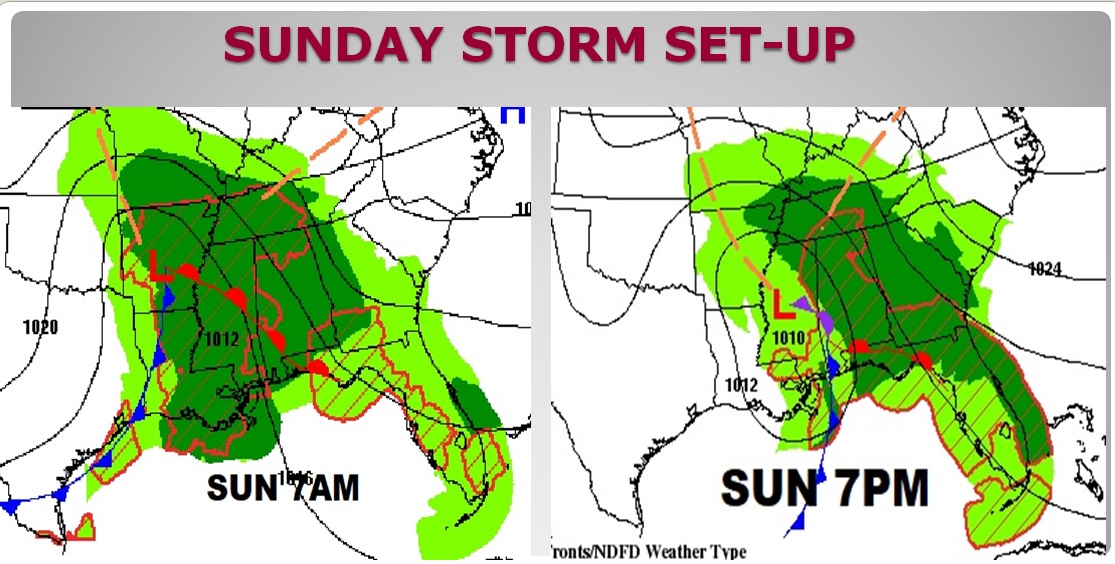
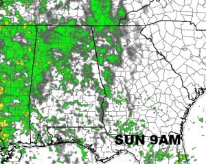
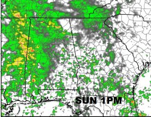
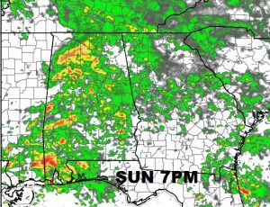
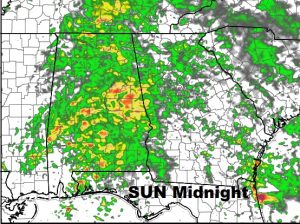
FUTURE RADAR: Here’s just a few snapshots, which will give you a sense of the widespread nature of the rain. Notice how the radar gets busier and the rain becomes heavier toward Sunday evening and Sunday night.
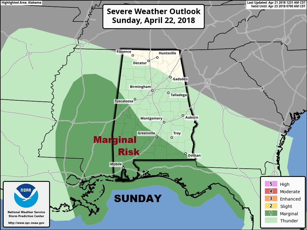
A FEW STRONG STORMS?: Along and south of the warm front, the air will be most unstable. The Storm Prediction Center shows a Marginal Severe Weather Risk over western and SW Alabama tomorrow and tomorrow evening. Damaging wind gusts are the main risk. This is a low end severe risk.
NEXT FEW DAYS: Nice today, but then it gets wet from time to time for several days. The bulk of the heaviest rain will be Sunday and Monday, but the risk of showers will be around through mid week and possibly beyond.
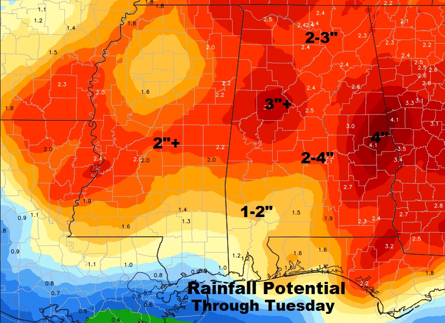
RAINFALL POTENTIAL?: Some of us in central Alabama could easily see 2-4” of rain, but a few spots in eastern and SE Alabama could see more than 4”. That should go a long way toward erasing the remaining drought.
—
Have a GREAT WEEKEND! I’ll have another important, complete Blog Update by dawn Sunday morning as we refine and update the storm details and risks.
Rich