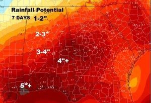
Good Morning! … All eyes on Invest 90-L, the tropical disturbance in the Caribbean, which will lift northward into the Gulf. I have a lot of good information this morning, as we try to figure out the fate of this tropical system, and how it could affect vacation plans for countless thousands over the Memorial Day Holiday Weekend. I’ll also show you potential rainfall totals which will raise some eyebrows for sure. Hope you have a couple of minutes to watch this Wednesday morning weather video.
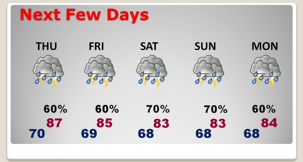
Flash flooding overnight in Lee county. Several flooded homes and roads. Today, scattered to numerous showers and storms will be around again with locally heavy downpours, again.
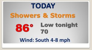
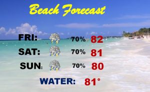
Numerous showers and thunderstorms will continue for the next several days, through the holiday weekend for here and the beaches.
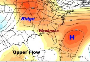
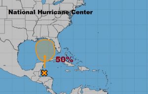
National Hurricane Center gives Invest 90-L a 50% chance of development into a Depression or Tropical Storm Alberto over the next 5 days in the eastern or central Gulf.
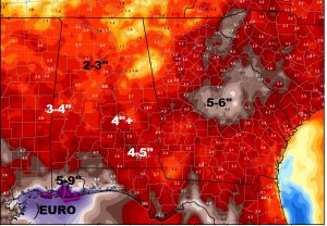
The Euro model is farther west, with most tracks through Louisiana into Mississippi, putting Alabama on the very wet side of this system.
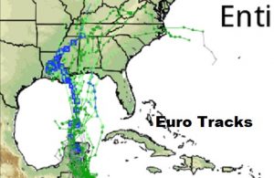
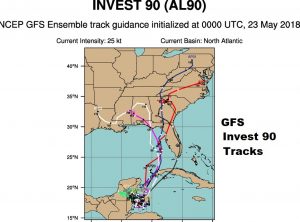
The GFS likes the idea of farther east track through the eastern Gulf or Florida.
Depending on which model you believe, rainfall amounts could be excessive over a wide multi-state area, particularly heavy down on all the beaches…not just some beaches.