
4;00PM NHC Update:
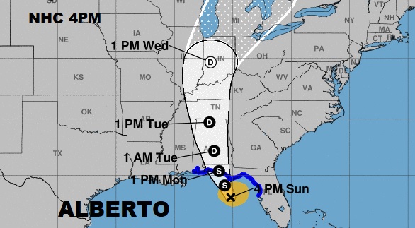
Alberto, still with winds of 50 mph, has made slight, and expected, turn toward the north-northwest. It’s located 120 miles south of Apalachicola, moving NNW at 12. Pressure 994 millibars. (no change) There is evidence that some drier air from the west is trying to wrap into the system. This would likely inhibit further intensification. The system will likely make landfall on the northern Gulf coast Monday. However, the tropical storm conditions will begin well in advance of landfall. Alberto will move northward into Alabama Monday afternoon, and then become weaken to a depression Monday night or Tuesday. Extremely heavy rainfall will cause localized flash flooding. Strong gusty winds will bring down tree limbs and small trees. Spin up tornadoes are possible, and are very common with a landfalling tropical system. Here’s the latest NHC forecast cone. It hasn’t changed much from the previous forecast.
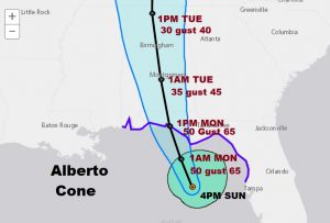
The storm will make landfall along the Florida panhandle Monday with winds of 50 mph gusting to 65, and then move northward into south Alabama. It will be a depression near Montgomery late Monday night and move into north Alabama Tuesday.

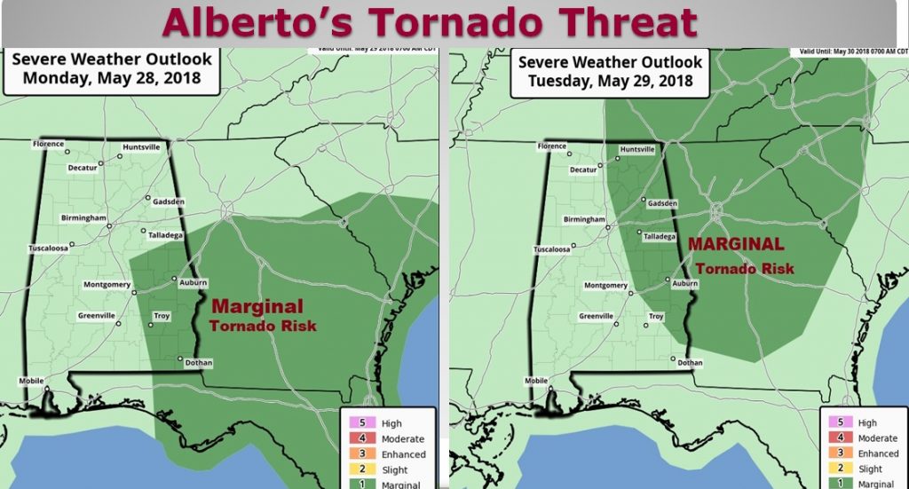
Tornadoes are possible on the right side of the storm’s track through Southeast and east Alabama Monday, and lifting farther north into east and northeast Alabama Tuesday.
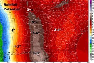
Rainfall amounts could be rather excessive, causing flash flooding in spots. Some spots, even in central Alabama could see more than 5″/
My next complete blog update will be first thing in the morning by about dawn. Have a good night. Stay weather aware. Download our weather app for your phone or tablet. Just search Rich Thomas Weather in the app store.
Rich