
After a rare,nice break, earlier in the week, summertime heat & humidity is back. Rain chances over the weekend are small, but not zero. Good Morning from the National Weather Association Conference in St. Louis. (an impressive thunderstorm is underway as I type this)
Another big high pressure “heat bubble” is starting to influence Alabama’s weather again. Typically that means that means showers & storms will be in short supply. It might be time to get the sprinklers out.
I see the airport had a shower yesterday evening with .08” and dewpoints were back in the middle 70’s. OUCH.
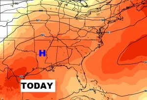
Here’s what’s happening up at 20,000 Ft. That upper high to the west of us is spreading it’s wings. That spells heat and not a lot of storms.
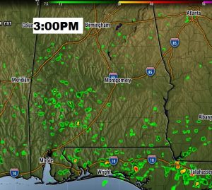
TODAY: Rain chances are not zero, but rather small. I have the rain chances for most of us at or below 20%. Rain chances are a little better across the southern strip of counties and in some of the western counties, like Marengo. High today around 92, low tonight 73. Here’s a Future Radar example snapshot showing you how limited the rain coverage should be at mid afternoon.
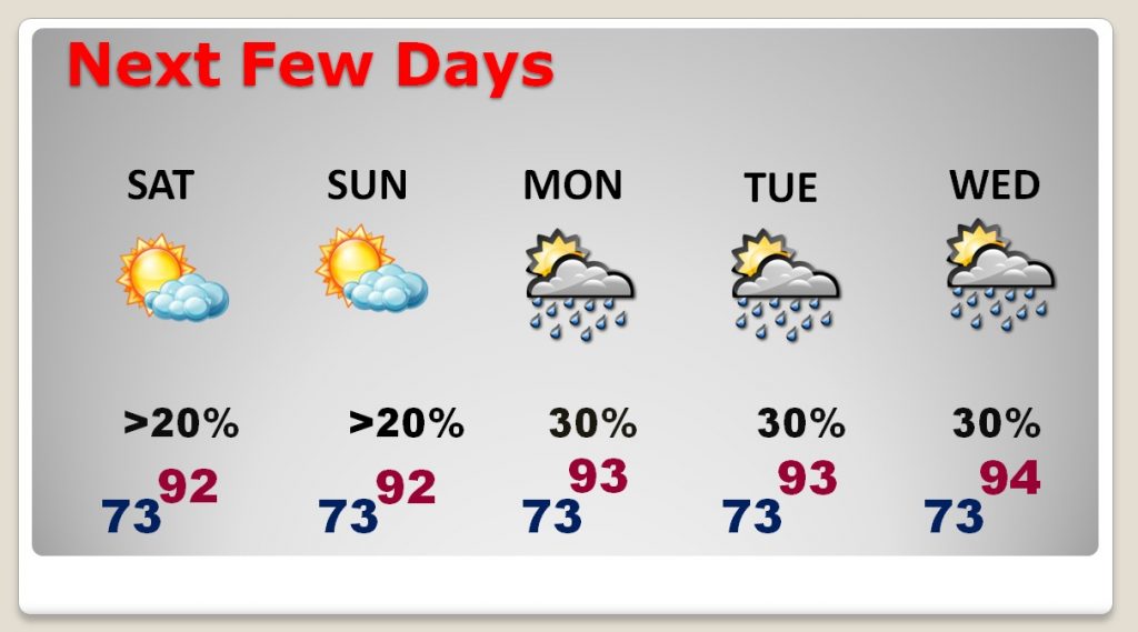
NEXT FEW DAYS: The forecast is very routine for the next few days, through mid week. Highs will range from the low to mid 90’s. Widely scattered storms are possible, but the better rain chances hold off until later in the week.
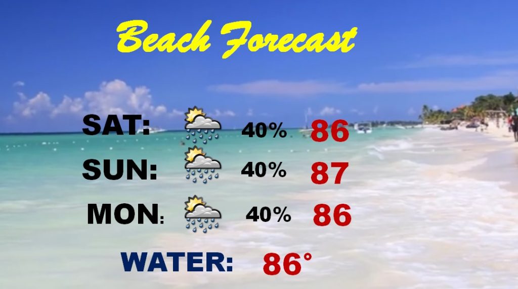
BEACH FORECAST: The “seabreeze front” will be a player today and tomorrow, and that’s why I took the rain chances a little higher..into the 40% range. But, all in all, a fairly decent beach forecast. Typical for August.
THE TROPICS: Nada. There is absolutely nothing I can see to worry about in the week ahead
—
I’m planning another Blog update first thing Sunday morning, from here in St. Louis. The next complete video will be Monday morning. Have a nice weekend!
Rich