
Welcome to September! Rain chances today, and over the next few days. For many of us, the forecast will be rather routine through Monday with widely scattered to scattered storms. If you are beach-bound, the rain chances are much better. As we ease into the week ahead, we will be paying close attention to possible tropical development in the north central Gulf. Read more about this below. Interest is growing.
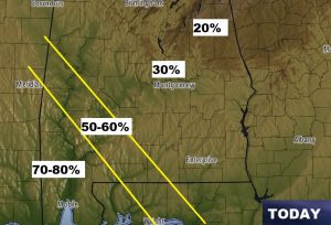
TODAY: Your rain chance today depends on where you live. The map below shows up to 80% rain chance near Mobile & Gulf Shores, scaling back to maybe only 20-30% in far east Alabama. Highs will be 90-92. Low tonight 72.
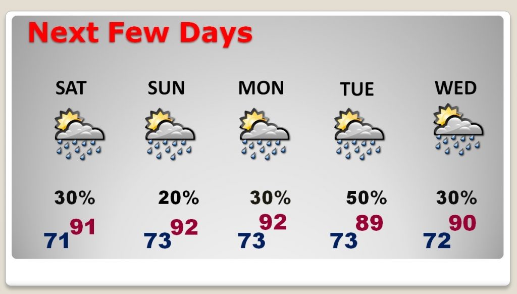
NEXT FEW DAYS: Storms will be will be rather widely scattered for the rest of the Labor Day weekend. By, Tuesday, however, Gulf developments will ramp up the rain chances. In fact, rain chances will be much higher, the farther south you live. The Tuesday/Wednesday forecast is highly subject to revision.
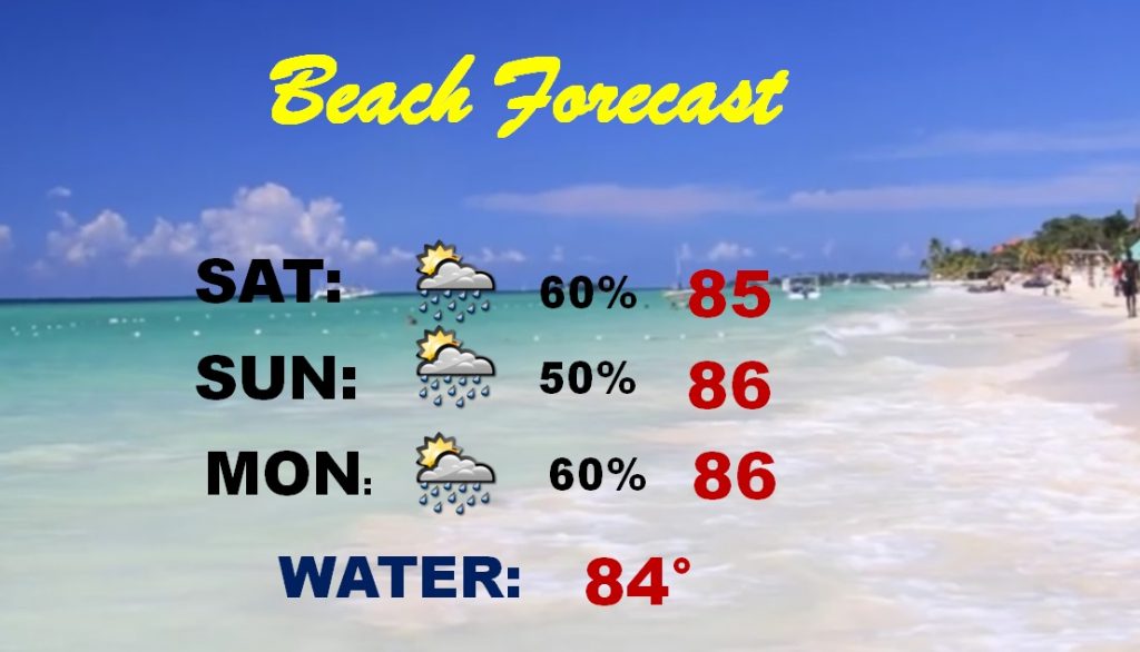
BEACH FORECAST: There’s no way to sugar-coat the beach forecast. It’s not good. In fact, I have listed a 60% rain chance for today. That’s an average number across the beaches. But, the chances are actually higher on the Alabama coast. The higher than normal chances continue through Monday. Then, by Tuesday…all eyes on the Gulf for tropical development. Conditions will deteriorate on the coast.
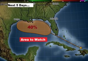
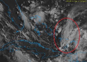
THE TROPICS: We will focus on the tropical wave north of Haiti, heading towards the Bahamas, south Florida and eventually the Gulf. While the National Hurricane Center has now elevated the chance development over the next 5 days to a medium 40%. I suspect that number will continue to rise.
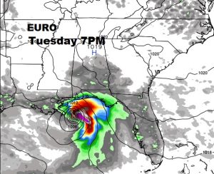
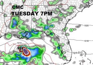
THE MODELS: Interest/concerns grows with each model run. The Euro model (ECMWF) continues to be the most bullish of the models, and has been for a few days, on development and most farthest north on potential track. The Canadian model is also on board with this system now, but farther south with the track. The American GFS hasn’t jumped on the bus yet. Here’s a couple of snapshot from the Euro and Canadian and 7PM Tuesday night.
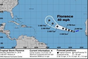
ELSEWHERE: Tropical Storm Florence is minimal tropical storm with 40 mph winds, in the tropical Atlantic. We don’t care about Florence or her future.
—
Happy Football Saturday! There will be another Blog update first thing Sunday morning. Monday morning, Labor Day, there will be either a Blog Update or a Special Video, depending on the gravity of the situation in the Gulf. Have a nice weekend!
Rich