
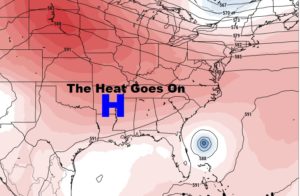
The update this morning is very short and sweet. There are simply no big changes from yesterday’s update. So, I have updated the numbers for you for the week ahead. The big upper Heatwave high is still in place across the South. That spells more Heat, and unfortunately the chance for precious raindrops is not good.
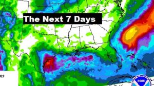
Here’s the rain prospects for the next 7 days. NOT good across the South.
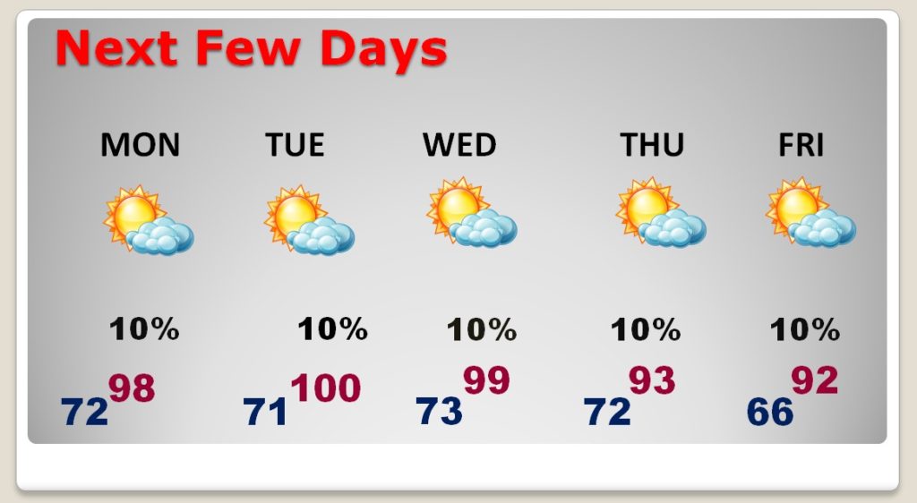
TODAY: ..Another Mostly Sunny…hot day. Rain chance about 10%. High 97. Low tonight 72.
NEXT FEW DAYS: We’ll tease 100 degrees through mid week. Perhaps not quite as hot late week. Rain chances continue very small.
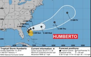
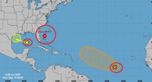
TROPICAL UPDATE: The track of Humberto continues to track this system well off the SE coast. And into the Atlantic. Expected to become a hurricane next 24 hours. Elsewhere, that Area to Watch in the Atlantic now has a 60% chance of development. The Gulf Area to Watch has 20% chance of development as it tracks westward.
—
I will have a video update for you first thing tomorrow morning at 4:45AM. We’ll take a more extensive look at the future. When can we expect rain? When can we expect heat relief? Have a nice Sunday!
–Rich