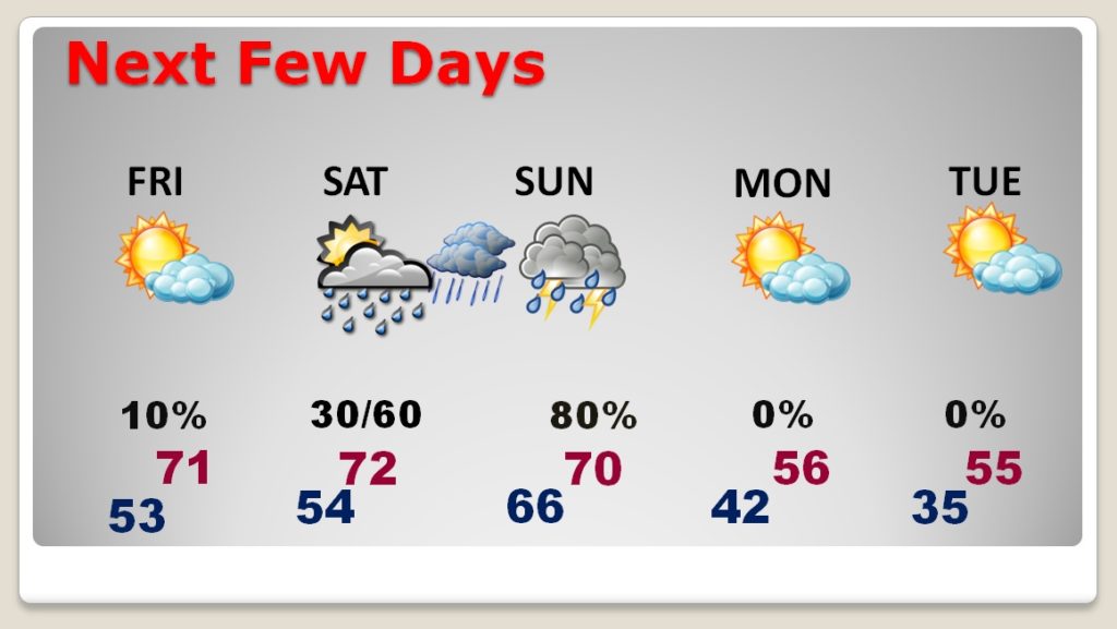
Good Morning! What a phenomenal pattern on this holiday week. Our string of 70 plus degrees days will continue for 3-4 more days, before a big change. So, if you’ll be out at the store, returning gifts, or picking up on bargains today…our Spring-like warmth will continue. On this video, I’ll bring you up to date on that weekend storm system. The timing has changed. And, what about New Years? Will another storm system dampen plans on New Years Eve and New Years Day?
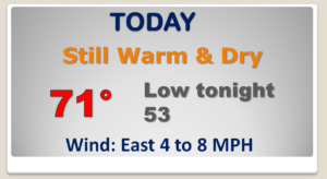
Good bit of high cloudiness today, but still warm & dry. Once again our high will likely surpass 70°.
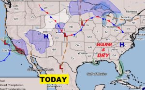
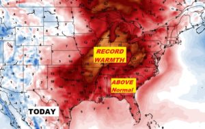
The Phenomenal Christmas Week Warmth covers much of the eastern half of the nation. In some places it is record warmth.
Next storm system brings in scattered showers and thunderstorms Saturday night into Sunday. Could this become a Marginal Severe Weather Threat situation. We are closely monitoring.
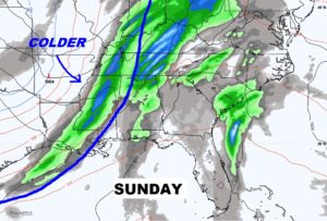
The phenomenal warmth continues for a few more days. Storm system Saturday night into Sunday. Much colder Monday.
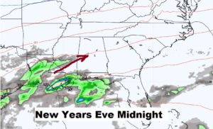
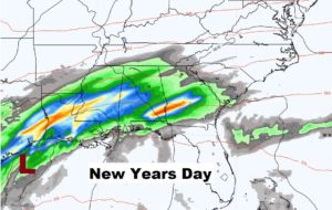
Next storm system could arrive late New Years Eve night, leading to a WET first day of 2020.
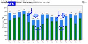
The GFS Raw Model temperature guidance gives us a general idea of when the next two cold fronts arrive. One next Sunday/Monday. Another around Jan. 5/6th.