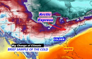
Happy Valentine’s Day! What a big temperature plunge in the last 24 hours. Alabama we’ll get only a tiny ‘sample’ of some brutally cold arctic air which will only ‘side-swipe’ our state. We are headed for a sub-freezing night tonight.
So, how long will we stay dry? I’ll update you on the weekend prospects, and we’ll take a peek into a potentially wet week ahead next week. I’ll show you how much rain could fall, and I have the updated River Flood Map, too.
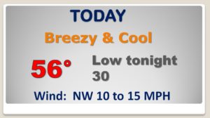
What a big change in 24 hours! We’re only in the mid 50’s today. The breeze will make it seem colder. We have a sub-freezing night ahead tonight..
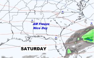
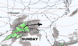
Saturday looks good, After a freezing start we’ll be up near 60 in the afternoon. Small rain chance Sunday.
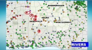
Rivers still running high, particularly in West Alabama.
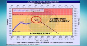
The Alabama River at Montgomery will peak on Saturday, about 6 feet above flood stage.
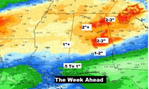
Another wet week ahead in Alabama. Here’s projected rainfall next week.