
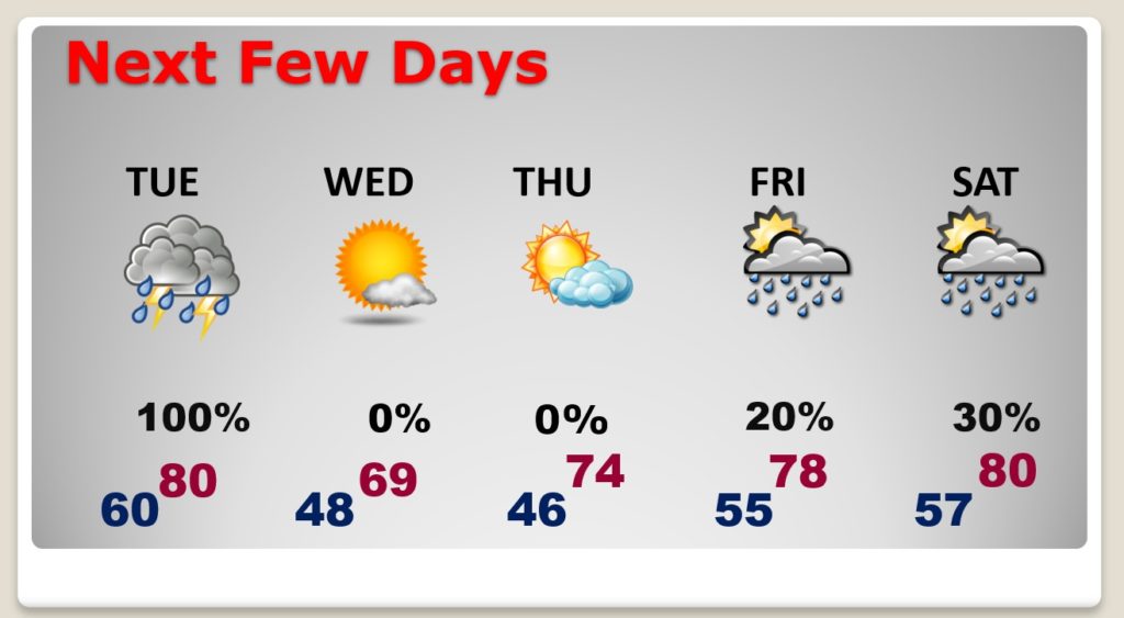
If you are enjoying this current string of beautiful weather, you will love today. In fact, this first weekend of April should be pretty nice. The warming trend continues. Yesterday’s high was 80. We will be in the low 80’s today and closer to the mid 80’s on Sunday.
Next week looks active. Showers and thunderstorms will overspread the area Monday night through Tuesday. The forecast for the rest of next week is a little more complicated, but periods of showers and storms are in the cards from Wednesday through Good Friday.
Details are sketchy, but it appears that more significant storm system will effect us on Easter weekend. It’s possible some storms with this storm system could be severe. Then, the models hint at some much cooler air.
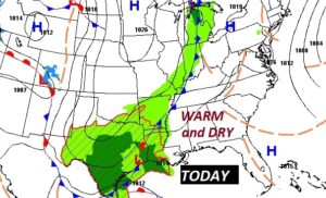
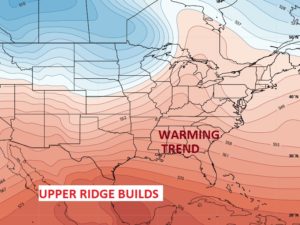
The storm system to the west of us will be held at bay for the next 2-3 days, as a upper level high pressure ridge builds above us.
TODAY: Nice day. Sun and cloud mix. Warmer. High 82. Not as cool tonight. Mostly cloudy. Low 59. Light north wind 5 to 10 mph.
NEXT FEW DAYS: Dry Sunday and mainly dry Monday, until Monday night. Warming trend continues. Showers and storms Monday night and Tuesday. Periods of showers and storms Wednesday through Friday.
– –
Today’s Blog update is short and sweet. I will have another Blog update tomorrow morning. Have a nice weekend. Stay safe and well.
-Rich