11:00AM UPDATE:
Not surprising…NWS In Birmingham says, “Isolated severe storms will be possible from noon to 8pm across all of Central Alabama. Damaging winds up to 60mph and large hail will be the primary threats.” (Much like yesterday..) #alwx
Early morning update:
Good Morning, on a very humid Saturday morning. Dense Fog will be widespread through about 9AM.
Yesterday’s pop storms were in rather generous supply. Some of the storms became strong, with a few reports of damaging wind gusts. Today afternoon and evening storms will again be in generous supply. Although no severe weather is expected, a couple of stronger storms are possible.
The rest of this Memorial Day holiday weekend will be very warm & humid. It will feel more like late June or early July. In fact this hot & humid pattern with scattered daily pop-up storms will continue.
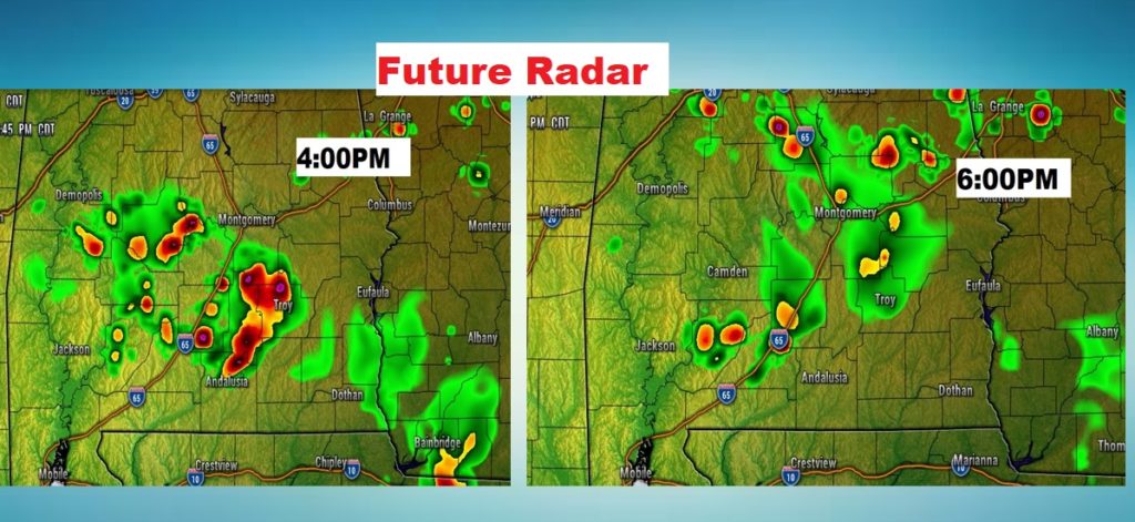
TODAY: Very humid. Hot today. Sun & cloud mix. High 91. Like yesterday, the morning will be dry, but those heat of the day pop up showers and storms will start popping up after lunchtime and become rather numerous by later this afternoon and into this evening. Coverage will be rather generous. Perhaps 40-50%. Again, a couple of the storms could be strong with gusty winds. Boaters on Lake Jordan and Lake Martin should be watchful. Keep an eye on Radar and Future Radar on our weather app.
Storms will fade out tonight. Low tonight 69.
I don’t like to show Future Radar in a situation, because it can be so misleading. However, this will give you at least some sense of how widespread the coverage could become by later afternoon.

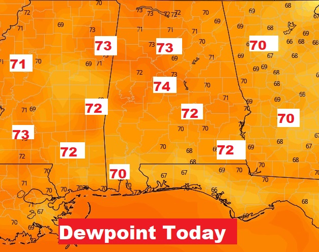
It’s only May, but how about some mid summer humidity today and over the next few days. Above 70 on the dewpoint today. OUCH. Not good.

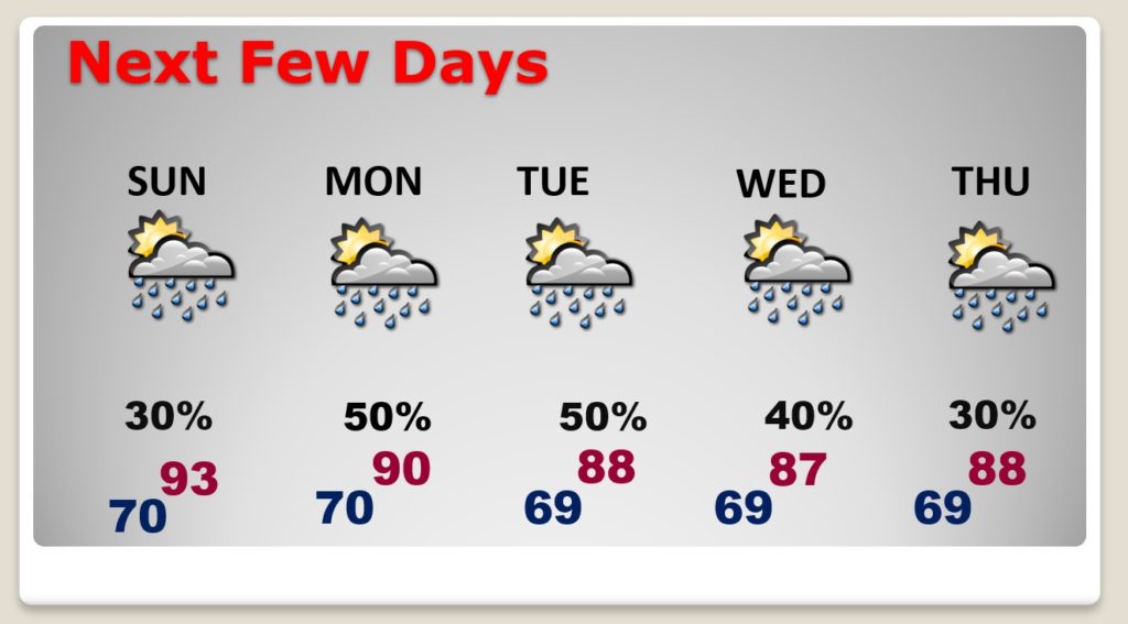
NEXT FEW DAYS: This pattern will continue through the holiday weekend and beyond. Sunday’s high could reach the low to mid 90’s. Monday will be at least 90. Scattered, random, pop-up storms will be around each day. They will peak in the later afternoon and early evening and fade out at night.

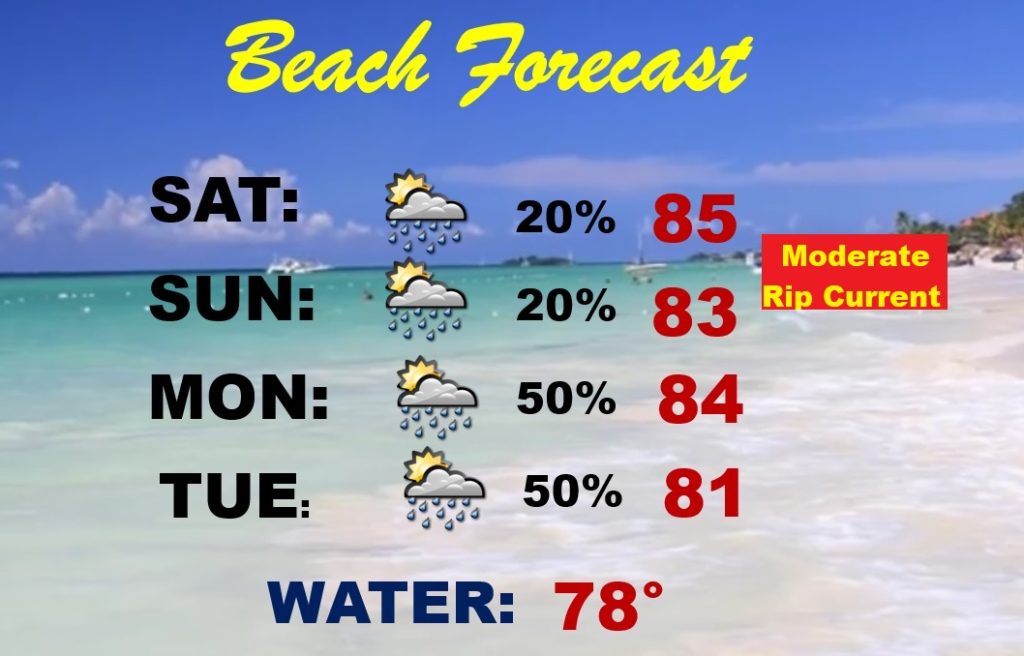
BEACH FORECAST: Widely scattered storms are possible today and tomorrow. Storms become more numerous on Monday & Tuesday. Moderate rip current risk is forecast for today and tomorrow.

I will have another Blog update tomorrow morning. Follow me on Twitter: @RichThomasWX. Have a great Memorial Day Holidat weekend. Stay safe and well.
-Rich
