
Good morning! Today’s update will be rather short and sweet. It’s rather routine summer forecast as August comes to an end and September begins. Deep tropical moisture is still in place for the next 2-3 especially. So, those random afternoon & evening storms will be in generous supply through at least Tuesday. Storms will tend to thin out in number by mid to late week. The nice thing about this week…there will be no tropical storms or hurricanes to track in the Gulf. However, the National Hurricane Center is currently monitoring four Areas to watch in the tropics.
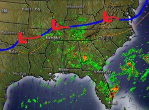
On the map this morning, there is a frontal system which will “tease” the state today, but I think it will stall and not be a big player in Alabama’s weather.
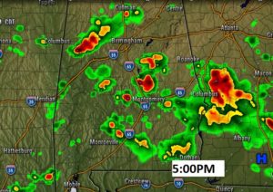
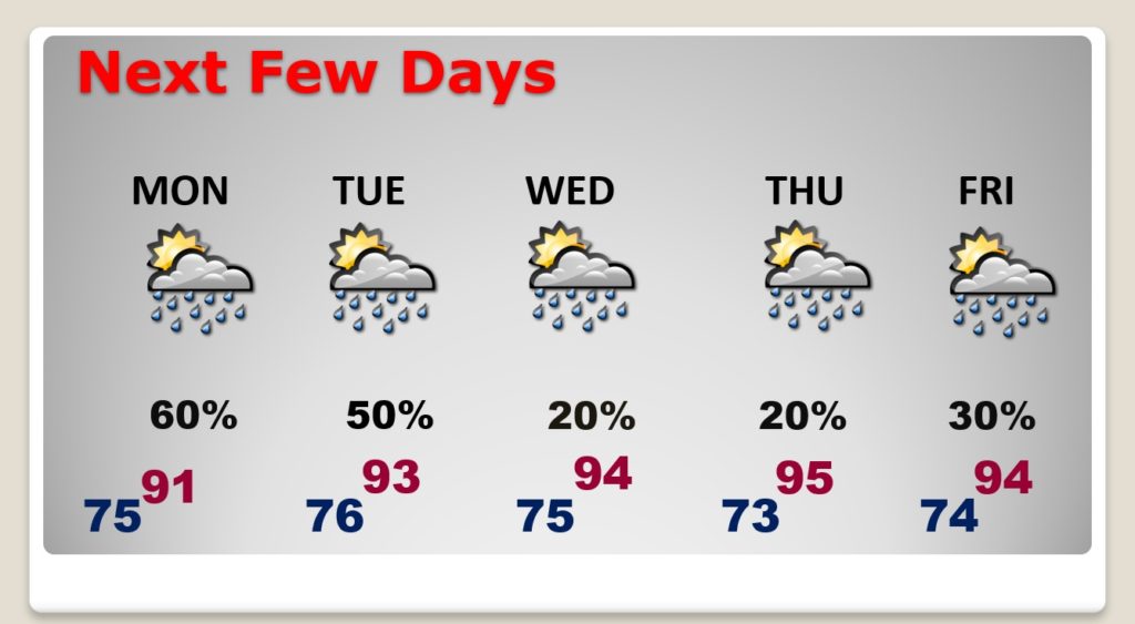
TODAY: Very humid. A sun/cloud mix. Showers and storms are possible anytime, but especially this afternoon and this evening. High 91. Low tonight 75. Here’s a hi-res future radar snapshot at 5:00PM. Generous coverage on the storms today. (50-60%)
NEXT FEW DAYS: The better than normal rain chance stays in place through Tuesday. But, by Wednesday and Thursday, storms will start to thin out in number. They will become widely scattered.
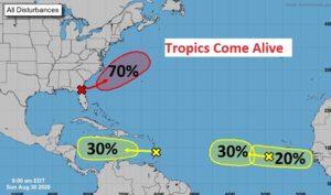
TROPICAL UPDATE: There’s a new X on the map near the southeast coast. There’s a decent chance that a depression or tropical storm will develop off the US East coast by mid-week. The next name on the list is Nana. Meanwhile, NHC continues to monitor three other Areas to Watch in the tropical Atlantic.
—
I’ll have a complete video update for you tomorrow morning. Sd have much to talk about I’ll have new information from the National Hurricane Center.
Stay safe and well. Enjoy your Sunday!
–Rich