4:00PM Update:
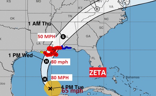
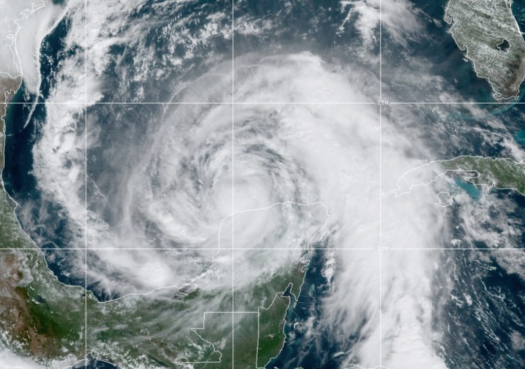
Zeta Is still a 65 mph tropical storm right now. It’s expected to regain hurricane strength later tonight. It will be near hurricane strength at landfall along the north central golf coast late Wednesday or Wednesday evening. Zeta’s is moving north west at 14.
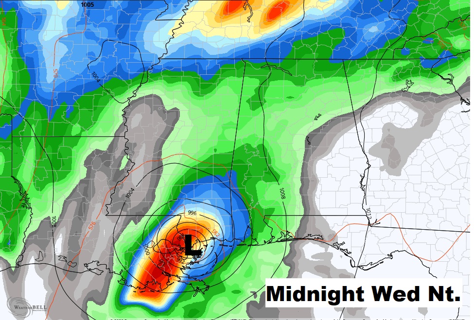
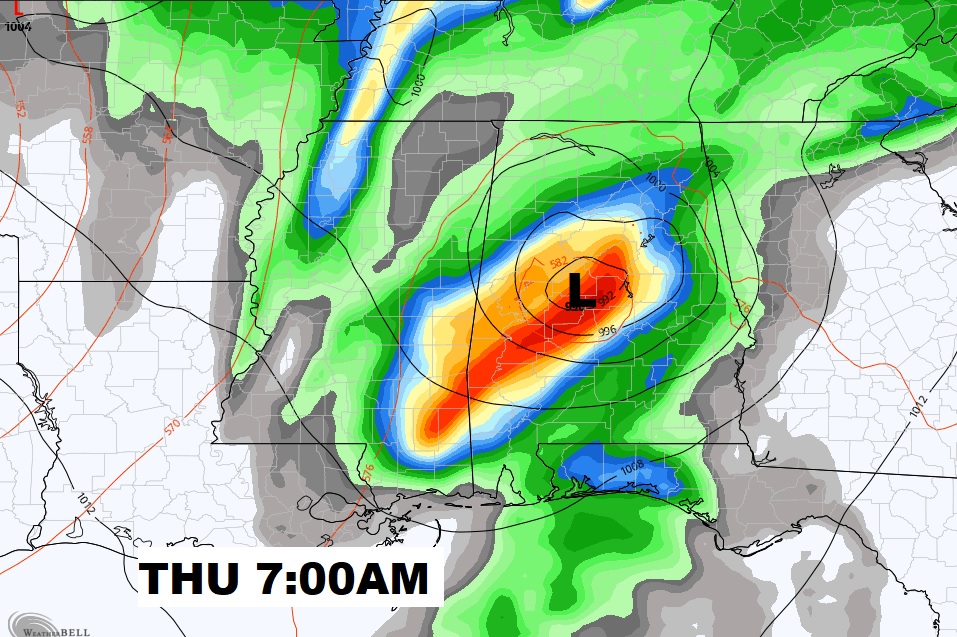
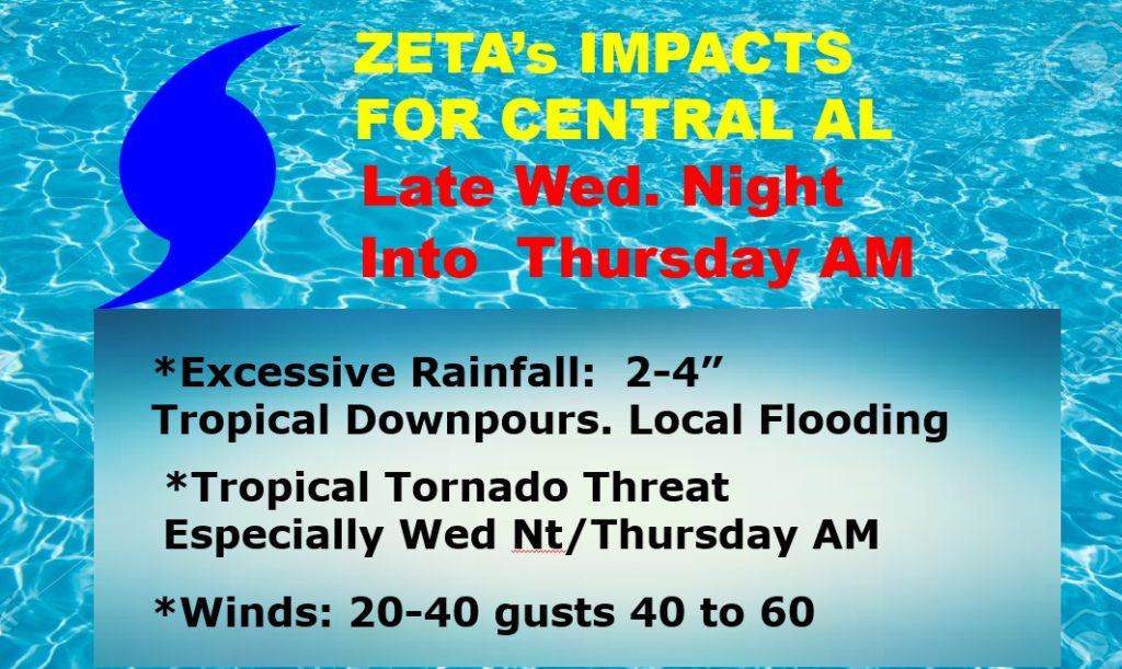
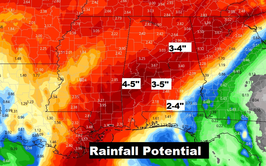
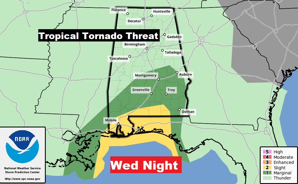
Tropical storm conditions are expected here in Central Alabama by late Wednesday night and early Thursday morning. Trees and powerlines are likely to come down causing power outages. Rainfall could be 2 to 4 inches. And, the tropical tornado threat will begin late Wednesday and through Wednesday evening and Wednesday night
1:00PM UPDATE:
Tropical Storm #Zeta Advisory 12A: Zeta Moving Over the Southern Gulf of Mexico. Expected to Regain Hurricane Strength Later Today. http://go.usa.gov/W3H
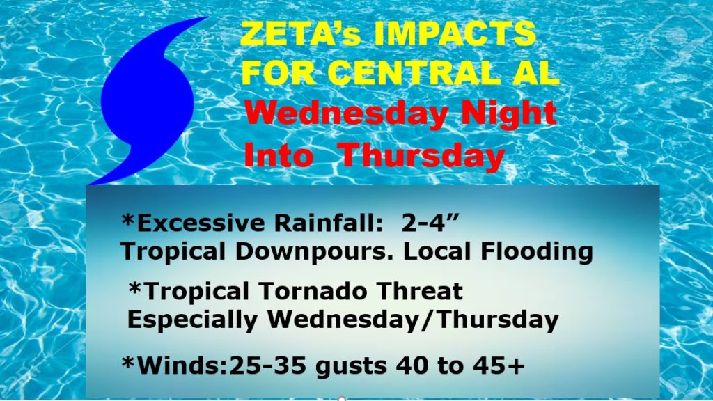
UPDATED Expected impacts for Central Alabama late Wed. Night/Early Thursday AM. Increased wind expectations.
EARLY MORNING UPDATE:
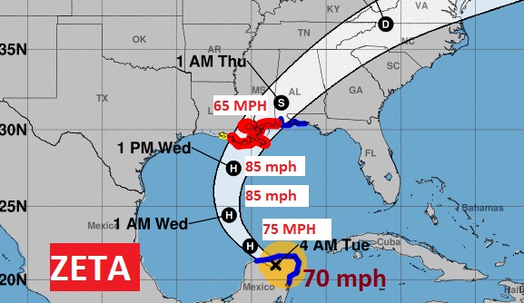
Hurricane Zeta is taking aim on the North Central Gulf coast. Landfall is expected Wednesday night. A Hurricane Warning has been issued as far east as the Alabama border. Tropical Storm Warning on the Alabama coast, east to Destin. Here in central Alabama, the effects from Zeta will be significant, with lots of heavy rain, Tropical Storm Force wind gusts, and a Tropical Tornado Threat. I’ll bring you up to date on the details and the timeline. We’ll also look ahead to NICE weather after Zeta.
Zeta expected to come ashore as a Cat 1 hurricane along the north central Gulf Coast Wednesday night.
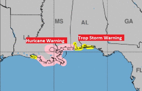
Hurricane Warning as far east as the AL/MS border. Tropical Storm Warning for the Alabama coast east to Destin.
Here in the interior of Alabama, Tropical Storm Watch as far east as Coosa, Elmore, Montgomery, counties. Across south and SW Alabama, its a Tropical Storm Warning.
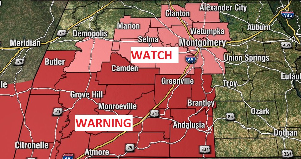
The roughest time here in central and south Alabama will be late Wednesday night in through Thursday morning.
Because of Zeta’s FAST movement, excessive rainfall totals will be avoided. But still, local flooding possible.
Of course, tropical tornadoes are ALWAYS a risk with every landfalling tropical system, especially Wednesday night and early Thursday.
Remember Sally’s effects here in central Alabama? Wind gusts to 45 mph. Expect trees down, & power outages … With the track of ZETA almost directly over us. I expect similar effects to Sally as far as the winds, Plus, locally heavy rain and the standard tornado threat. The biggest effects will be late Wednesday night in through the first half of the day Thursday especially Thursday morning. The details of this graphic are subject to further review as we get closer.
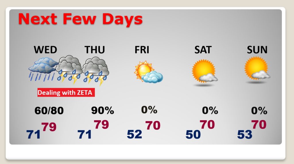
After ZETA, the stage is set for a very nice Halloween Weekend. Time change late Saturday night. (2:00AM Sunday morning)
