Good Morning! “Baby, it’s COLD outside.” In fact, it is the coldest morning of the season so far. It’s Colder than any morning last winter. Temperatures will end up near or just above 20 by Dawn. Fortunately, wind chill is not a factor.
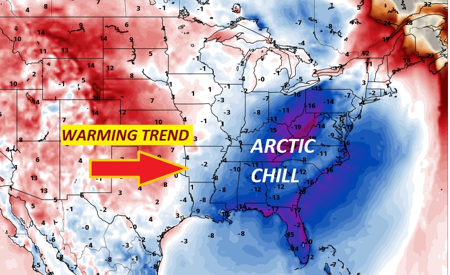
Today, will be another very chilly December day. Highs will not make it out of the 40’s. We are headed to the Deep Freeze again. (Mid 20’s) But, hang on. A nice warming trend begins Sunday afternoon and continues through mid-week.
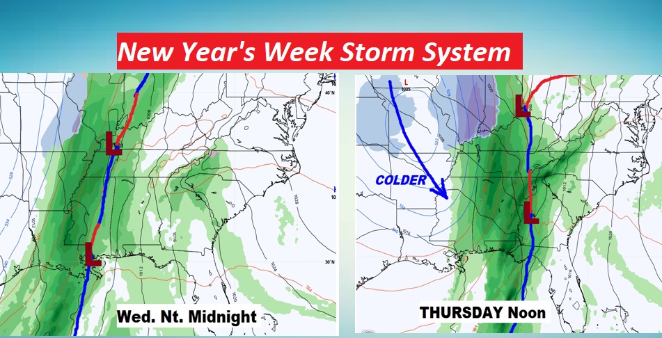
Another significant storm system will affect us on a similar time-table to last week’s storm. Showers and storms move in Wednesday night into Thursday, followed by a big temperature plunge. Sound familiar?
TODAY: VERY COLD this morning. Sunshine today. CHILLY again. High 49. (Normal hi 58). Not nearly as windy. Northwest wind at 5 to 10 mph. Clear and cold tonight. Low 26.
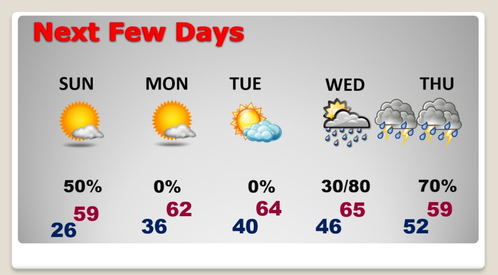
NEXT FEW DAYS: Get ready for a nice temperature recovery Sunday afternoon. It will seem like a heatwave. We’re into the 60’s Monday through Wednesday. Showers & thunderstorms Wednesday night into Thursday.
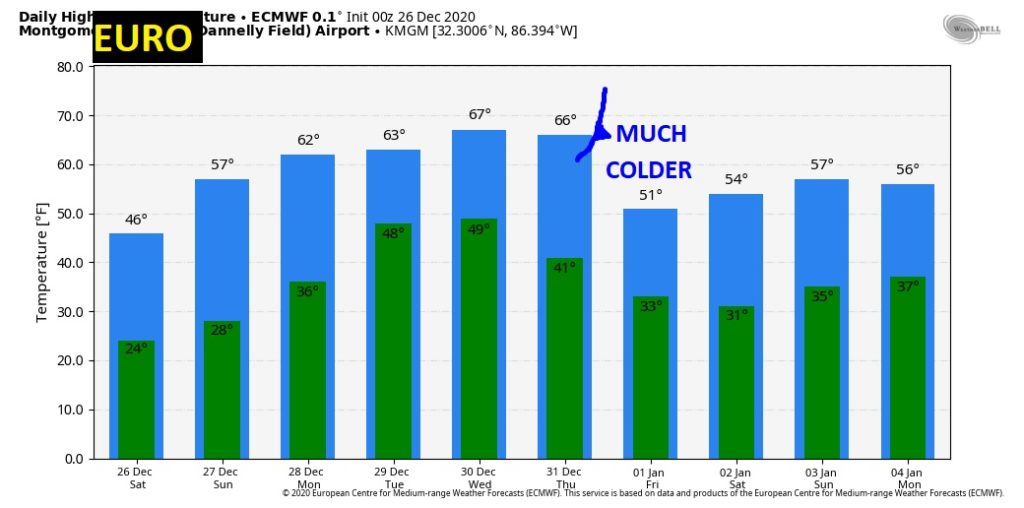
Another temperature plunge on New Years Day, behind the storm system.
NEW YEARS’S WEEK DRAMA: Another significant storm system will affect us on a similar time-table to last week’s storm. Showers and storms move in Wednesday night into Thursday, followed by a big temperature plunge. It’s a little too early to say if this system will bring a Severe Weather Threat. But, every storm system this time of year is suspect. Stay tuned.
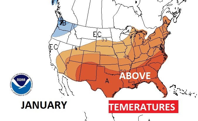
NOT AS COLD IN JANUARY? Keep your fingers crossed. The Climate Prediction Center says January temperatures will average above normal. But, these long range outlook have their flaws. We can dream, though.
I’ll have another Blog update early tomorrow morning. Stay safe and warm.
–Rich
