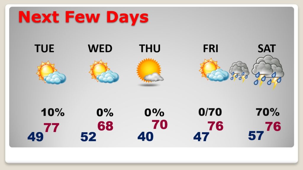
Good Morning! Great start to the new week! Like yesterday, today and Tuesday will be nearly perfect. A block of unusually chilly Canadian air will move into the United States this week. We will sample a tiny bit of the chill by Wednesday and Thursday. The cool-snap will be brief. Storm-free through Friday afternoon. Showers and storms return to the forecast closer to the weekend.
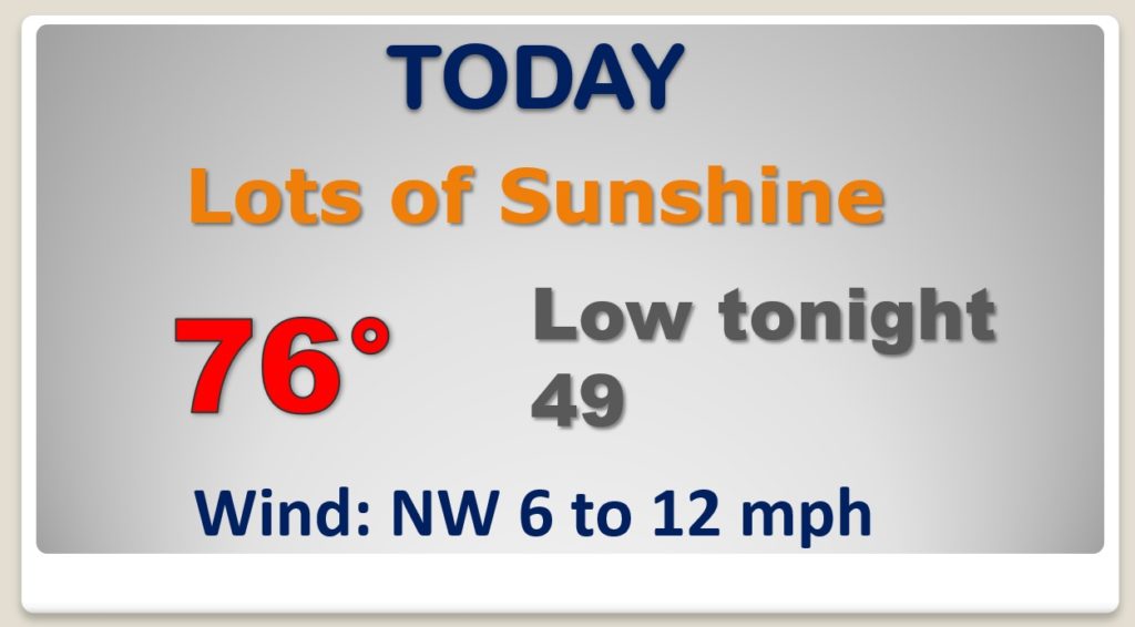
It’s hard to improve on yesterday, but today will be very nice and perhaps a degree or two warmer. Nice way to start the week.
Rare late season cool-snap ahead. Unusually, cold block of Canadian air will invade much of the eastern half of the United States this week. SNOW for parts of the northeast. We’ll sample just a bit of this unusually cool air Tuesday night through Thursday. It’s good thing it’s not January or February. This would be much worse.
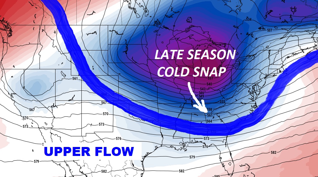
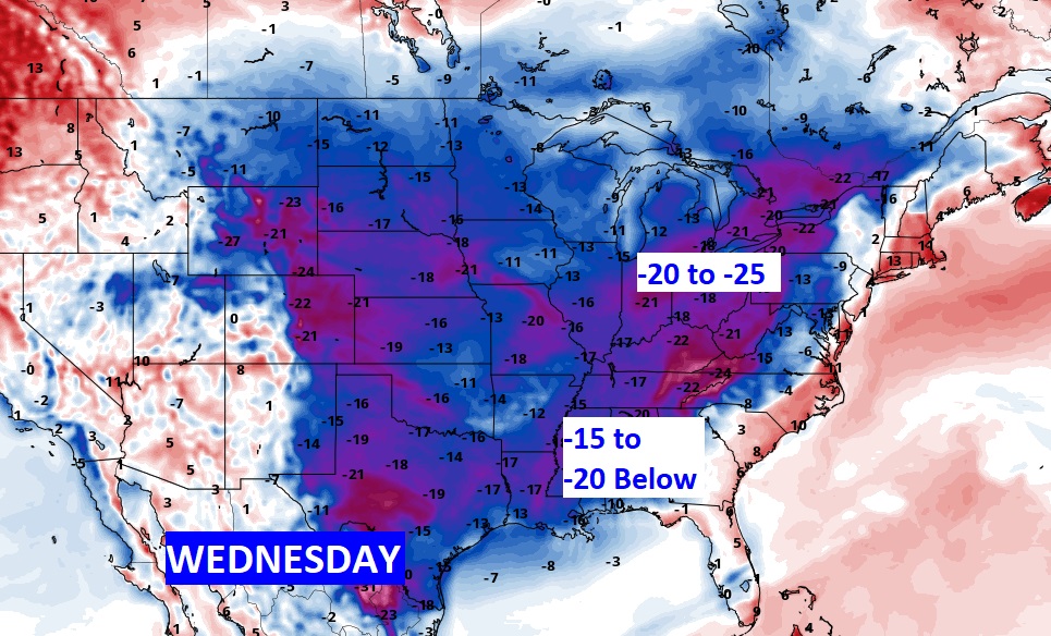
Nice string of storm-free days until perhaps Friday night and Saturday. Rare late season mid week cool snap. Thursday morning near 40. The record is 38.
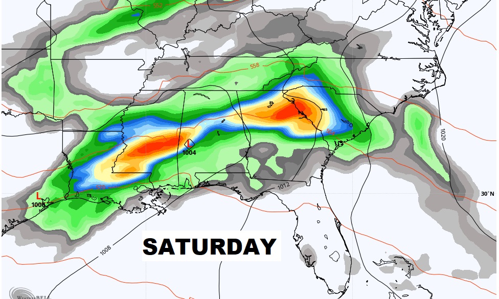
Will the Saturday storm system bring any strong to severe storms?

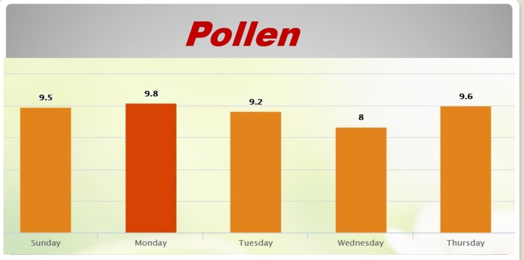
Here’s this week’s outlook from pollen.com.