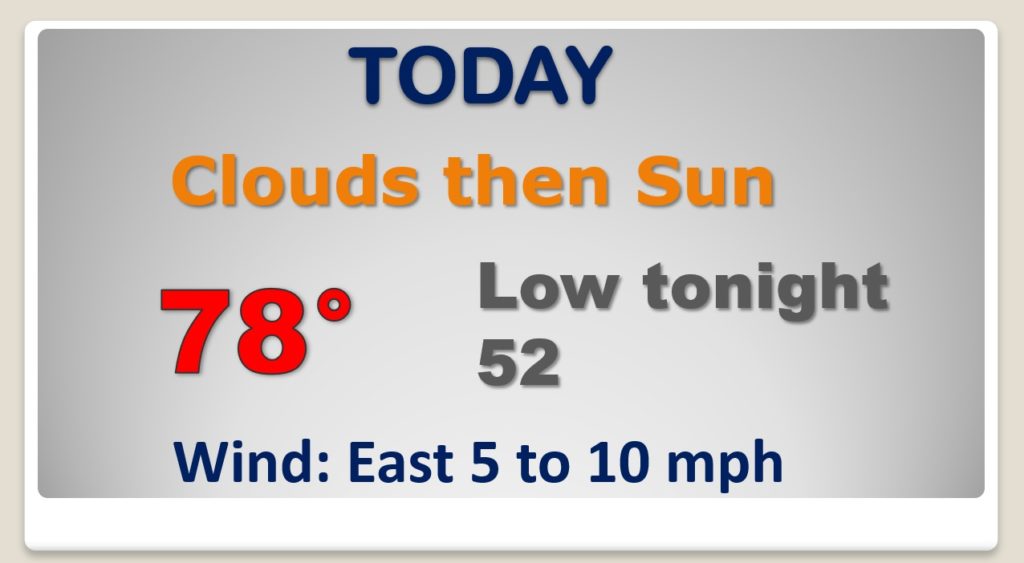
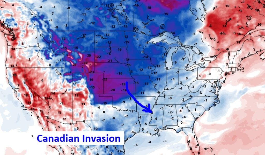
Good Morning! Get ready for another very nice April Day. We’re headed for the upper 70’s. But, stand by. A Cool Front will sweep through the state overnight tonight. Much of the Nation is poised for a Canadian Invasion of much cooler air, for so late in the season. We may be close to a record low by Thursday morning. The chill won’t last long. We’ll look ahead to the details of the next storm system, perhaps as early as Friday night. Will there be any strong storms?
Ready for one more warm April day? We’re headed for the upper 70’s. Canadian Cool Front sweeps through the state late tonight. Significant changes ahead.
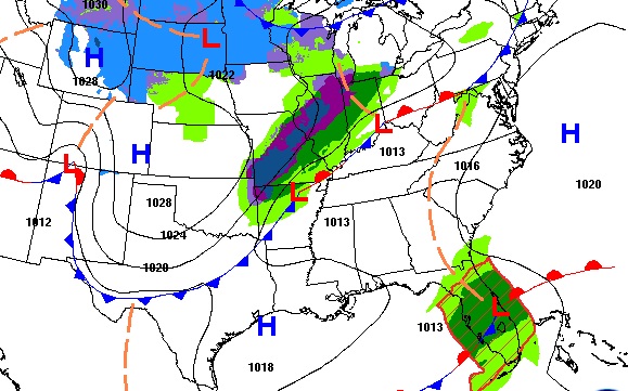
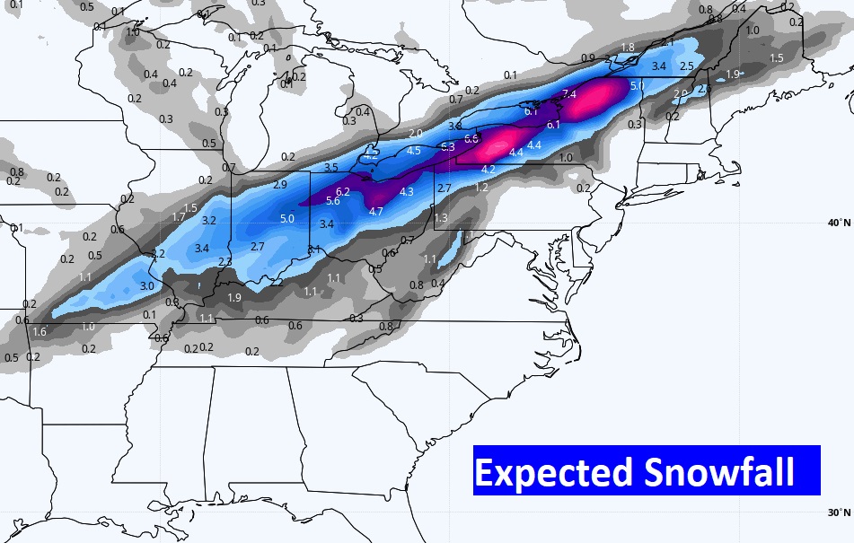
Late Season Canadian Shocker ahead for much of the nation. Including snow from the Midwest to the northeast.
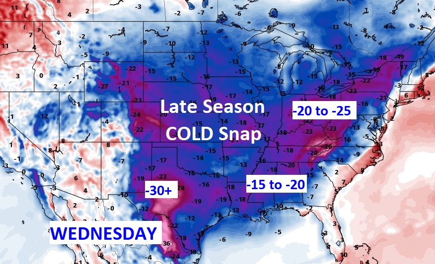
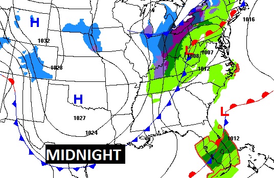
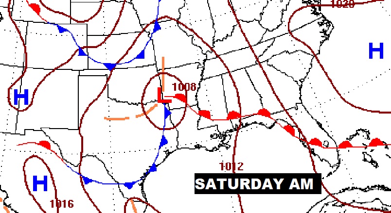
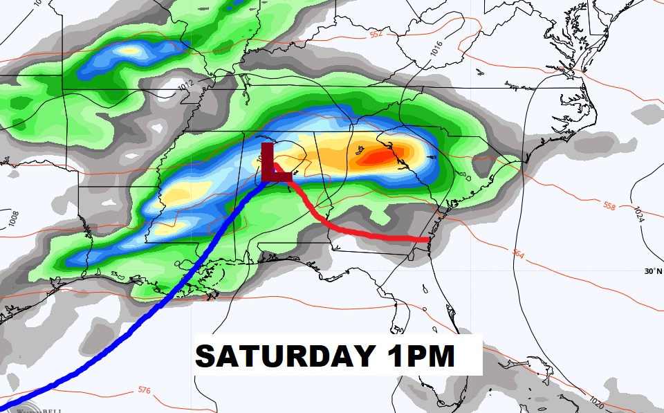
Well below normal Wednesday. Highs only in the 60’s. Breezy. Near record low Thursday morning. Too cool for April Thursday. Warmer Friday. Storm system brings showers and storms Friday night and Saturday. Better day Sunday.
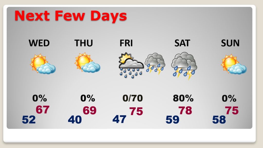
Will the Saturday storm system be severe? It all depends on how far north the warm front gets into the state. Question marks remain.
Coolest day Wednesday. Coldest morning Thursday at Dawn. Then Warming. 80’s next week.
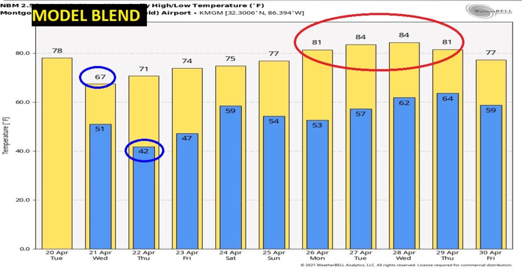
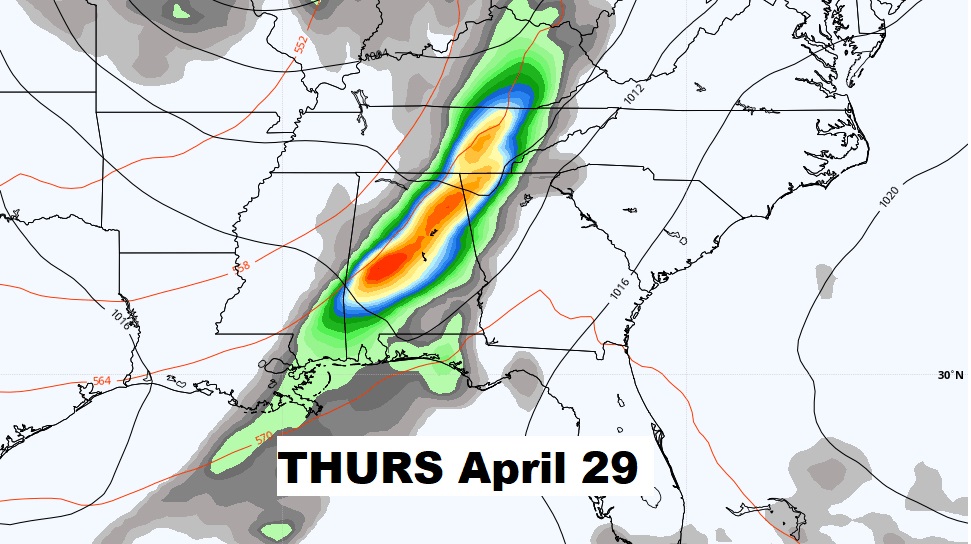
The next big deal storm system will arrive sometime around Thursday April 29th.