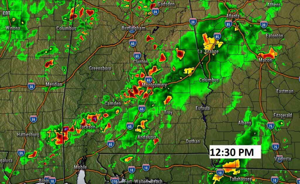
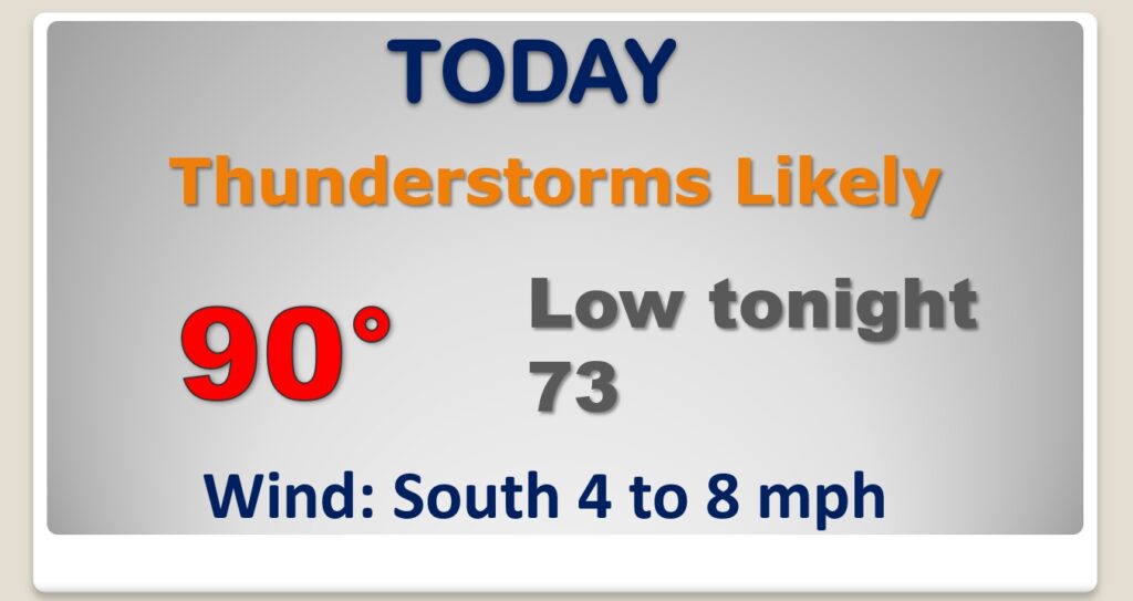
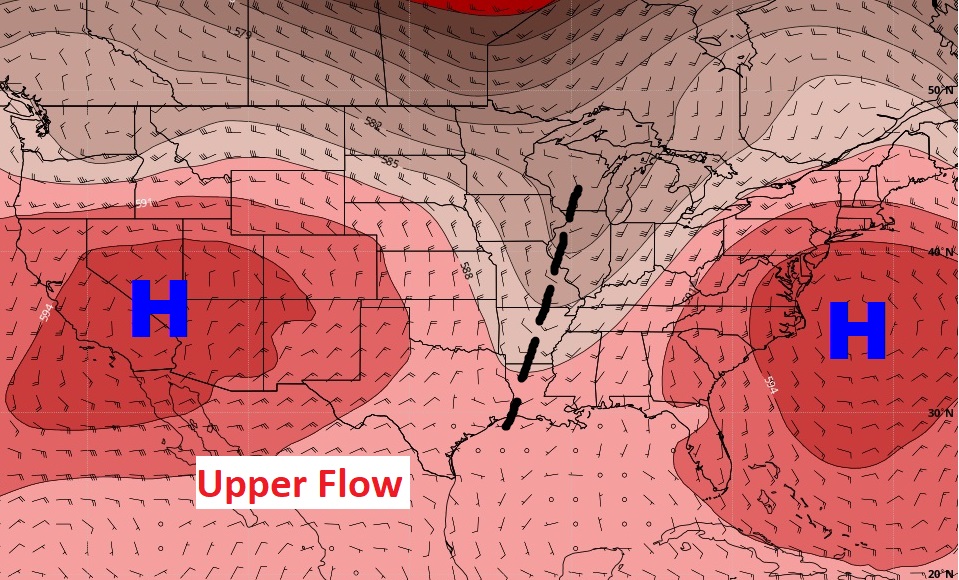
Good Morning! All signs point to the potential for an active thunderstorm today. A better than normal chance. We are on the wet side f an upper trough of low pressure. Although not every town will get wet today, many will. Locally heavy downpours in spots. Even Tuesday, the coverage on showers and storms will be generous. But, the trend by mid to late week, will be more routine. Fewer random storms. The tropics are quite now, but for how long?
Better than normal chance you may encounter a storm today. Scattered to numerous showers and storms.
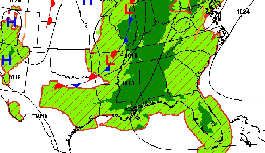
Today we are on the wet side of an Upper Trough. That’s conducive to a rather active storm pattern today. By mid to late week, the upper ridge of high pressure builds across the Gulf South. Storms will start to thin out.
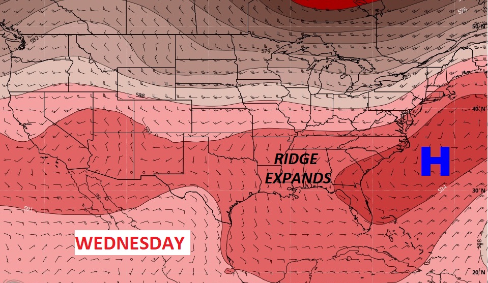
The better than normal rain chance remains through Tuesday. But, by mid to late week, storms thin out. We’ll be back to a more typical summer pattern. Highs in the low 90’s. Lows at night in the lower 70’s.

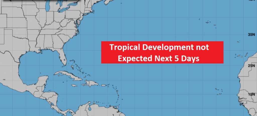
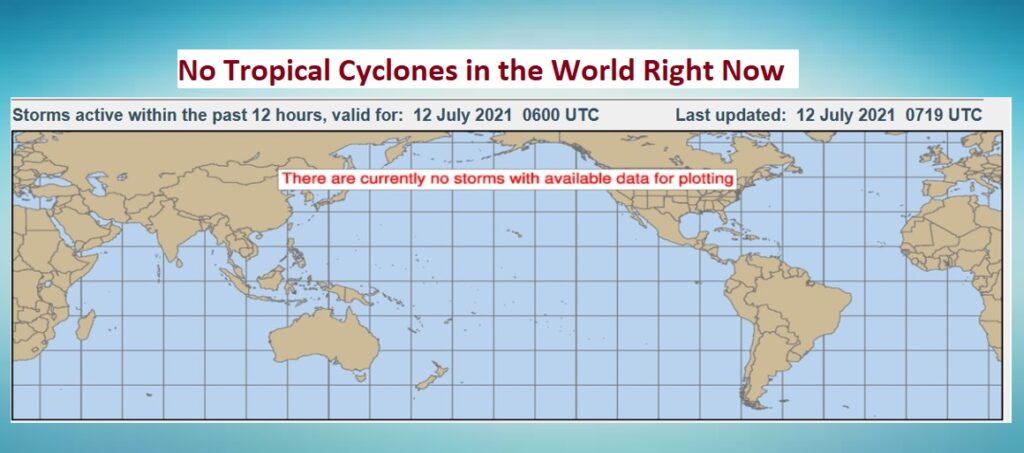
The tropics are quiet as a mouse right now. We are in a “null pattern” for now. Not only that. There are NO tropical cyclones or invests anywhere in the world right now. Very rare on July 12th.