
Good Morning! Are you ready for a nice change? Our wetter than normal pattern is about to fade away. Big improvements begin Friday and continue through the weekend. Sunshine will be in abundance. Humidity will be somewhat lower. Nights will be a little cooler. Here’s a video introduction to the Blog.
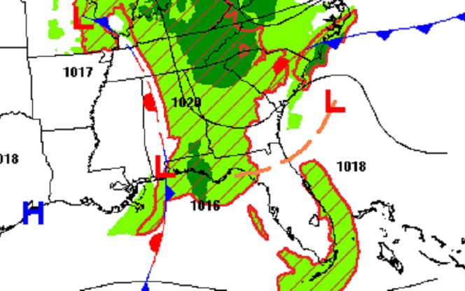
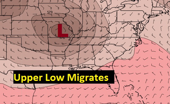
THE SET-UP: We have been om the wet side of a surface front, and upper Low all week. That’s the reason for the torrential downpours we’ve seen all week. Today, the front migrates into the state and starts to fade. The upper low is now pulling away from our region and is now in Missouri. It’s effect on us will start to fade.
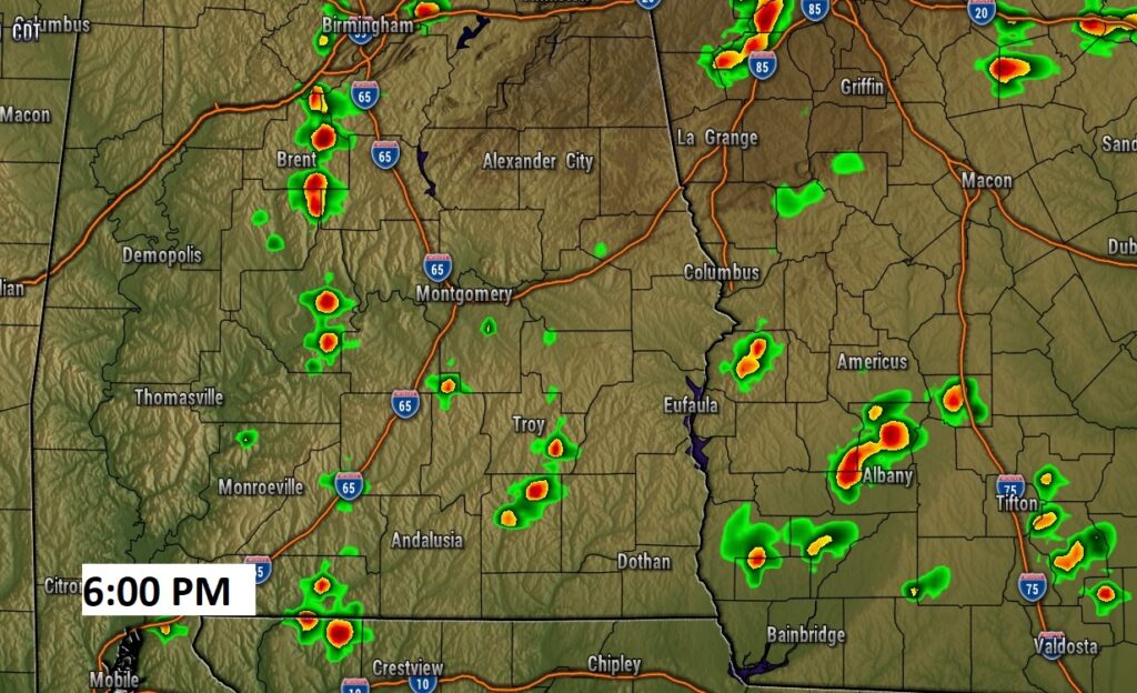
TODAY: Like yesterday, there will be sunshine at times today. There will still be some heavy downpours roaming around. There won’t be as many storms on the radar, however. You could still get some very heavy downpours, but your odds of getting wet are a lot lower today. It will be quite humid with dewpoints in the 70’s. Today’s average high will be 83. Your odds of getting wet are roughly 40%. Tonight’s low 67. Here’s a Future Radar snapshot at 6:00PM.
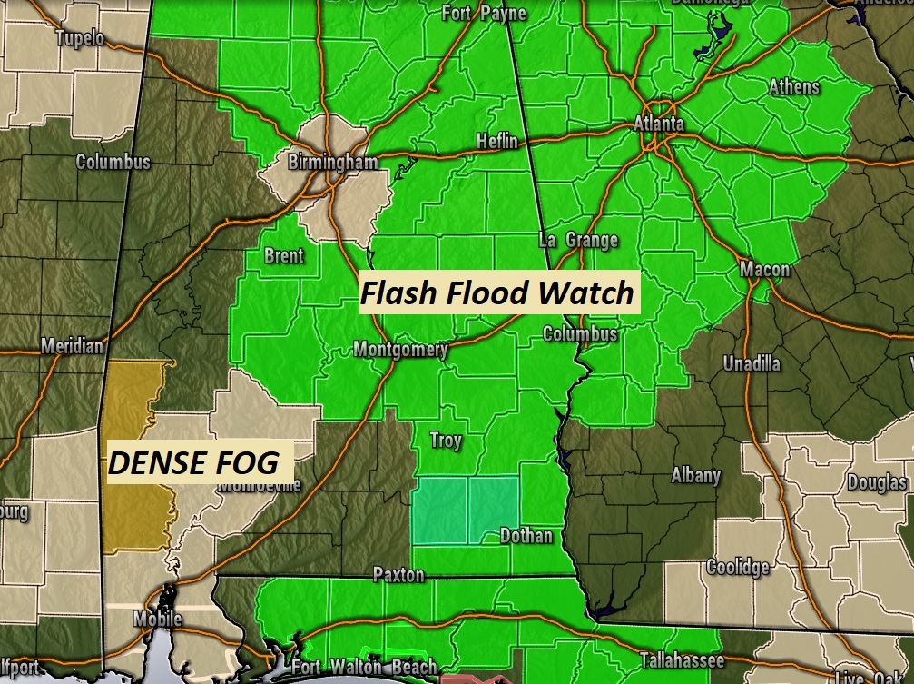
The Flash Flood Watch has been adjusted. It now mostly takes in the eastern half of the state today, and a few counties in central Alabama, through this evening. Dense fog advisory in SW Alabama.
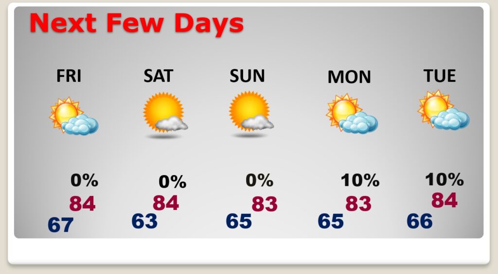
FRIDAY: There will be a few leftover clouds, but sunshine will dominate. It will be rather humid in the morning but, not quite as humid by afternoon. High 84. A little cooler Friday night. Low 63. That’s a nice change.

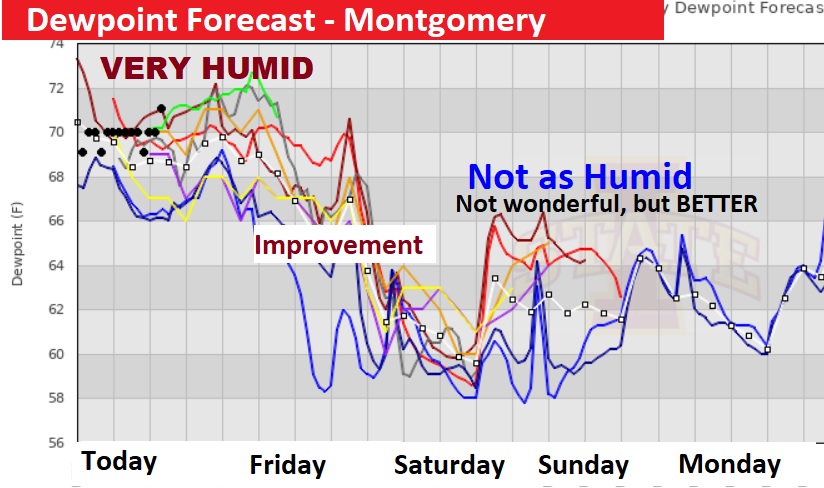
BETTER AIR…NOT WONDERFUL, BUT BETTER: I don’t want to oversell the “niceness” of the air for the weekend. It’s going to be like that first weekend of Fall. Dewpoints, this time in around will be in the 60’s. This is an improvement in what we’ve had all week. So…BETTER…Yes, wonderful…NO. We’ll take it.
NEXT FEW DAYS: A nice change, with abundant sunshine, somewhat less humidity, dry days, cooler nights. A weak front approaches the state by Monday night/Tuesday, but it looks like it will stay northwest of us. I have removed rain chances.
TROPICAL UPDATE: NHC is still keeping an eye on that Area to Watch off the Southeast US coastline. Right now, it has a low 20% chance of development. The rest of the tropics are quiet now. That doesn’t mean we are done. Not by a long shot. Season continues until November 30th.

.
Tomorrow, everything is back to normal. I’ll be bacon on radio and TV Friday morning. Have a good day. There will be a complete video update first thing in the morning.
–Rich