Good Morning! Our string of dry, spring-like days is about to change in a big way. Today we’ll be mainly dry with mid 70’s. But, Monday we start a wet, and at times, stormy pattern which will be around for the next 7 days.
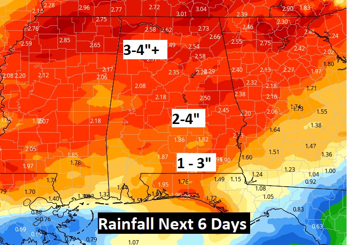
A front sweeps across the state Monday with showers & storms. That’s just part one of a series of impulses that will affect the state in the coming week. Total rainfall amounts in the week ahead could be rather impressive.
We need the rain. Montgomery’s November rainfall was only 1.42”. Normal is 3.85”.
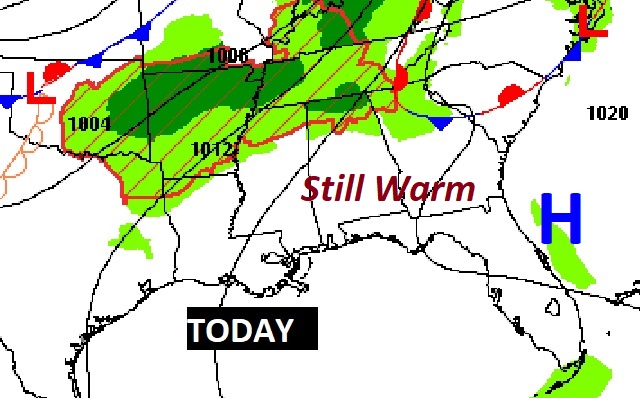
TODAY: Patchy AM fog…again. There will be sunny intervals, but clouds will dominate much of the day. (Risk of a shower under 20% ) Spring-like warmth continues. Mid 70’s…again. Cloudy, very mild tonight. Low 59. Enjoy this last tranquil day.
Today, the best chance of showers will be across the northern counties today. Most of us should be dry & warm.
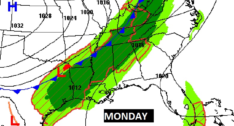
MONDAY: An approaching front will bring a risk of showers and thunderstorms to the state. Here’s the set-up at 6AM Monday morning.
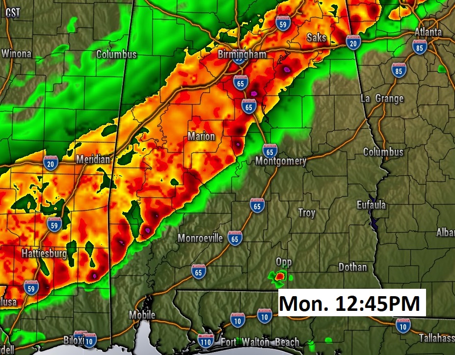
For most of us the best chance of showers & thunderstorms will be after lunchtime. Here’s one model idea (HRRR) on the potential timing. This is 12:45 PM Monday. Don’t take this literally.
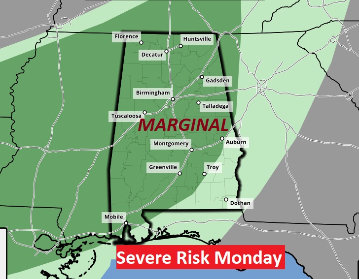
‘Tis the season for severe weather. The storm Prediction Center has most of us in a Level 1 – Marginal Severe Risk. The main threat would be damaging wind gusts. There may, perhaps, be some other severe weather concerns as the week unfolds.
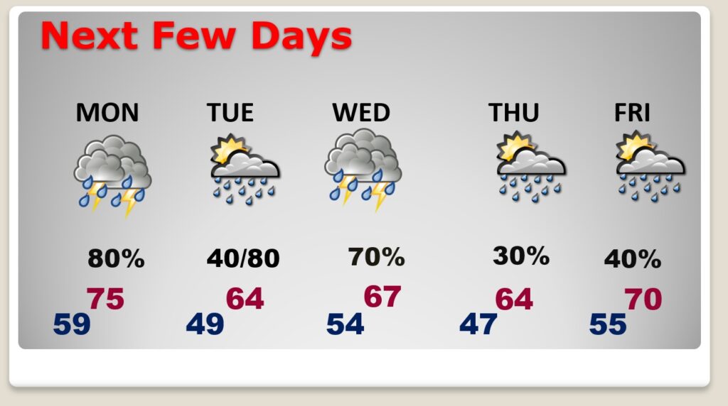
NEXT FEW DAYS: There’s at least some rain in the forecast every day. The next “concentrated” rain and thunderstorm risk will be Tuesday night into Wednesday. And, another one over the upcoming weekend in the 12/11 – 12/12 timeframe. That one next weekend, could be a little more concerning. After that, long-range, it looks like we start to quiet down after Sunday 12/12.
This is a very conservative model blend of potential rainfall amounts in the next 6 days. I suspect the amounts could easily be heavier than this.
.
I’ll have a complete video in the morning, online by 4:45 AM. Enjoy your Sunday!
–Rich
