
Good Morning! Radar was very quiet Thursday & Friday. Not many storms. Today we return closer to a summertime normal. Scattered afternoon & evening showers and thunderstorms Still storms will be random. Not every town will get wet.
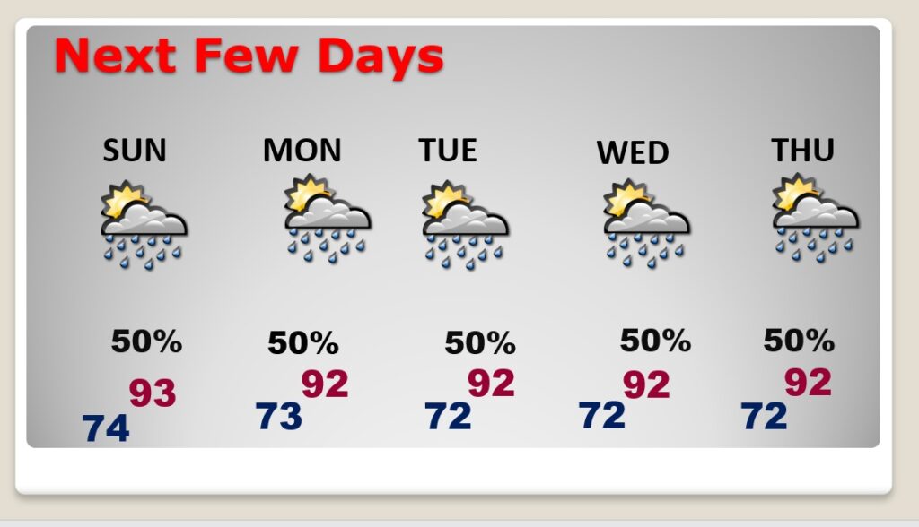
Tomorrow and Monday (and even Tuesday through Thursday, storms will become more numerous. Closer to 50% coverage. Higher than the standard summer 30%. Temperatures next week will be down just a notch. Lower 90’s.
CLIMATE DATA: Yesterday’s high in Montgomery was 94, with a Heat Index as high as 101. Morning low 73. Normal High/Low 94 and 72. Rainfall: 0.00. Sunrise at 6:04 AM, Sunset 7:38.
TODAY: Good bit of sunshine. Hot & humid. High 95. Heat index near or above 100. Random scattered afternoon & evening showers and thunderstorms. Storms fade out tonight. Low tonight 74.
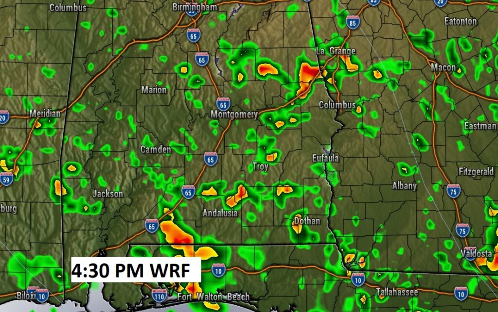
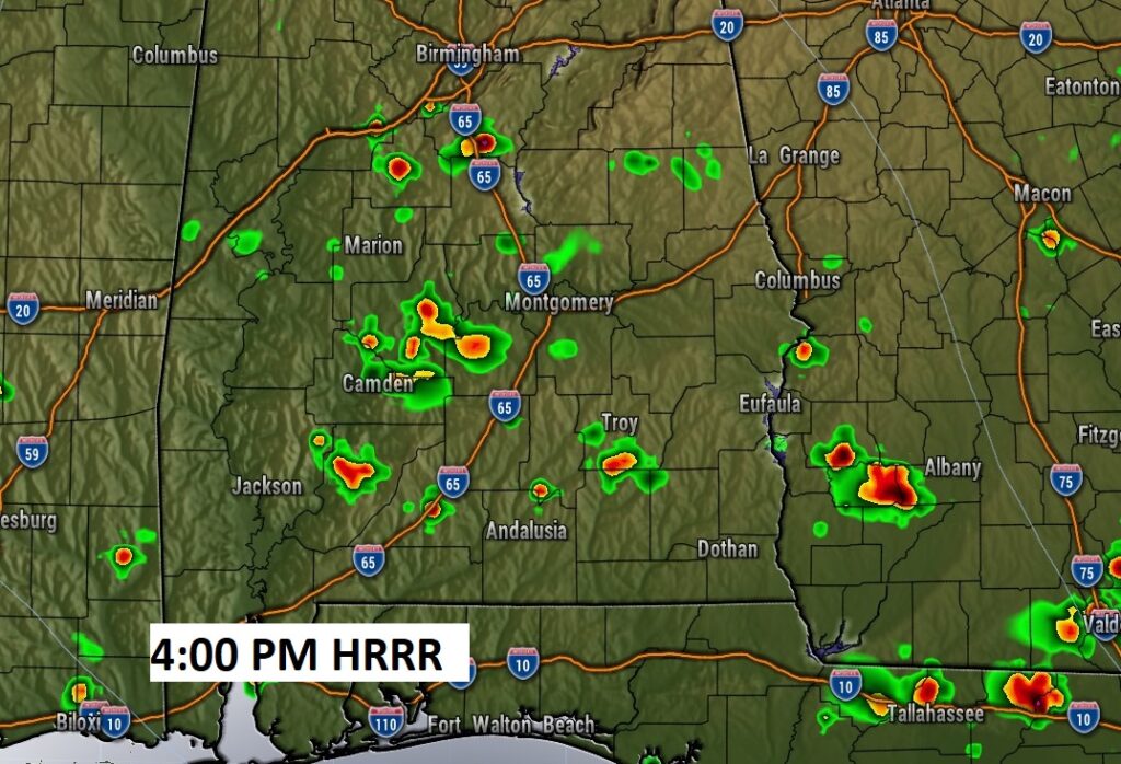
Here’s a couple of future Radar examples The WRF model could be a little too wet.
The HRRR model seems more reasonable to me on the storm coverage.
NEXT FEW DAYS: Not much day to day change. Better than normal coverage of the daily Hit or Miss storms Sunday through Thursday. Temperatures will be down just a notch. Generally Lower 90’s. Lows in the low 70’s.
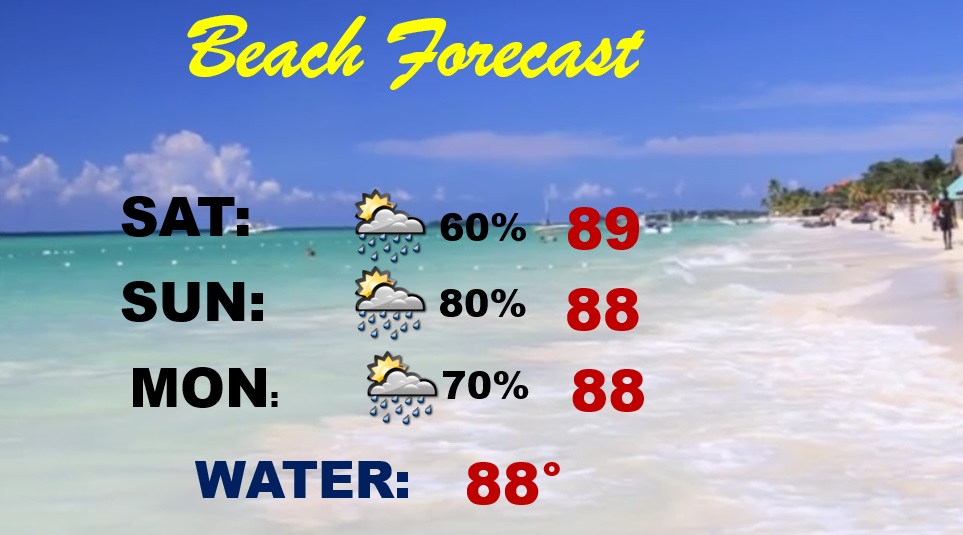
BEACH FORECAST: Scattered storms today Scattered to numerous storms Sunday & Monday. Watch out for lightning. Highs in the upper 80’s. Gulf water temp is 88. Moderate Rip Current Risk especially from Destin eastward today and Saturday. High risk Monday.
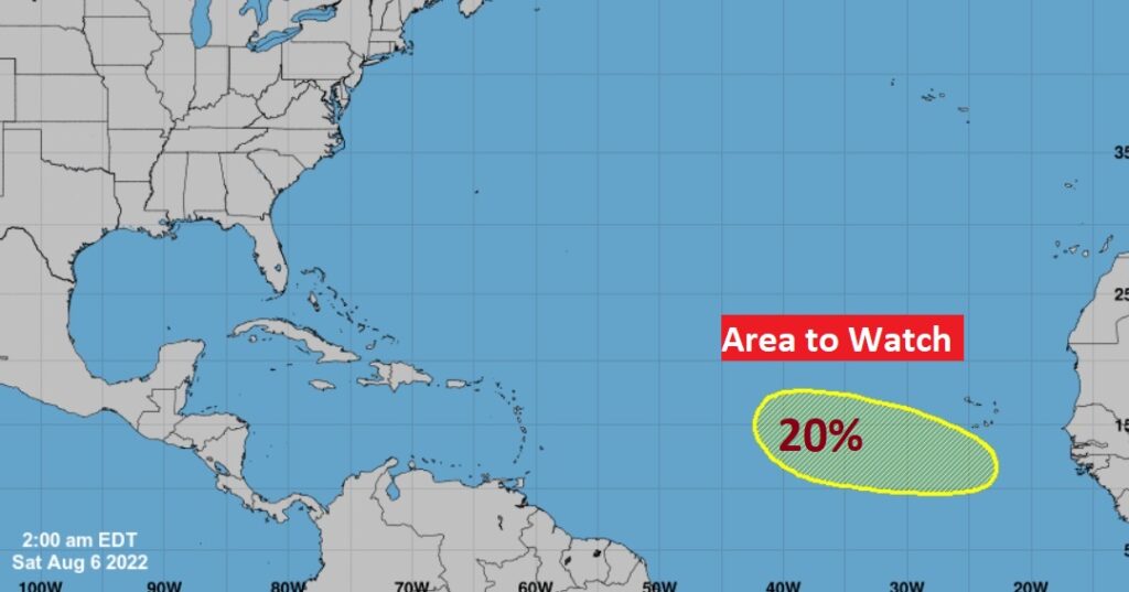
TROPICS: After several days of NOTHING…Finally NHC is indicating a “Area to Watch” in the tropical Atlantic, with a low 20% chance of development in the next 5 days.
—
I’ll have another Blog update in the morning. Have a nice weekend!
–Rich