
Good Morning! Here’s my brief video forecast discussion.
TODAY: It’s not going to rain all the time, but be prepared for frequent periods of rain, just about anytime today, but especially in the afternoon and evening. But, also, into the overnight hours tonight. Widespread rain and maybe a few thunderstorms. Locally heavy downpours will cause localize flooding. Due to clouds and showers, the high temperature may struggle to reach 81. Low tonight 71.
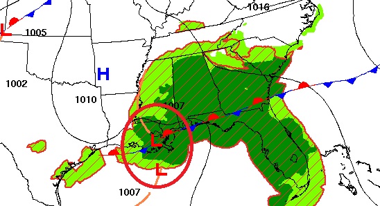
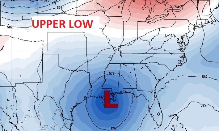
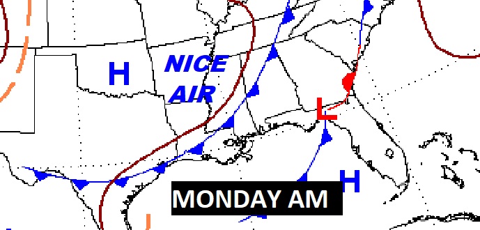
Here’s the set-up. Everything points to RAIN. Low pressure moving northeast from Louisiana and Mississippi, at the surface, combined with the fact that we’re on the wet side of an upper level low on the Gulf coast.

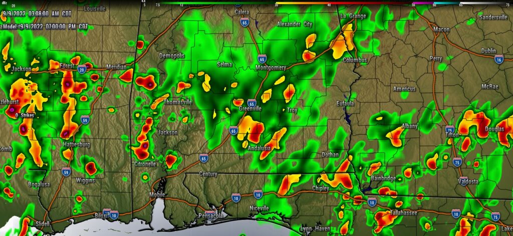
Future Radar: Pick a model. Everything points to widespread rain and storms.
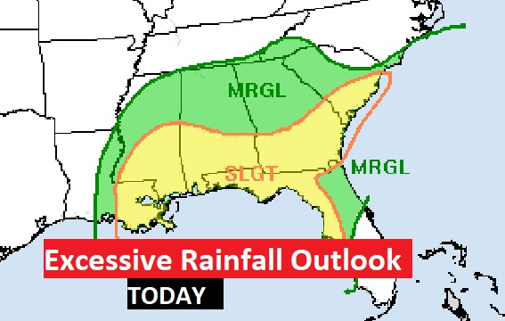
Many of us, especially from I-85 southward, are in a Level Two Excessive Rainfall Outlook from the Weather Prediction Center in Washington.
NEXT FEW DAYS: Showers and storms will be scattered to numerous again on Saturday. Locally heavy rainfall amounts possible. High’s in the mid 80’s Saturday and Sunday. More scattered storms Monday as a Nice “Cool” front slips through the state. NICE AIR behind the front on Tuesday. Lower humidity. I think MOST of next week will be great. Sunshine. Comfortable days and cooler nights. This is exactly what we’ve been waiting for all summer.
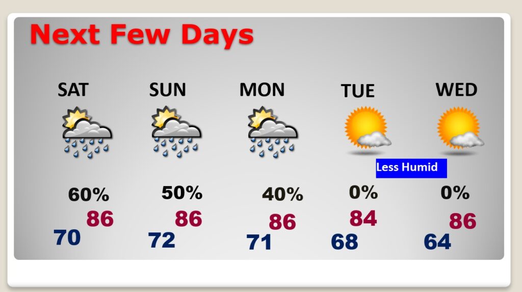
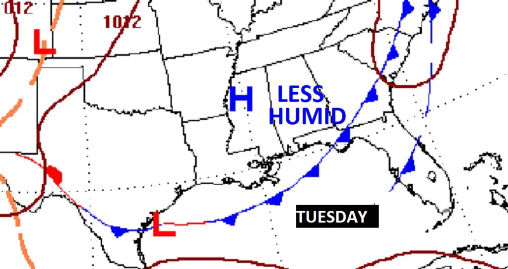
FRONTAL RELIEF!: More scattered storms Monday as a Nice “Cool” front slips through the state. NICE AIR behind the front on Tuesday. Lower humidity. I think much of next week will be great. Sunshine. Comfortable days and cooler nights. This is exactly what we’ve been waiting for all summer.
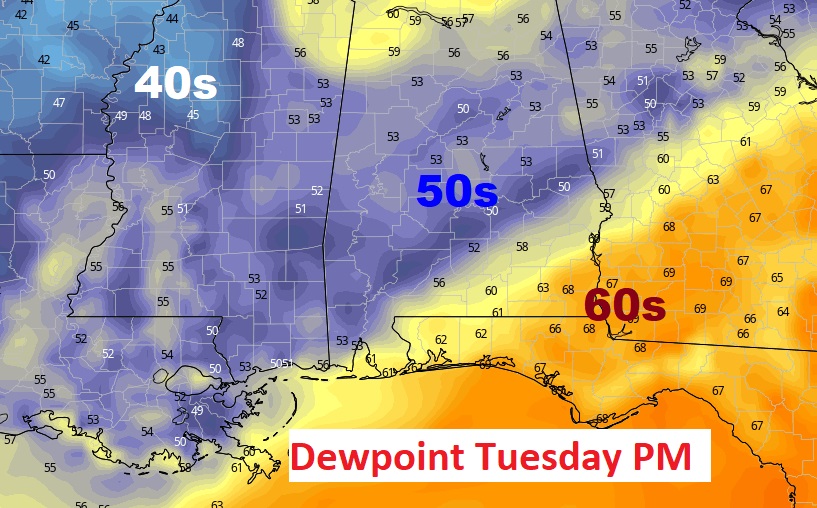
This map looks nice! Here’s a sample of dewpoints Tuesday afternoon. Very comfortable air. When the dewpoint is below 60…the news is GREAT!
TROPICAL OUTLOOK:
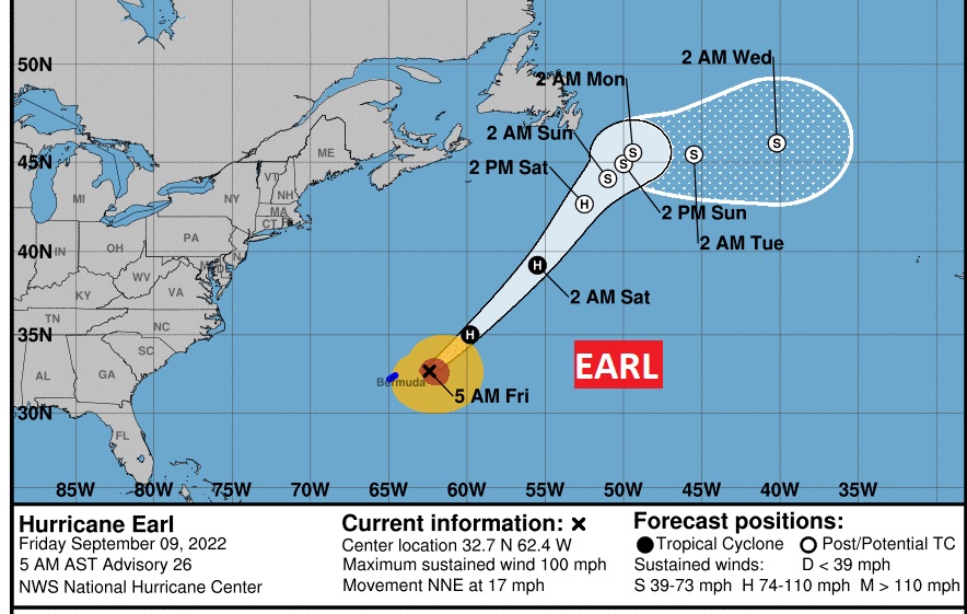
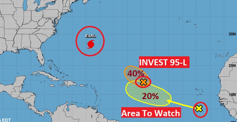
Earl is a 90 mph hurricane, passing southeast of Bermuda. Expected to become a major hurricane by tonight.
The probability of Invest 95-L developing has gone down a bit. It’s in a hostile environment. It still could become Fiona, as it curves into the Atlantic.
An Area to Watch in the eastern Tropical Atlantic, has a chance of becoming a named tropical storm in a few days.
FULL MOON: The Full Harvest Moon is tonight. But we probably won’t be able to see it.
Thanks for reading this Blog this morning! This morning we are LIVE on the radio from 6 to 9 on NewsTalk 93.1. Watch us on TV on CBS 8 and ABC 32. I’ll have another update for you in the morning. Have a great day!
–Rich