
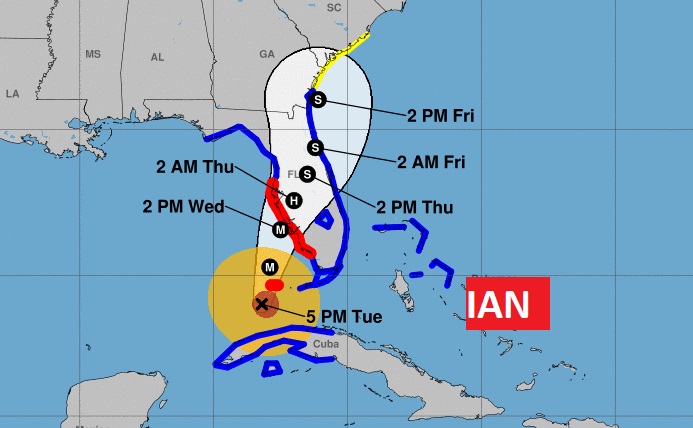
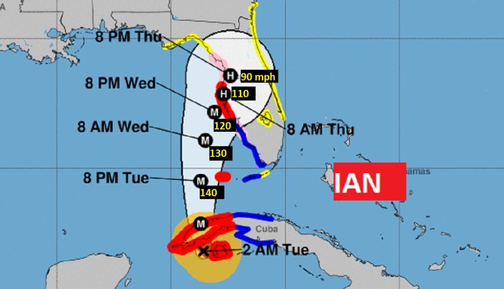
4PM UPDATE: Ian will be getting even stronger soon. Cat 3. Hurricane Ian, winds now 120 mph. Pressure: down a bit to 952 mbs. (lowest reading so far) Moving north at 10 mph. More intensification is expected. Ian could become a Cat 4 Hurricane in the SE Gulf, before losing some of it’s intensity just before landfall. Latest forecast advisory suggests a potential landfall between Fort Myers and Tampa Bay Wednesday afternoon. Then, the center will cross Florida northeastward to near St. Augustine and into the Atlantic.
1PM UPDATE: Ian getting stronger in the SE Gulf. Cat 3. Hurricane Ian winds now 120 mph. Pressure: 955 mbs. (lowest reading so far) Moving north at 10 mph. Next full advisory at 4PM.
10AM UPDATE: Small temporary reduction in Ian’s wind, after its trek across western Cuba. Hurricane Ian winds now 115 mph. Pressure: 963 mbs. Moving north at 10 mph. But, Ian is forecast to resume Rapidly Strengthening, shortly, as the storm moves into the southeast Gulf of Mexico. It will become a Cat 4 hurricane in the eastern Gulf. Still expected to be a major hurricane by landfall Wednesday over the southwest to west central Florida Gulf coast. Extremely dangerous storm surge of up to 9-10 ft. the southwest to west central Florida Gulf coast. possible in the Tampa Bay area. Ian will weaken quickly right after landfall but the storm will slowdown and become larger. There will be extremely heavy rainfall.
EARLY MORNING UPDATE:
Good Morning! All eyes on IAN, destined for a Florida landfall. For us, the news is good. Here’s my brief video forecast discussion.
TODAY: Get ready for another great Fall Day. Early this morning you may need a jacket. Sunshine. Breezy. Low humidity. High in the mid 80’s. NW wind 6 to 16 mph. Clear and pleasantly cool tonight. Jackets? Low 56.
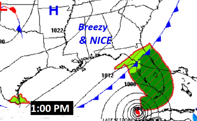
Here’s the Map set-up at 1:00PM All is well here in Alabama. All the drama is in Florida and the eastern Gulf.
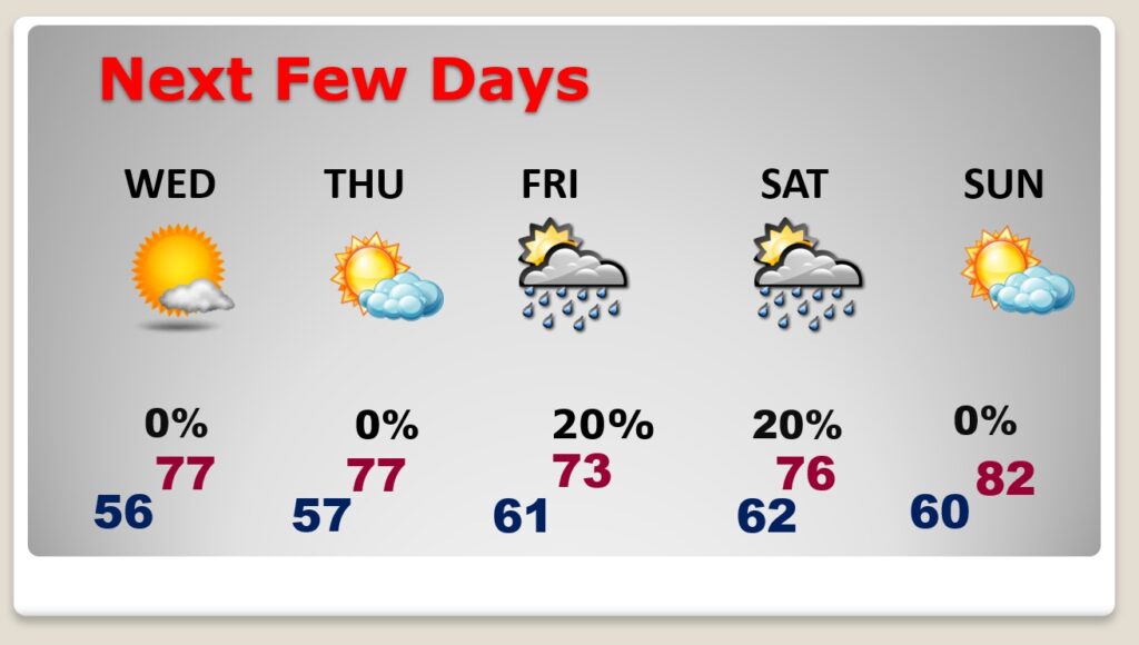
NEXT FEW DAYS: For us, beautiful Fall Weather continues through Thursday. Breezy at times. The Friday/Saturday forecast is obviously subject to change depending on Ian’s exact track. However, right now I only have a tiny rain chance in for Friday and Saturday. Many towns may not see any rain at all. Being on the west side of Ian’s track is good news for Alabama. The circulation will drag down some cooler air. We’ll be in the lower 50’s for a high Friday. Mid 70’s Saturday.
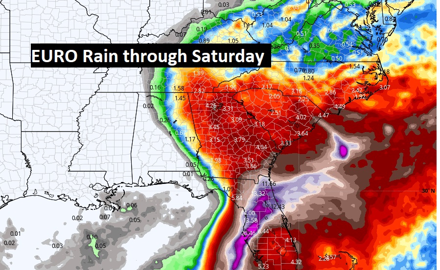
Take a look at the expected rain shield for Ian (based on the current track), through Saturday. This is the EURO model. It takes the western limit of the Ian rain shield barely into east Alabama. Much of central and west Alabama could be bone dry. I will maintain a tiny 20% rain chance for Friday and Saturday, but I keep lowering the chances.
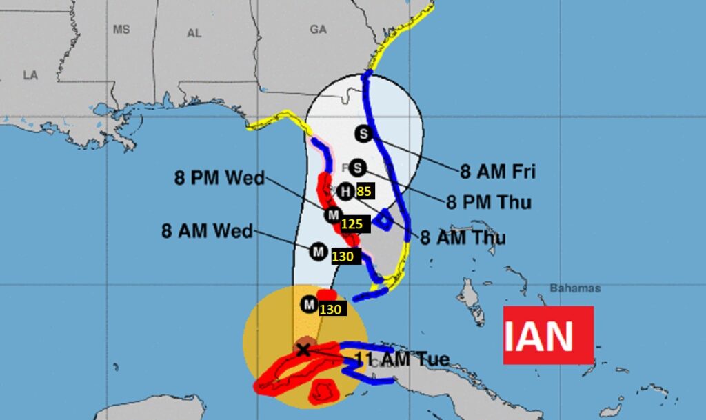
TROPICAL OUTLOOK: Major hurricane Ian will cross western Cuba today as it aims for the Gulf of Mexico and Florida. Rapid intensification continues. Winds are now 125 mph. The central pressure has dropped to 952 mbs. Movement is NNW at 12 mph. Ian made landfall on the Cuban coast at 3:30 AM CDT. Ian will still be a major hurricane when it makes landfall on the west central Florida coast Wednesday or Wed, Night.
Various Tropical Watches and warnings continue along the Florida western Gulf coasts, including Hurricane Warnings, Storm Surge Warnings, Tropical Storm Warnings.
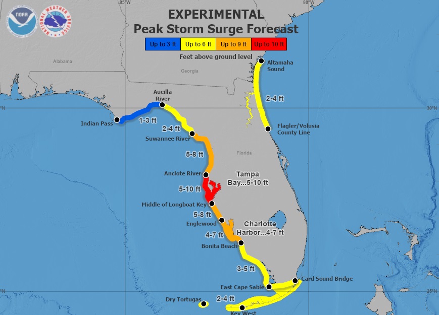
This map is most frightening. Maximum expected storm surge. Take a look at the Tampa Bay area forecast. 5 to 10 feet surge could be devastating.
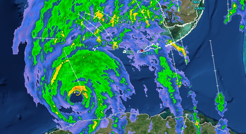
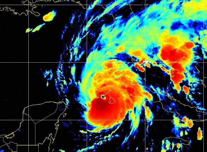
IAN’s satellite presentation this morning is very impressive as rapid intensification continues. The storm is becoming larger in size.
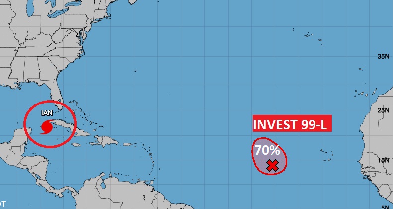
Elsewhere in the Tropics, there’s Invest 99-L in the tropical Atlantic. Could this become Julia this week? There is a 70% chance of development.
Thanks for reading this Blog this morning! This morning we are LIVE on the radio from 6 to 9 on NewsTalk 93.1. Watch us on TV on CBS 8 and ABC 32. I’ll have another update for you in the morning. Have a nice day!
–Rich