
4PM UPDATE:
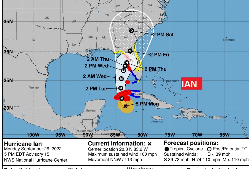
Ian continues to rapidly intensify. Hurricane #Ian winds now 100 mph.
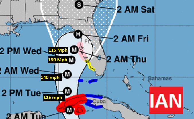
It will be a major hurricane by it’s western Cuba arrival. Could be a Cat 4 hurricane in the SE Gulf Wed. Extremely dangerous storm surge of up to 9-10 ft. near Tampa Bay. Hurricane Warning.
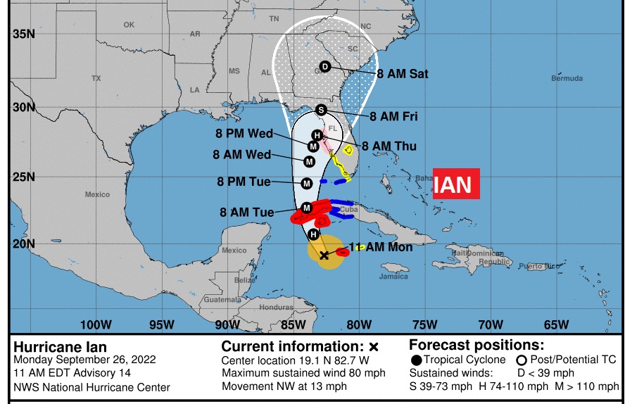
10AM UPDATE: Not much change in the forecast cone. Hurricane #Ian winds now 80 mph. Pressure: 980 mbs. Ian Forecast to Continue Rapidly Strengthening. Conditions in Western Cuba to Deteriorate This Evening And Tonight With Significant Wind and Storm Surge Impacts Expected. http://hurricanes.gov
Good Morning! Here’s my brief video forecast discussion.
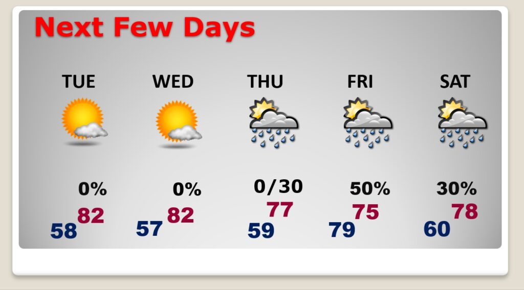
TODAY: Nice day! Fresh air behind the cool front which moved through overnight. Sunshine. Breezy. Low humidity. High in the mid 80’s. NW wind 6 to 16 mph. Clear and pleasantly cool tonight. Low 57.
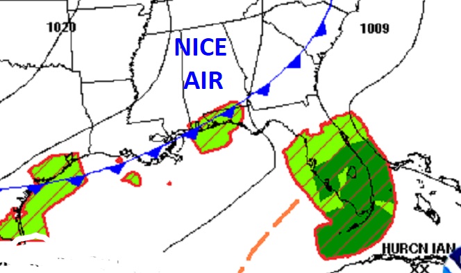
The front that brought a few showers to the state yesterday will be close to the coast by lunchtime.
NEXT FEW DAYS: Beautiful Fall Weather continues Tuesday & Wednesday. Our late week weather will be highly dependent on the future track of Ian. Right now, I have an increasing chance of showers by Thursday night, and a better chance of showers Friday into Saturday. Becoming breezy. This forecast is obviously subject to change depending on Ian’s exact track. However, the good news, at the moment for us, it appears Ian’s track will stay EAST of us. We defiantly want to be on the west side of Ian’s track.
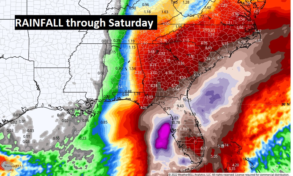
Take a look at the expected rain shield for Ian (based on the current track). Notice the heaviest rain will be near the Georgia/Alabama border. Notice how the rain totals quickly taper off as we go toward west. Hardly any rain along the Mississippi/Alabama border. This forecast goes through Saturday.
It’s too early to talk about potential wind gusts here in Alabama. But, due to the pressure gradient, it is likely to be quite breezy here, especially Friday. We’ll focus more on the wind potential as we get later in the week.
TROPICAL OUTLOOK: National Hurricane Center’s new forecast cone continues to look very problematic for west Cuba and the Florida peninsula, particularly. Ian is now a Hurricane with winds of 75 mph. Located 90 miles SW of Grand Cayman, moving NW at 14 mph. Notice that much of eastern Alabama is still in the cone from I-65 eastward.
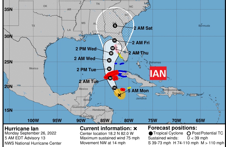
Conditions continue to be very favorable for potential explosive development in the NW Caribbean and the eastern Gulf. It could reach Category 4 status in the Gulf. This could be a benchmark storm for parts of Florida. I’m particularly worried about the Tampa Bay area, including the Storm Surge and flooding potential.
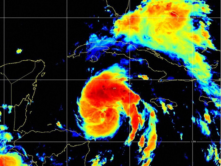
IAN’s satellite presentation this morning is starting to look more impressive with rapid intensification underway.
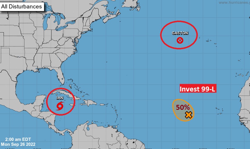
Elsewhere in the Tropics, NHC is also tracking Gaston in the north Atlantic. Plus, there’s Invest 99-L in the tropical Atlantic. Could this become Julia this week?
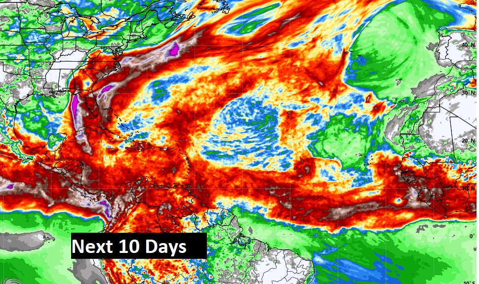
Look at the rainfall potential over the next 10 days in the Atlantic Basin. There’s clues of a lot of tropical mischief in that alleyway through the Tropical Atlantic through the Caribbean. Stay tuned.
Thanks for reading this Blog this morning! I’ll have another update for you in the morning. Have a nice Wekend!
–Rich