
Good Morning! Our beautiful Fall weather continues. Here’s my brief forecast discussion.
CLIMATE DATA: Yesterday’s high was 85, after a chilly morning low of 49. Normal: 85/61. Rainfall: 0.00”. Sunrise 6:42, sunset 6:28.
TODAY: Warm & Dry again today. Sunshine. Low humidity. High in the low to mid 80’s. NE wind 7 to 14 mph. Clear and pleasantly cool again tonight. Low 57.
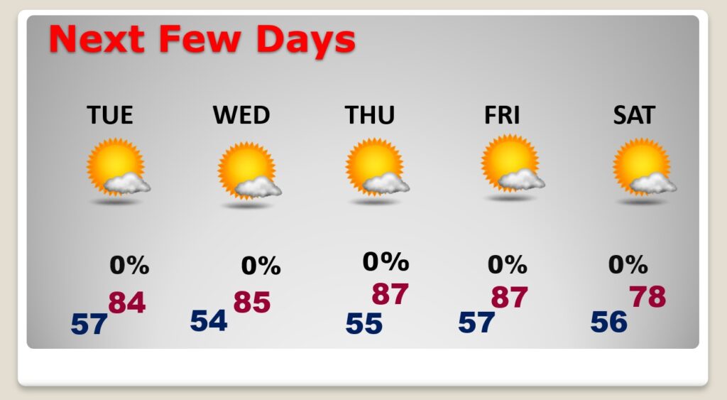
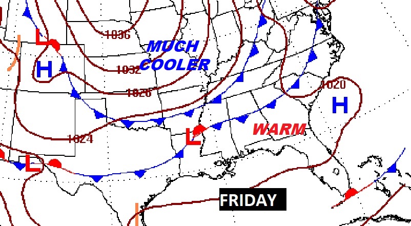
NEXT FEW DAYS: Our long string of dry, storm-free days continues. We should stay dry and sunny through all of this week. High mostly in the mid 80’s Tuesday & Wednesday. Upper 80’s Thursday & Friday. Nights will be pleasantly cool, mainly in the 50’s. Late week, a Cold front will bring in a batch of cooler air by Saturday.
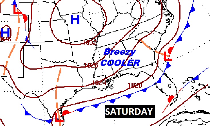
Late week cool front will deliver much cooler air. Breezy & Cool Saturday.
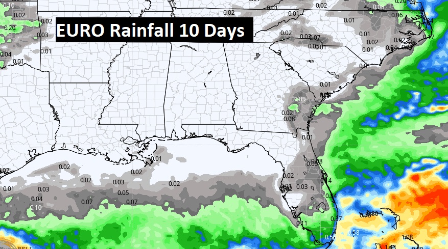
We should be dry for several more days. Here’s the Euro model through 10 days.
TROPICAL OUTLOOK: All eyes on Invest 91-L in the Tropical Atlantic. It has a medium 40% chance of development over the next 5 days, as it treks through the Caribbean.
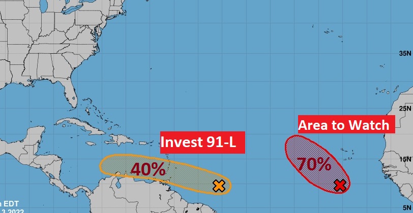
Elsewhere in the Tropics, there is an Area to Watch in the far eastern Atlantic. It has a 70% chance of development in the next 5 days. The rest of the tropical Atlantic is very quiet for now.
Thanks for reading this Blog this morning! I’ll have another update for you in the morning. Have a nice day!
–Rich