
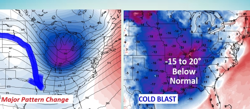
Good Morning! Throw a log on the fire. Much colder air has engulfed our state. This is a fundamental change in our pattern for an extended period of days. The normal hi/lo this time of year is 71/44. We will not see normal for the next 10 days. Meanwhile there’s more rain in the forecast by Monday night into early Tuesday. Here’s my brief forecast discussion below….
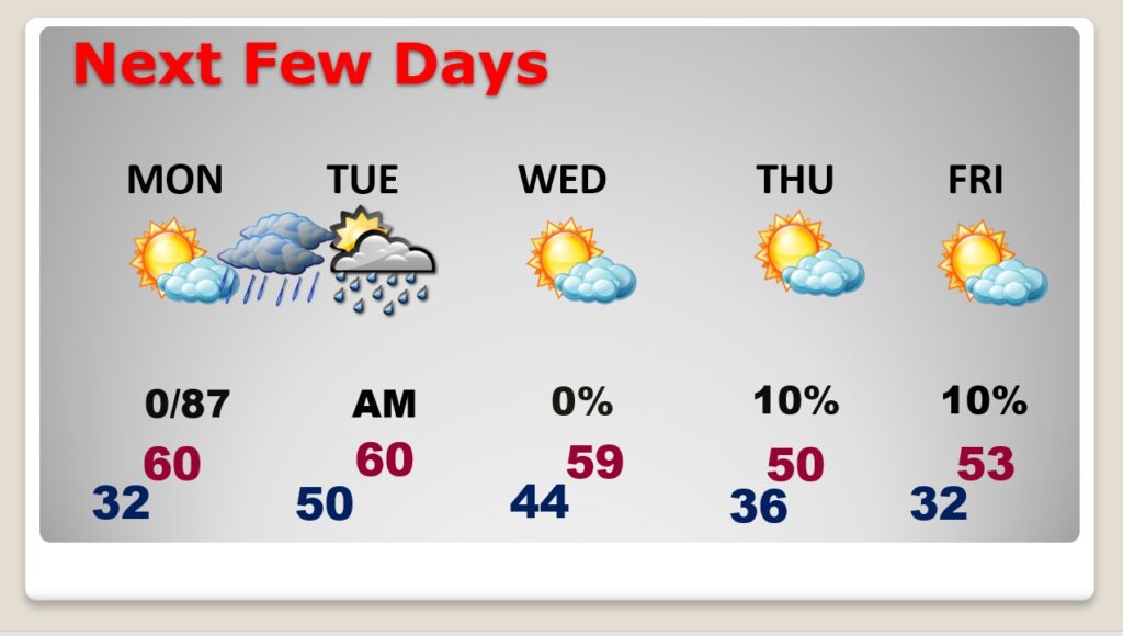
TODAY: Brisk today. Sunshine. North wind 10 to 20 mph. Today’s high of 52 is almost 20 degrees too cold compared to normal. We’re headed for a freeze tonight. We’ll fall close to 32 at Dawn.
Temperatures will be running 15-20 degrees below normal today as arctic air invades the region.
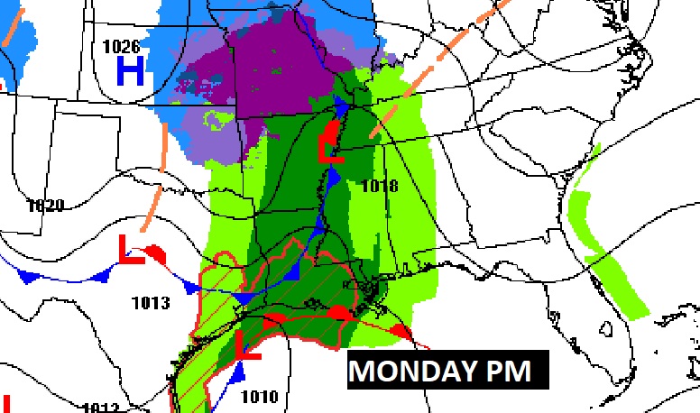
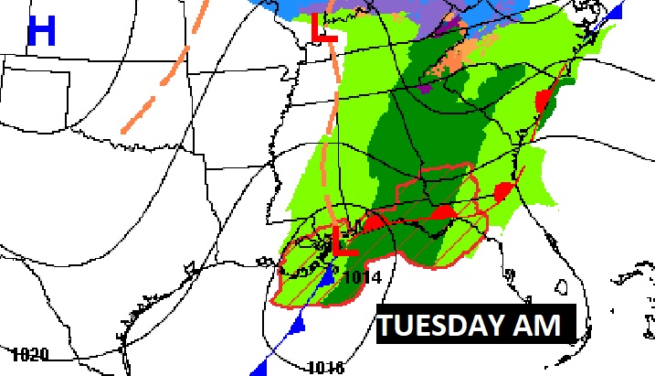
NEXT FEW DAYS: It will be way too cool for way to long. Monday will be dry but very cool. More rain returns to the forecast Monday night into Tuesday as a storm system moves eastward along the Gulf coast. The rest of the week looks very chilly with highs in the 50’s and lows in the 30’s.
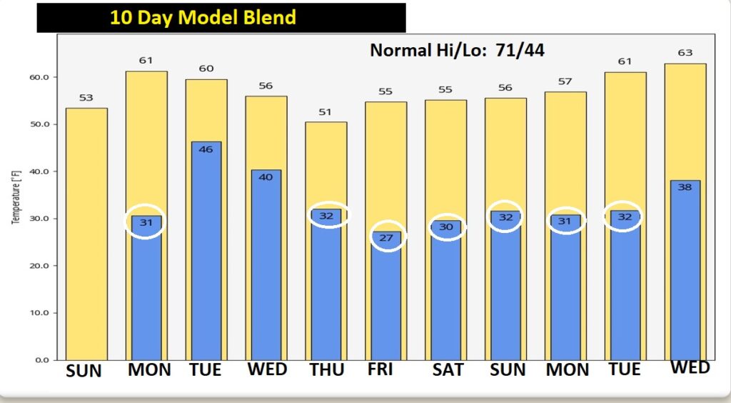
Here’s the model temperature blend for the next 10 days. Normal high 71. Normal Low 44. We won’t come within a mile of normal for a long time. I see temperatures freezing or below on 6 of the next 10 mornings. In the distant future I see a Big turnaround late in the month. But, perhaps not until November 27th or 28th. The only nice thing I can say – I do not see any severe weather threats in the next 10-12 days. This is great news because we are in the heart of our Fall Tornado season.
Thanks for reading this Blog this morning! Chase is enjoying a warm fire this morning!
I’ll have another update for you in the morning. Have a nice day!
–Rich