
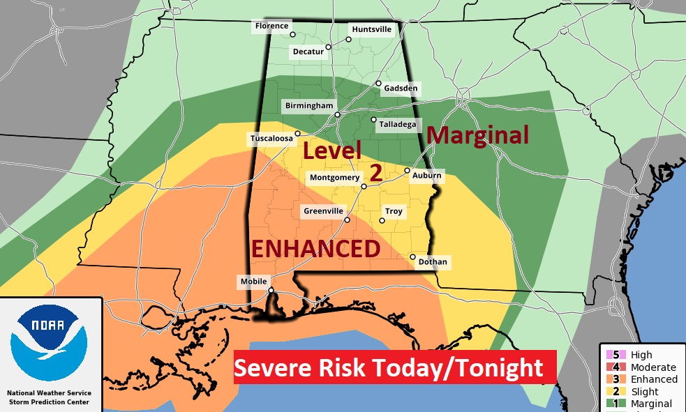
Good Morning! We have a major storm system approaching. This system will bring severe weather to much of Alabama, along with the threat of locally heavy rainfall. The Enhanced Risk covers most of southwest Alabama. That’s where we could see a few strong tornadoes. The Level 2 threat covers most of us. You can bet on a Tornado Watch later. All modes of severe weather are possible including tornadoes and damaging wind gusts. Much cooler air will follow the storm system, especially by Friday and beyond. It will be a complete change of climate. Stay weather aware. Here’s my brief forecast discussion.
TODAY: Showers are possible in the morning. But, the strong to severe storms will hold off until late afternoon and tonight. Windy today. SE wind 10 to 20 gusting to 25 mph. High 69. Strong to severe storms through the evening hours, until they move out late tonight. Windy and colder by late tonight. Low 49.
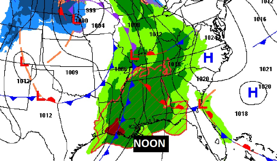
Here’s today’s outlook from the Storm Prediction Center. The Enhanced Severe Risk covers most of southwest Alabama. That’s where we could see a few strong tornadoes. The Level 2 threat covers most of us. You can bet on a Tornado Watch later. All modes of severe weather are possible including tornadoes and damaging wind gusts.
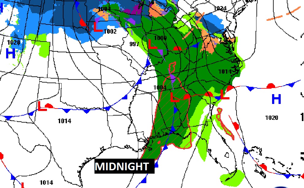
Here’s some Future Radar snapshots, which will give you some general idea on how the late afternoon and evening hours could unfold, with the movement of the stronger storms.
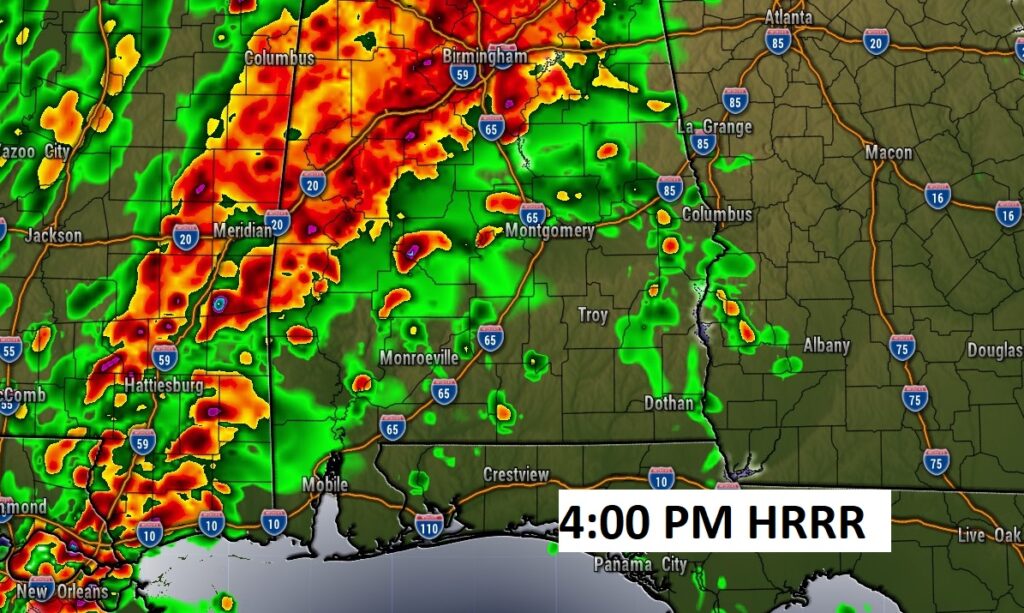

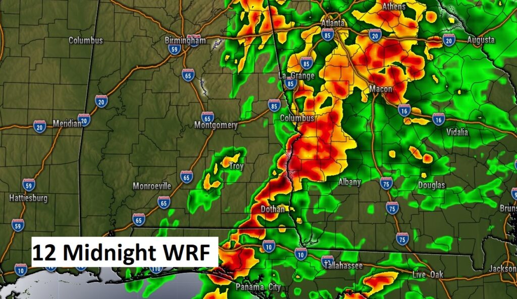
This map is helpful on timing. Storms could begin as early as Noon in the far western counties, and as late as late as 3AM in the far SE counties. For most of us, in the middle, 4PM to 11 PM will be key hours.

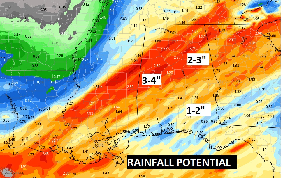
Locally heavy rainfall amounts are expected.
This storm system will be a HUGE snow storm/blizzard for multiple state. It will make many national news headlines. There have been a number of tornadoes that have already caused lots of damage, injuries and at least one fatality in the ArkLaTex area.
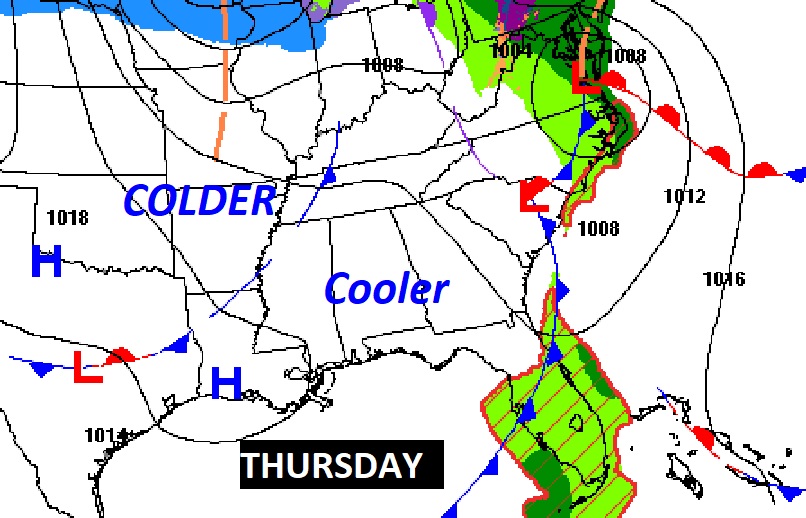
By tomorrow, the storm system will be long gone. Much cooler air will flood into the state.
NEXT FEW DAYS:
It will be much colder Thursday night…mid 30’s. Friday’s high in the lower 50’s. Near freezing Friday night. Saturday’s high barely near 50. Sunshine. We should be near freezing Saturday night and Sunday night. Small risk of showers returns on Monday.

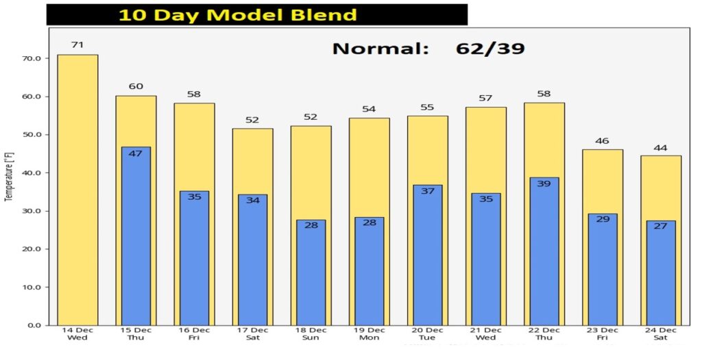
Attention Cold Weather Fans…you’ll love seeing the much colder temperatures over the next 10 days. In fact, check out some of the numbers as we get closer to Christmas Day. That’s some very chilly stuff!
Get our free weather app on your phone or tablet if you don’t already have it! It will give you INSTANT push notifications for Severe Weather Watches and warnings today and tonight. PLUS, you’ll be able to track the storms with Interactive Radar and Future Radar. Our weather app will be your best friend. Plus, it has hourly forecast, 10 day forecasts and access to all my Blog updates, videos and tweets. It’s free in the app store. Just search Rich Thomas Weather.
Thanks for reading this Blog this morning! I’ll have another update for you in the morning. Stay weather aware!
–Rich