Good Morning! It’s a cold Sunday morning. We’re starting off in the 20’s. Today will be not as cold as Saturday. You’ll notice a difference. Look for a major temperature turn-around in the week ahead. In fact, expect 70 or above Tuesday through Thursday. There will be two storm systems in the week ahead. The first storm system will be bring showers to the state by Tuesday. There will be a brief break between storm systems until the second one delivers a round of showers and storms by late Wednesday/Wed. Night and into Thursday. System two needs to be watched for a potential sever weather risk. It’s too early to say.
THURSDAY TORNADO TRAGEDY SURVEYS: The National Weather Service continued surveying central Alabama tornado damage yesterday. Seven tornadoes have been surveyed so far, including the Selma Tornado (EF-2), which may have lifted near the Dallas/Autauga line, before touching down again in Autauga county, reaching EF-3 strength and becoming deadly. Quoting NWS:
“A long-tracked tornado is believed to have moved through Autauga,
Elmore, Coosa, Tallapoosa, and into Chambers. Surveys will
continue Sunday. At least EF3 damage has been confirmed in Autauga
and in Coosa Counties. Seven fatalities occurred in Autauga
County.”
Here’s the preliminary updated Storm survey from NWS Birmingham.
https://forecast.weather.gov/product.php?site=NWS&product=pns&issuedby=BMX
TODAY: Cold start in the 20’s at Dawn. Sunshine and not as cold today. High 57. (Normal 59/36) Not as breezy today. Southwest wind 6 to 12 mph. Clear and cold tonight. Perhaps one more freeze. Low 32.
NEXT FEW DAYS: Look for a major temperature turn-around in the week ahead. Monday, MLK day will reach into to the 60’s. 70’s look likely Tuesday through Thursday. Cooler Friday.
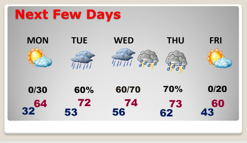
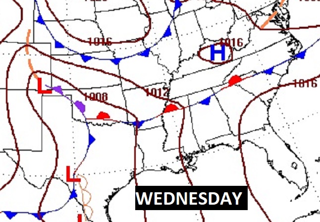
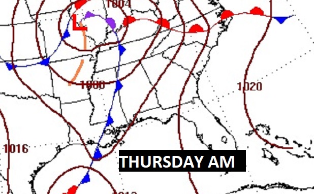
There will be two storm systems in the week ahead. The first storm system will be bring showers to the state by Tuesday. There will be a brief break between storm systems until the second one delivers a round of showers and storms by late Wednesday/Wed. Night and into Thursday.
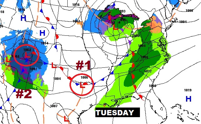
System two needs to be watched for a potential sever weather risk. It’s too early to say, at this point. Instability will be limited, but there will be plenty of directional sheer.
.
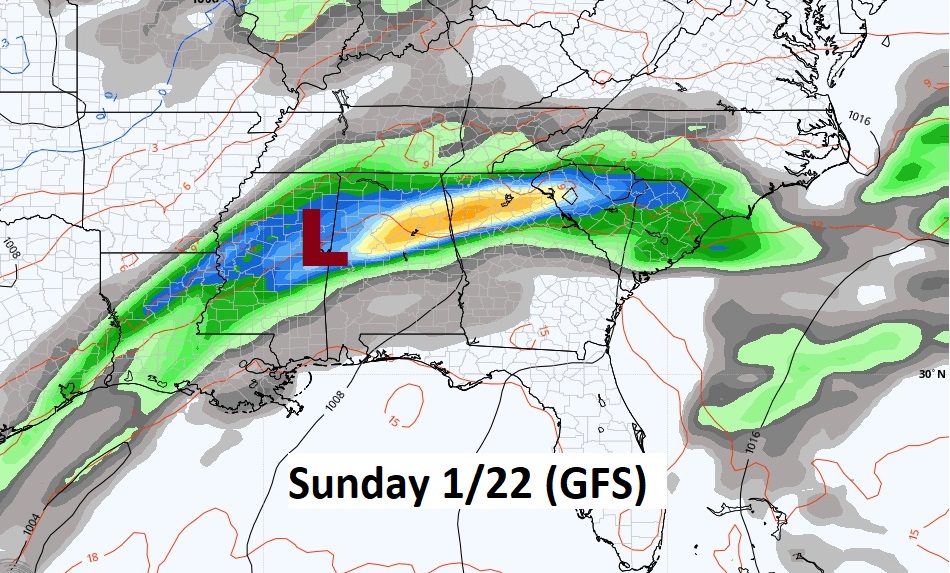
Another significant storm system is possible during the weekend of January 21/22.
Thanks for reading this Blog this morning! I’ll have another update for you in the morning. Have a nice day!
–Rich
