
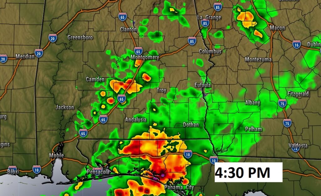
Good Morning! After a Record Tying 81 degrees on Wednesday, it’s a very stormy early morning across much of Alabama as a cold front approaches. The front could bring a few hefty storms this morning and today, particularly from US 80/I-85 southward. There is a Marginal Severe risk. The front will slow and stall, and it will be wet at times today through Saturday. Much cooler air will gradually funnel in. Saturday will be the coldest day. We’ll be in the 30’s Saturday night. Sunshine will return Sunday. Here’s my brief forecast discussion.
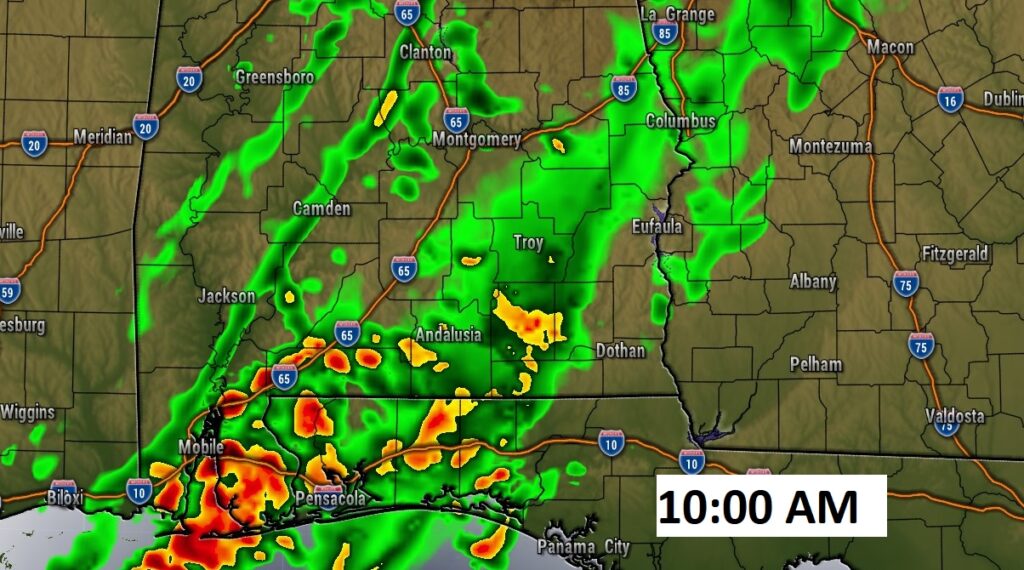
TODAY: Showers and thunderstorms likely at times. A few stronger storms, possibly severe, mainly in south Alabama. Cloudy and breezy. Not as warm. High 69. South winds 10-15 gusting to 25, shifting to the west by afternoon. Scattered showers tonight. Cooler. Low 50.
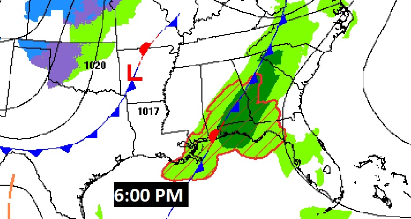
The front will stall in south Alabama this afternoon and tonight.
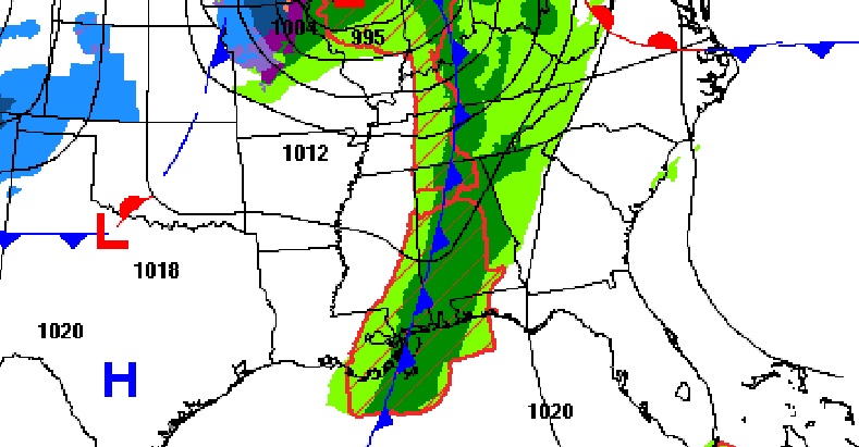
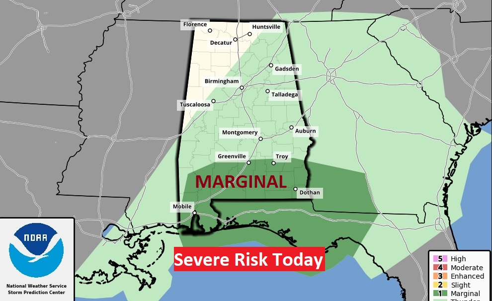
From SPC, the Marginal Severe Risk shifts south today, mainly from U.S. 80/I-85 southward. Damaging wind gusts will be the greatest threat.
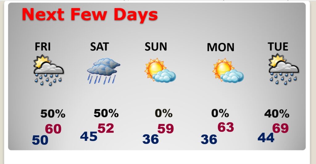
NEXT FEW DAYS: Wet at times through Saturday. Colder air will follow the storm system, especially Friday night into Saturday. Fortunately, the cold will not last long. The coldest day will be Saturday. High in the lower 50’s at best. Breezy. Periods of mostly light rain. Coldest morning will be Sunday morning. Mid 30’s Sunshine returns Sunday. We’ll be back in the 60’s by Monday & Tuesday, and probably the 70’s on Wednesday. Rain returns to the forecast Tuesday & Wednesday.
One complicating factor in the weekend forecast involves an upper low which will migrate eastward across the Gulf states. That will set the stage for a wet and chilly Saturday.
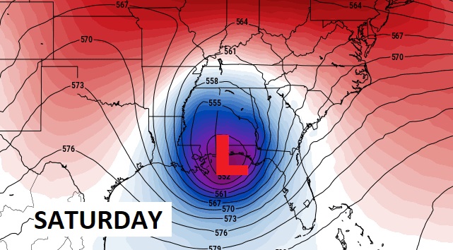
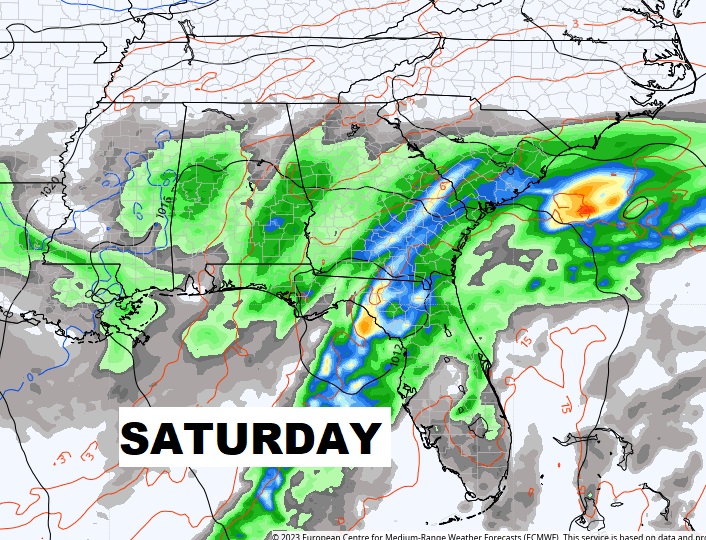
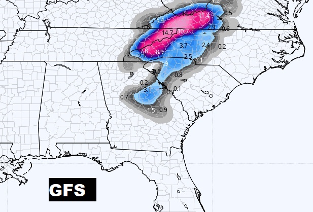
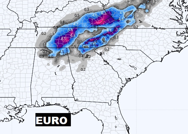
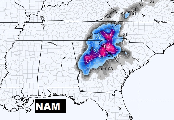
SOUTHERN SNOW?: Cold Upper Low will help promote a rare accumulating snow event for parts of the South this weekend, especially Tennessee, the Carolinas and North Georgia. But the models vary widely on the coverage area and snow amounts. Stay tuned. Very interesting.
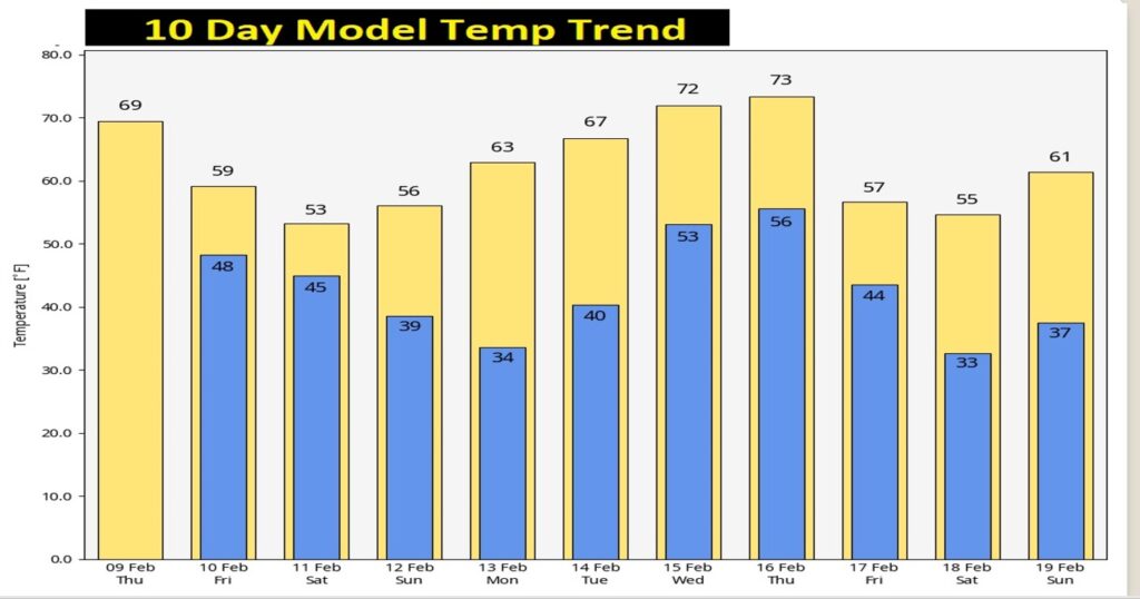
Here’s the 10 day temperature trend.
Thanks for reading this Blog this morning! This morning we are LIVE on the radio from 6 to 9 on NewsTalk 93.1. Watch us on TV on CBS 8 and ABC 32. I’ll have another update for you in the morning. Have a nice day!
–Rich