
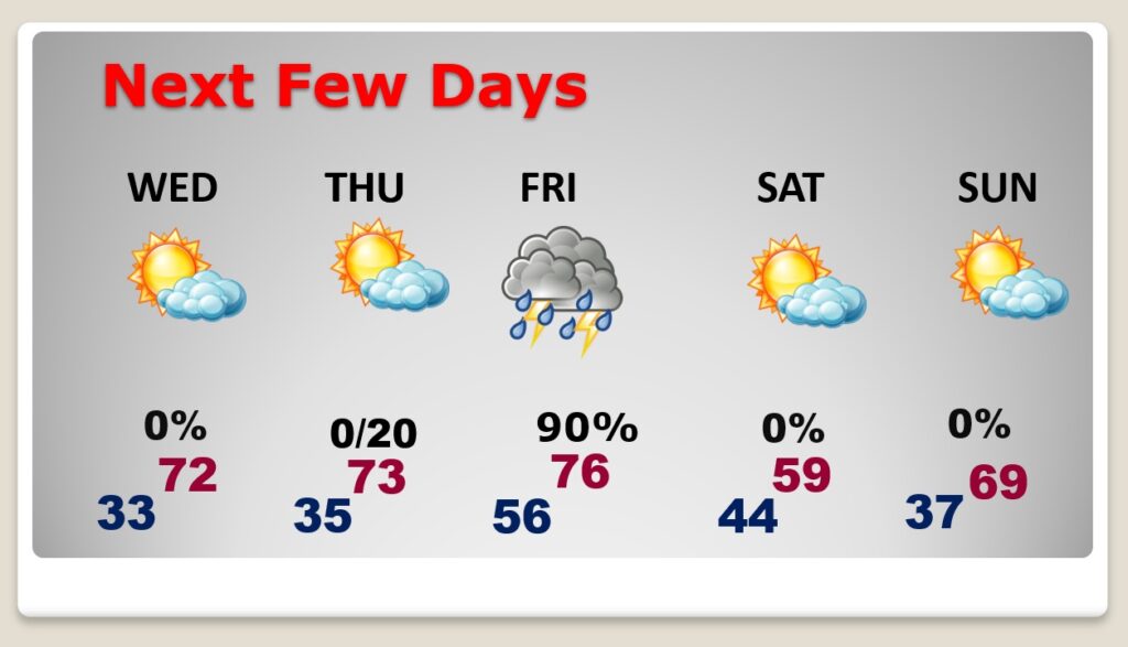
Good Morning! It’ll be quite a frosty start in most towns this morning. Our March Cold Snap continues. Today’s high will not make it out of the 50’s. A Freeze Warning is in effect Tonight. There will be widespread frost Wednesday morning. Alabama growers should take necessary precautions. Temperatures will rebound to the 70’s Thursday and Friday. There will be another round of showers and storms Friday as a strong cold front approaches. A few strong/severe storms are a good bet. Then, get ready for yet another Temperature Crash starting Saturday. Here’s my brief forecast discussion.
TODAY: Widespread frost is likely in many towns this morning. Mostly sunny today. Quite cold for March. High 57. (Normal 71/46) North wind at 10 to 16 mph. Clear and cold tonight. FREEZE WARNING. Low 32.

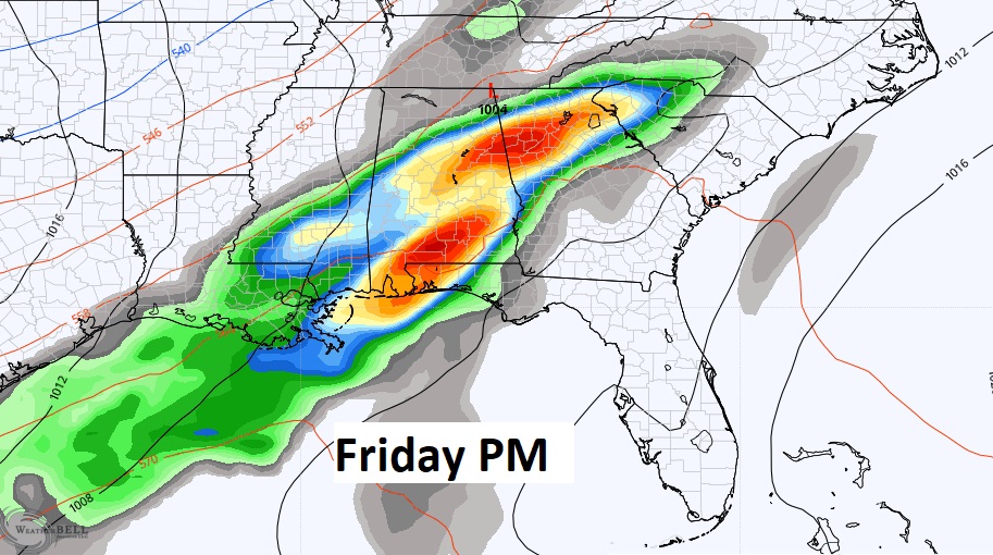
NEXT FEW DAYS: Temperatures will rebound to the 70’s Thursday and Friday. There will be another round of showers and storms Friday as a strong cold front approaches. A few strong/severe storms are a good bet. Then, get ready for yet another Temperature Crash starting Saturday.
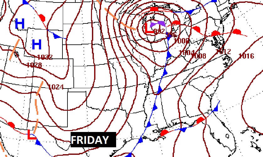
We continue to monitor the Friday storm system for any signs of strong to severe storms.
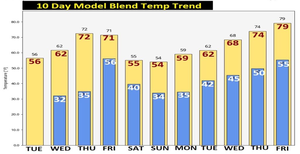
Here’s the 10 Day Model Temperature Blend from WPC. Chilly through Wednesday. Warmer Thursday and Friday. Then, another cold snap. We could be back to the mid 30’s over the weekend and on the first day of Spring , Monday, before temperatures rebound again.
Thanks for reading this Blog this morning! This morning we are LIVE on the radio from 6 to 9 on NewsTalk 93.1. Watch us on TV on CBS 8 and ABC 32. I’ll have another update for you in the morning. Have a nice day!
–Rich