
(**This morning I will get on a plane to New York City. My Blog Updates will be very, very brief for a few days through Sunday, as I enjoy a super-packed itinerary on my vacation. Some of those mornings, just the forecast. Thanks for your understanding. You’ll still hear by updates on the radio, everyday 😊)
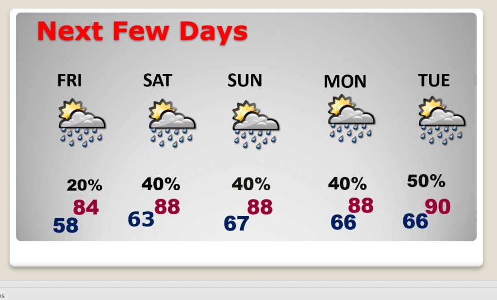
Good Morning! We have had a wonderful first week of May! It started off cool, but gradually we have been warming each day. Now, even the nights are starting to moderate. Today should be a nearly perfect early May day. We’ll be near 80 today, mid 80’s Friday and upper 80’s over the weekend. A few isolated showers may start to pop up Friday. But, Saturday through Tuesday, look for more of a summer-like scenario with spotty, random hit or miss storms. Here’s my brief forecast discussion.
** This is interesting. Wednesday morning’s low of 46, at MGM, tied a RECORD LOW from 1876. AMAZING.
TODAY: We’ll be in the mid 80’s Friday and upper 80’s over the weekend. A few isolated showers may start to pop up Friday. But, Saturday through Tuesday, look for more of a summer-like scenario with spotty, random hit or miss storms..
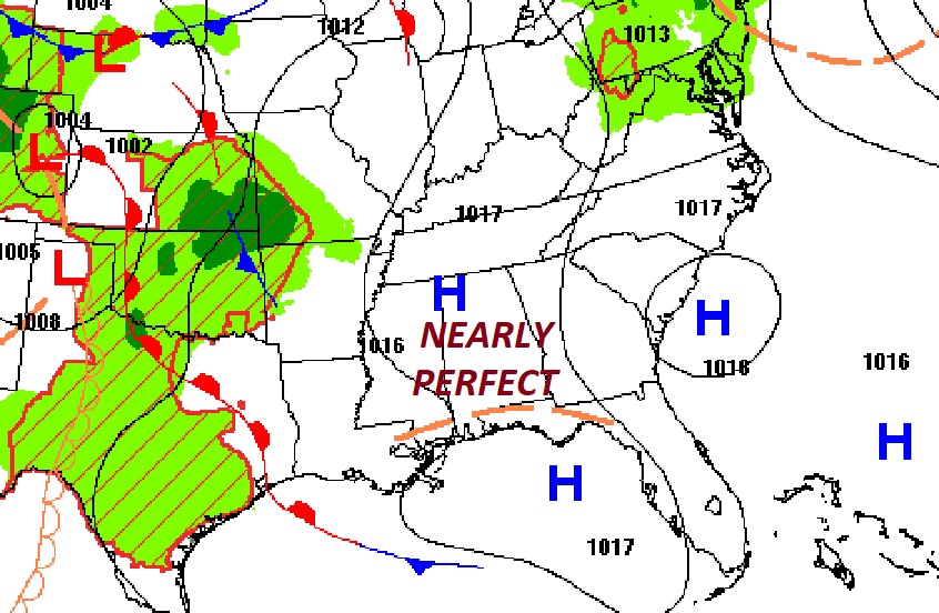
NEXT FEW DAYS: Our storm-free pattern continues for now. Thursday will be nearly perfect with a high near 80. Scattered showers Saturday, Sunday & Monday, but not a wash out by any means. Highs in the upper 80’s over the weekend.
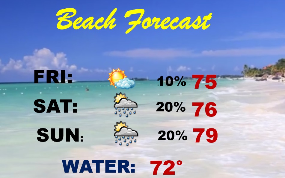
BEACH FORECAST: Not bad! Lots of sun Friday. Just a small rain chance Saturday and Sunday. Chilly Gulf water temperature 72. Moderate rip current risk.
Thanks for reading this very brief Blog this morning! As mentioned above, I’ll beon vacation in New York City, starting today We have an extremely packed itinerary. My daily updates to you through Sunday will be very brief, indeed. Thanks for understanding!
–Rich