
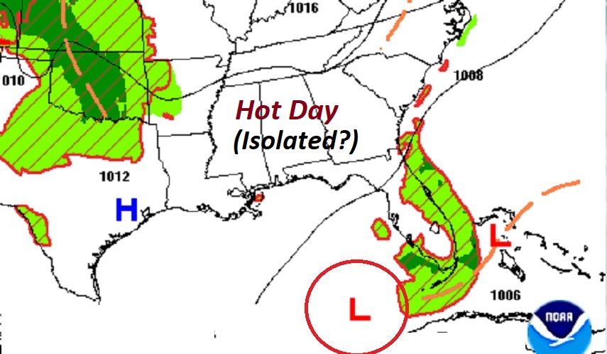
Good morning! Friday we made it to 90 at MGM. That’s actually normal. Today will likely be a little hotter. We are headed for the lower 90’s. It’s a little more humid, but not crazy yet. Dewpoints will be in the lower 60’s. Humid enough, but not awful. Fairly isolated, random pop-up showers and storms, mostly in the afternoon & evening hours, for the next several days. Very little day to day change. Have the sunscreen ready. Great weather for a trip to the Lake or your backyard pool. Here’s my brief forecast discussion.
CLIMATE DATA: Friday’s morning low was a cool 67 at MGM. Afternoon high was 90. Normal hi/lo: 90 and 66. No rain at the airport.
TODAY: Mostly sunny. A little more humid. High near 90. Isolated, random showers & storms, especially afternoon & evening, fading out at night. NE wind 5 to 10 mph. Partly cloudy tonight. Low 68.
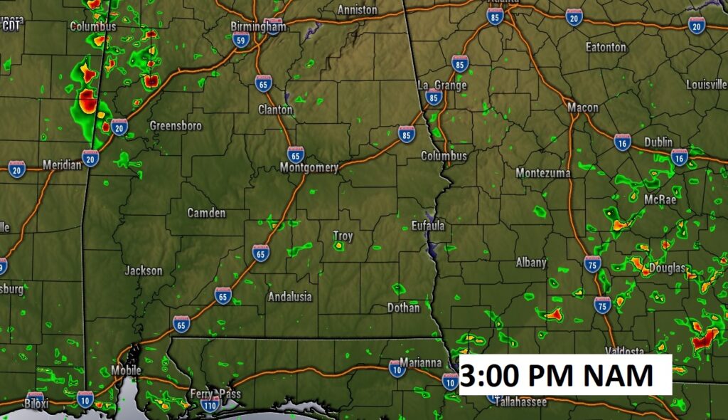
Here’s Future Radar. Afternoon snapshot example. Rain chances today are rather remote.
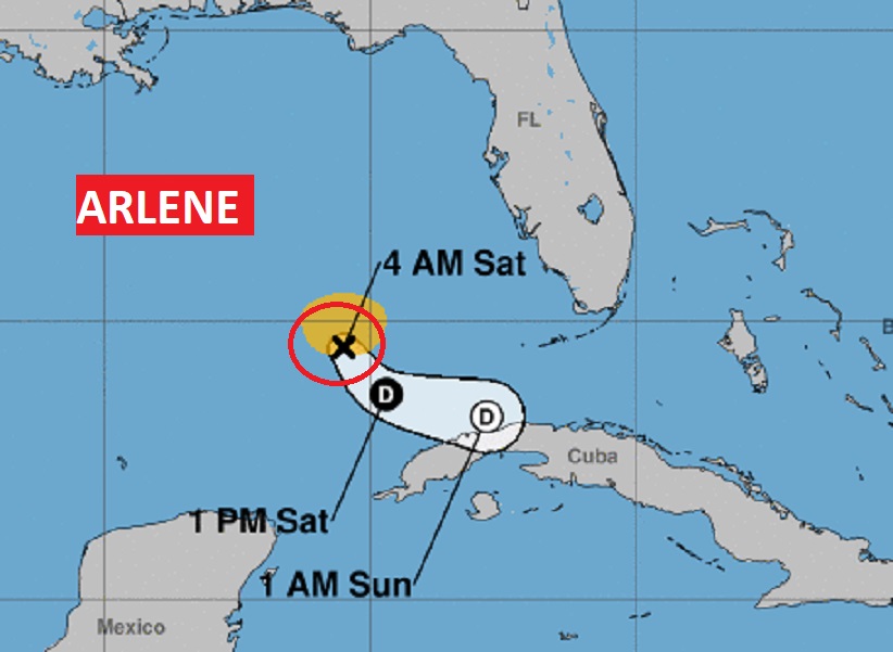
TROPICAL UPDATE: Minimal, weak, tropical storm Arlene is in the southern Gulf of Mexico moving south southeast at 9. Winds 40 mph. Arlene is encountering hostile winds aloft. It should weaken to Depression status today, and then become a Remnant Low by tonight or tomorrow, before dissipating.
.
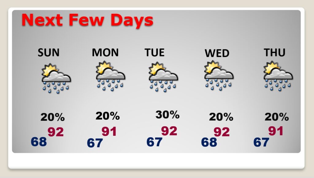
NEXT FEW DAYS: Not much day to day change. Hot days in the lower 90’s. A little more humid. Fairly isolated, random pop-up showers and storms each day, mostly in the afternoon & evening hours. It’s that typical summertime pattern.
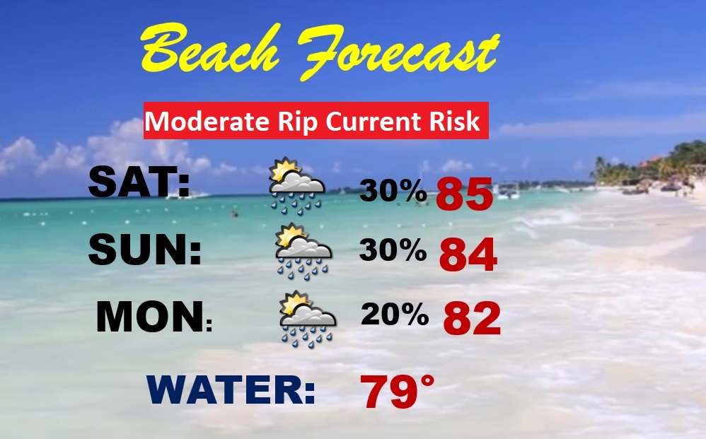
BEACH FORECAST: Pretty routine. Highs in the low to mid 80’s. Widely scattered thundershowers. Gulf water at 79 degrees. Moderate Rip Current Risk through Sunday. Yellow flags.
Thanks for reading this Blog this morning! I’ll have another update for you in the morning. Have a great weekend!
–Rich