
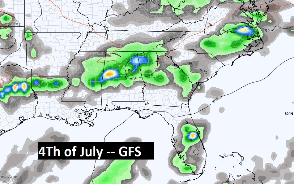
Good morning! Make no mistake about it. We are in for a very hot and humid 4th of July holiday weekend. The models have backed off just a tad on the intensity of the Heat. But still, on the biggest outdoor weekend of the year, the combination of heat and humidity will reach dangerous levels. By Saturday, widely scattered storms will return. Slowly, Sunday through Tuesday, the number of random storms will begin to increase. On the 4th of July, there will be a generous supply of hit or miss storms on the radar. Here’s my brief forecast discussion.
TODAY: Hot and Humid again. High 98-100. Heat index as high as 10`. Low tonight 76.
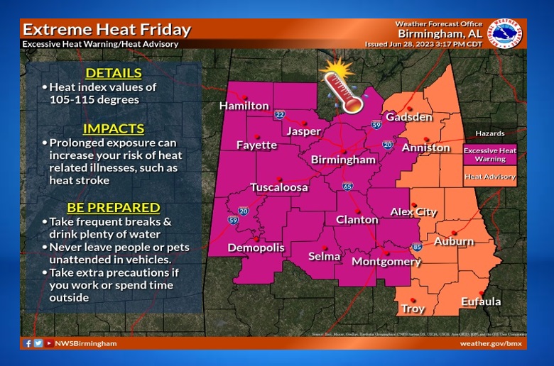
NEXT FEW DAYS: Excessive Heat Warning is in effect for Thursday and Friday. Extreme Heat indices of 110 to 115 are possible. There could be some widely scattered storms on Saturday. Rain chances are slightly better Sunday through Monday. Scattered storms on the 4th of July. Highs near 100 Friday and Sunday, upper 90’s on Sunday, and middle 90’s by Monday.
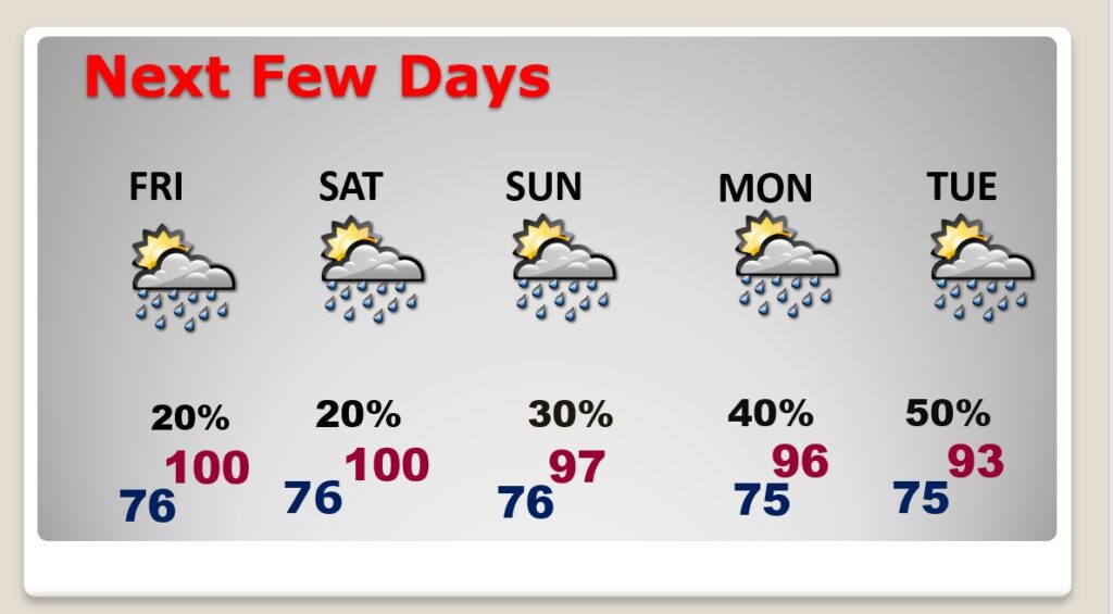
Scattered storms will be most numerous on the 4th pf July.
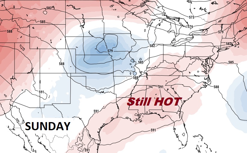
That big Upper High Heat Dome will be in control across the Gulf South for the next few days. By Sunday, the High starts to break down just a bit. But it will still be extremely hot.
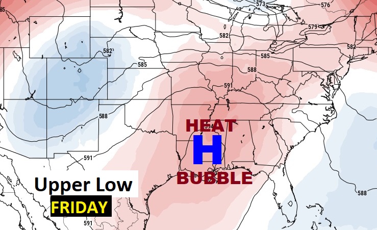
An Extreme Heat Warning is in effect on Friday. Heat index 100-115. A Heat Advisory covers the far east counties with a heat index of 105 to 110.
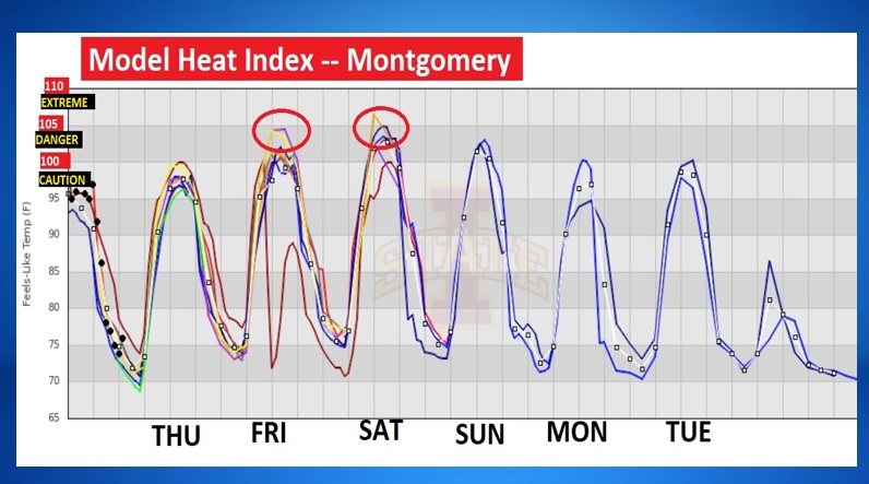
Here’s the Model Heat Index guidance for the next several days. While the numbers are not quite as intense, as you can see, it’s still going to be sizzling hot, with Heat Indices into the danger range, especially Friday and Saturday.
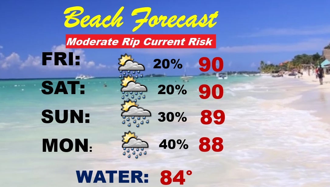
BEACH FORECAST: Brutal heat indices next few days. Stay hydrated. Even the beach sand will be blazing hot. Widely scattered storms. Better rain chances begin Monday and Tuesday. PLEASE respect the Flags on the Beach. Moderate Rip Current Risk. 11 people have lost there lives in just the last two weeks along the Alabama and NW Florida coast due to dangerous rip currents.
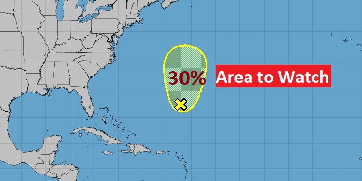
TROPICAL UPDATE: NHC is monitoring an Area to Watch in the Atlantic. Otherwise, the rest of the Atlantic, the Caribbean and Gulf of Mexico are quiet for now.
Thanks for reading this Blog this morning! This morning we are LIVE on the radio from 6 to 9 on NewsTalk 93.1. Watch us on TV on CBS 8 and ABC 32. I’ll have another update for you in the morning. Have a nice day!
–Rich