
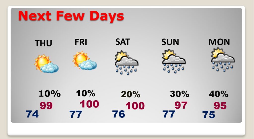
Good morning! Get ready for excessive/dangerous heat in the coming days. Some of the hottest days will be Thursday through most of the weekend. Officially the Excessive Heat Warning is in effect for Thursday and Friday. Extreme Heat indices of 110 to 115 are possible. There could be some widely scattered storms Friday and Saturday. Rain chances are slightly better Sunday through Monday. Scattered storms on the 4th of July. Highs near 100 Thursday and Friday, upper 90’s over the weekend, and middle 90’s by Monday. Here’s my brief forecast discussion.
TODAY: Hot and Humid again. High 96. Heat index as high as 100 to 102. Low tonight 73.
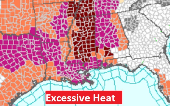
NEXT FEW DAYS: Excessive Heat Warning is in effect for Thursday and Friday. Extreme Heat indices of 110 to 115 are possible.
There could be some widely scattered storms Friday and Saturday. Rain chances are slightly better Sunday through Monday. Scattered storms on the 4th of July. Highs near 100 Thursday and Friday, upper 90’s over the weekend, and middle 90’s by Monday.
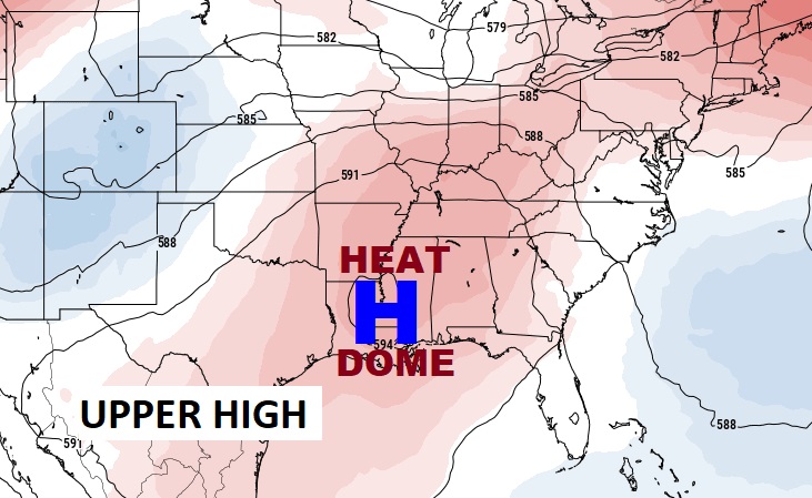
A big Upper High Heat Dome will be in control across the Gulf South for the next few days/
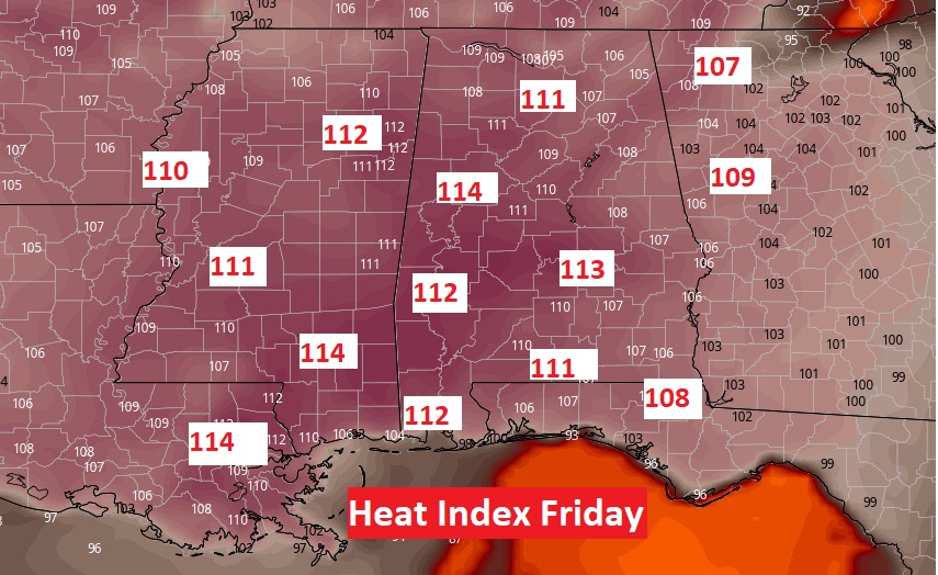
Take at look at the Heat Index forecast across the Deep South Friday. Thursday & Friday will be particularly tough. Let’s hope our Air Conditioners continue working properly!
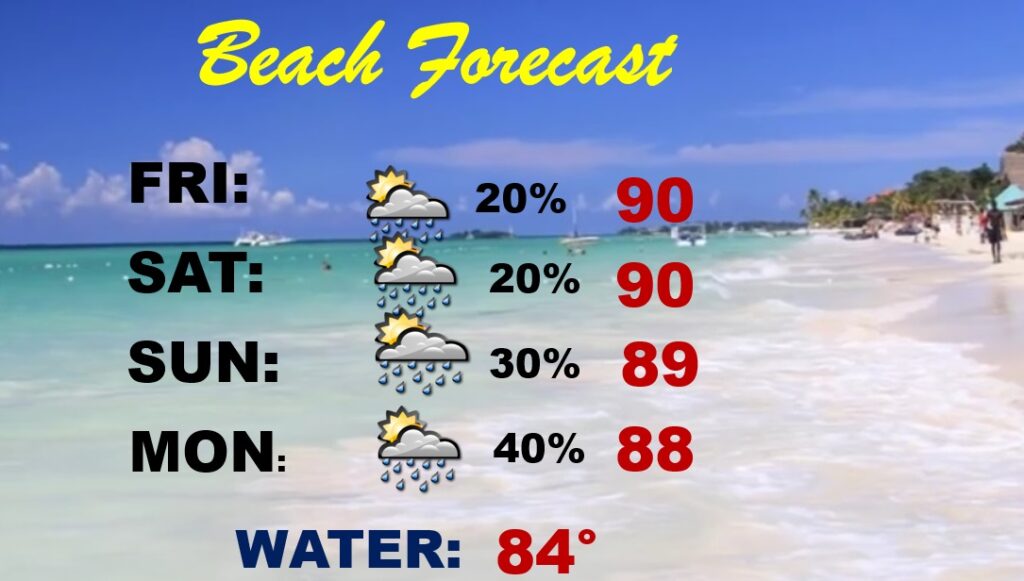
BEACH FORECAST: Brutal heat indices next few days. Stay hydrated. Widely scattered storms,
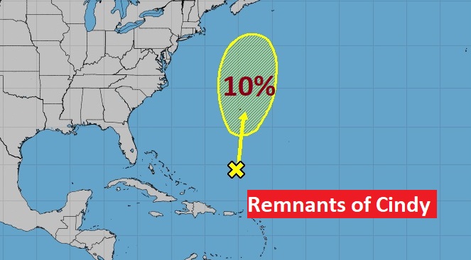
TROPICAL UPDATE: The Ruminants of Cindy have only a 10% chance of re-generation in the next few days, according to NHC.
Thanks for reading this Blog this morning! This morning we are LIVE on the radio from 6 to 9 on NewsTalk 93.1. Watch us on TV on CBS 8 and ABC 32. I’ll have another update for you in the morning. Have a nice day!
–Rich