
Good morning! It’s too early in the summer to talk about Dangerous Heat Indices. But, ready or not, here it comes. Get ready for excessive heat in the coming days. An upper level “Heat Dome” is spreading eastward. Some of the hottest days will be Thursday through the weekend. The heat index will be well into the 105 danger range. Officially we are under an Excessive Heat Watch. That will almost certainly become a warning by Thursday. Rain chances will be very small, but not quite zero. Get ready for some mid to late summer heat. Here’s my brief forecast discussion.
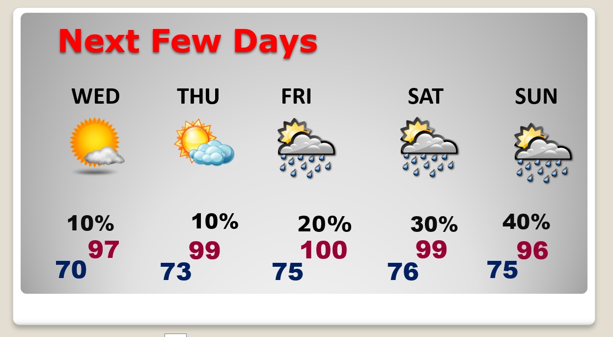
TODAY: Hot and Humid again. Rain chance is not quite zero, but close. High 96. Heat index as high as 102. Low tonight 70.
NEXT FEW DAYS: The heat will build. Mid 90’s by mid-week. Mid to upper 90’s late week. By mid to late week, the Heat Index will be near or above the 105 danger range. Storms thin out in number. Widely scattered hit or miss storms.
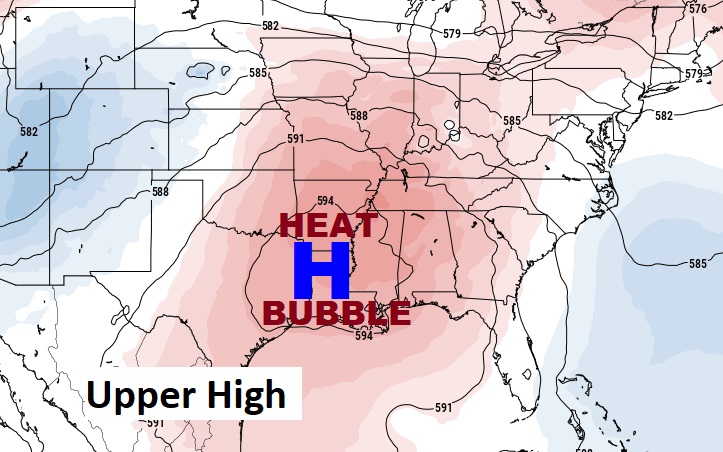
A big Upper High Heat Bubble will spread eastward from the Ark/La/Tex region. Get ready for excessive heat. Dangerous heat indices later in the week.
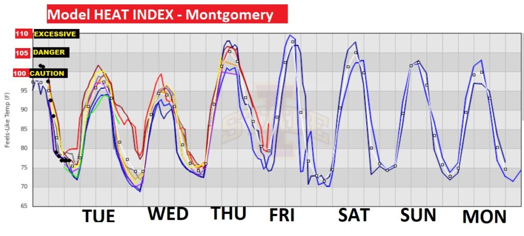
Here’s a snapshot of the model blend Heat Index guidance for the week ahead. 100 is the Extreme Caution Range. 105 is the Danger Range. 110 is Excessive. Look at this graph. Late July/August kind of heat in late June.
Take at look at the Heat Index forecast across the Deep South Thursday. Crazy, dangerous heat.

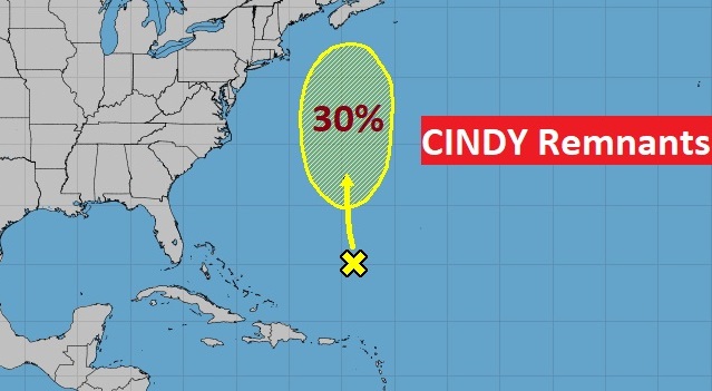
TROPICAL UPDATE: The Ruminants of Cindy have a 30% chance of re-generation in the next few days, according to NHC.
Thanks for reading this Blog this morning! This morning we are LIVE on the radio from 6 to 9 on NewsTalk 93.1. Watch us on TV on CBS 8 and ABC 32. I’ll have another update for you in the morning. Have a nice day!
–Rich