
Good Morning! We are stuck in a Deep Summer Pattern. Hot & Humid. Highs most days in the low to mid 90’s. Triple digit heat Indices. Scattered to numerous random storms, most prominent in the afternoon and evening hours. Occasionally, some of these storms put on a big show. Gusty winds to 40 mph. Prolific lightning. Occasionally a downburst or two which could cause damage. A better than normal chance of PM storms daily. I see nothing to change this pattern through early next week. The higher rain chances continue to be down on the coast. The Tropics, for now are very quiet. But, the prospects for an above normal season continues. I have the updated CSU Hurricane Season Forecast. Here’s my brief forecast discussion.
TODAY: Partial sunshine. Hot & Humid, again. High near 94. Heat index 102-106. Scattered to numerous showers and storms, especially in the afternoon and evening hours. A couple of stronger storms are possible. Low tonight 74.
Future Radar by late afternoon is likely to be quite colorful. Much like yesterday and the day before. The most concentrated action will be closer to the coast.
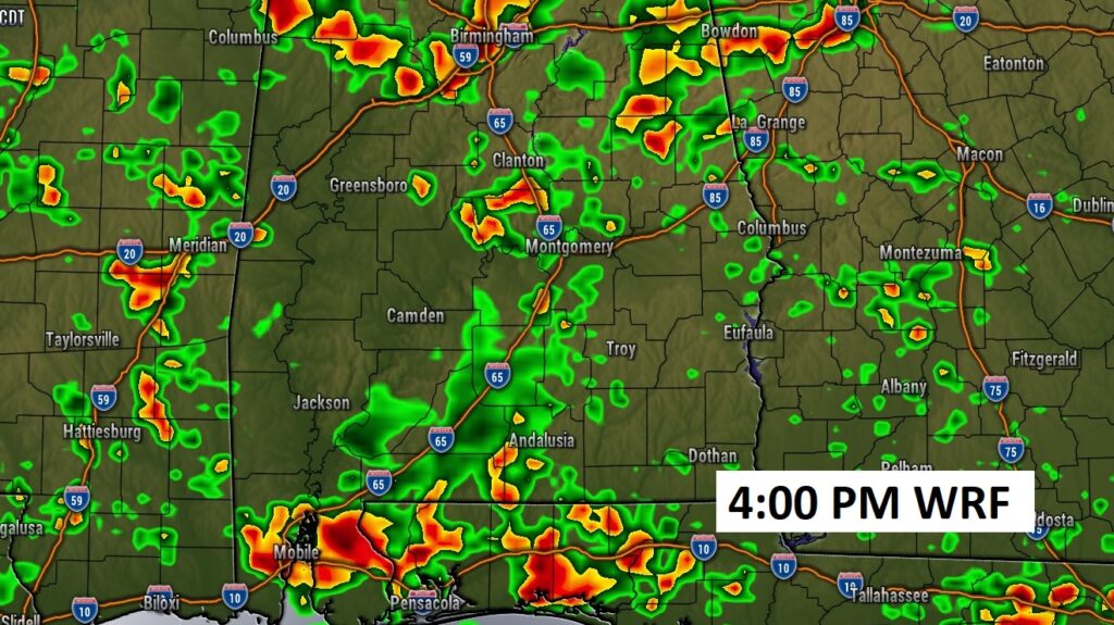
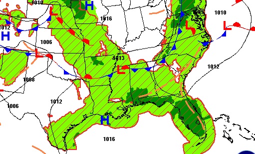
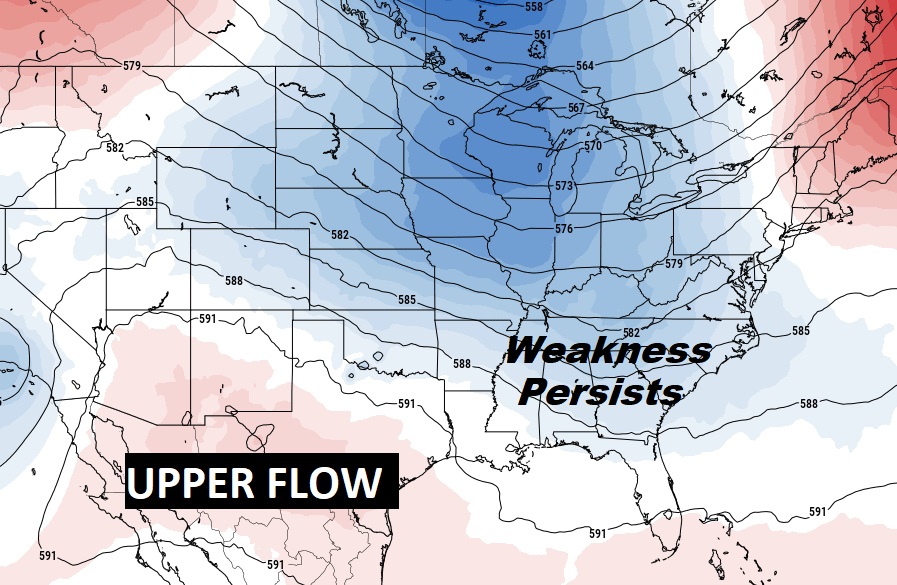
The atmospheric set-up on the surface and aloft will be conducive to better than normal rain chances for the next several days.
NEXT FEW DAYS: No surprises. Scattered to numerous strong storms will be rather numerous through the weekend and through early next week. Storms will be most numerous in the afternoon and evening hours. Highs in the low to mid 90’s through the week and into the weekend, and into early next week. Lows at night in the 70’s.

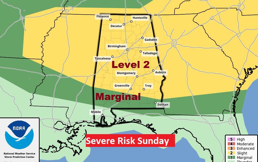
The strongest risk of strong to Severe Storms will be Sunday. Level 2 risk for a big chunk of the state. Damaging wind risk. Coulld be some damage from thunderstorm downbursts.
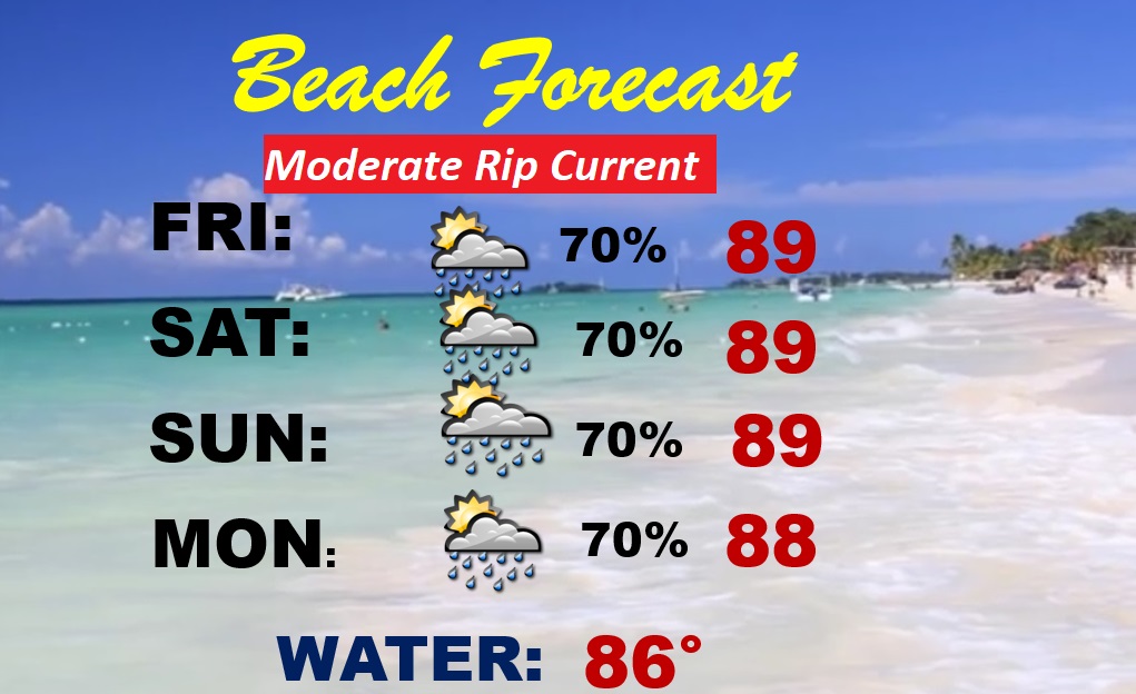
BEACH FORECAST: Down at the Beach, this is peak Tourist season, especially this week. Unfortunately, the better than normal rain chance. Numerous storms each day. (not the best news…at all) Hot and Humid. Highs in the upper 80’s. Moderate rip current risk. Gulf water at a season high 86.
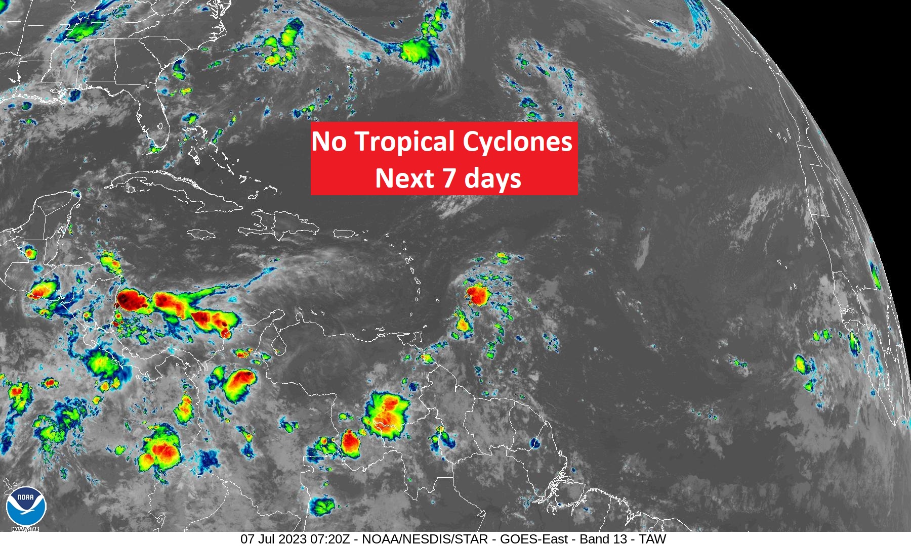
TROPICAL UPDATE: There’s nothing in the tropics, for now. The Atlantic Caribbean and Gulf of Mexico are quiet for now. We see various tropical waves from the African coast to the Yucatan.
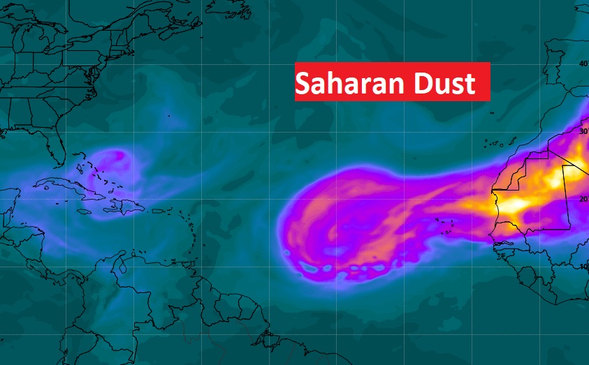
Hampering development in the Main Development Region (MDR) is Saharan dust, which is stifling activity for now.
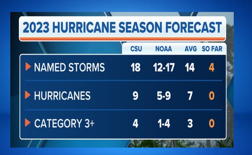
UPDATED CSU SEASONAL HURRICANE FORECAST: BUT, The Updated forecast from the Tropical experts at Colorado State University has higher numbers. !8 Storms, 9 Hurricanes and 4 Major Hurricanes. That has raised some eye brows. Despite El Nino, warmer than normal Sea Surface Temperatures (SST) may win out. Could be a very busy late season. Stand by.
Thanks for reading this Blog this morning! This morning we are LIVE on the radio from 6 to 9 on NewsTalk 93.1. Watch us on TV on CBS 8 and ABC 32. I’ll have another update for you in the morning. Have a nice wdeekend!
–Rich