
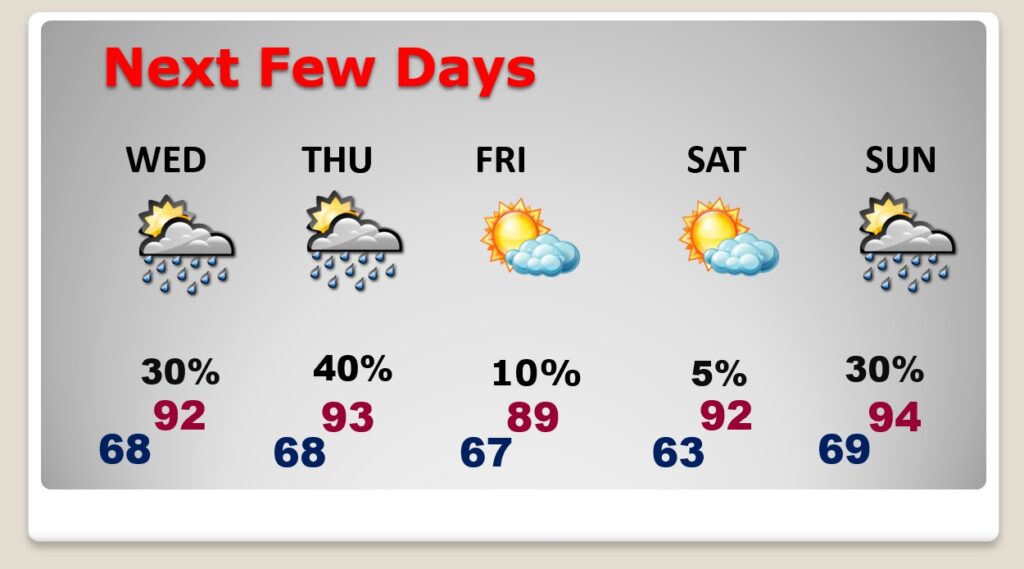
Good Morning! On Friday, there were some very heavy downpours in spots. A storm sat over west and SW Montgomery for hours. Maxwell AFB had 2.50”. Today will be more routine. Hot & Humid. Highs in the low to mid 90’s. Triple digit heat Indices. On Sunday, storms will be much more numerous and some of the storms could be strong to severe. Gusty winds to 40 mph. Prolific lightning. There could be a few downbursts which could cause damage. A better than normal chance of storms continues Monday. . I see nothing to change this pattern through the middle of next week. The higher rain chances continue to be down on the coast. The Tropics continue very quiet for now.
SATURDAY: Partial sunshine.Hot & Humid, again. High near 94. Heat index 100-104. Scattered showers and storms, especially in the afternoon and evening hours. A couple of stronger storms are possible. Low tonight 74.
Here’s a Future Radar sample. Late afternoon and early evening will be the most active hours on Saturday.
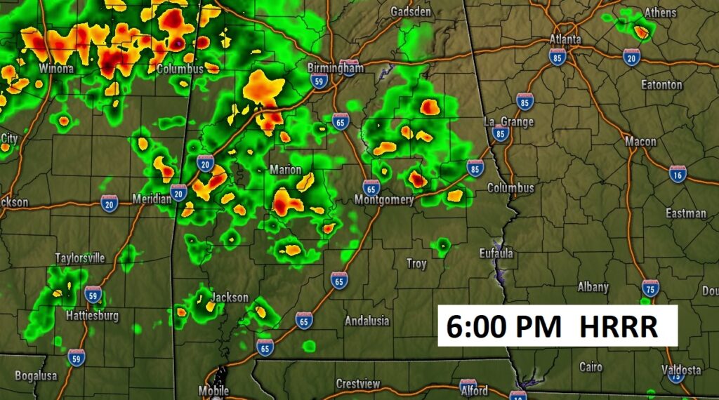
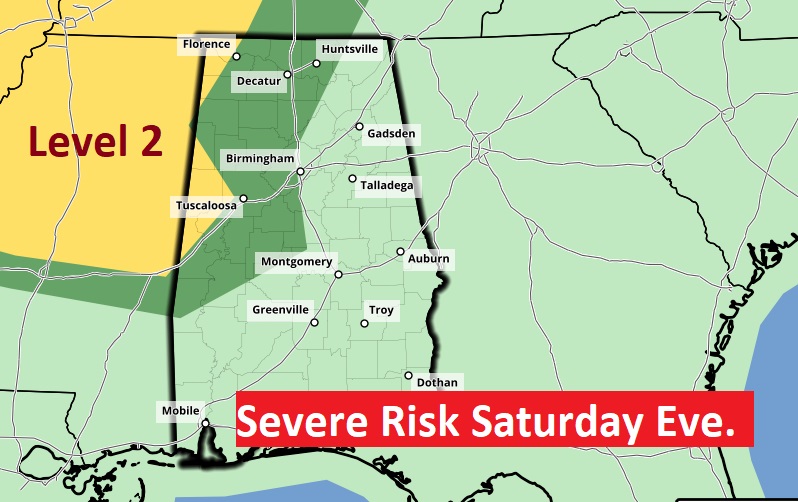
SPC has outlooked a Severe Risk mainly for west and NW Alabama and mainly into the evening hours tonight. A few stronger storms, possibly severe, primarily west of I-65,
SUNDAY: The atmosphere, at the surface and aloft, will be primed for action on Sunday. Numerous and stronger storms. Several boundaries will be in play including an approaching front.
Storms will be much more numerous, and some of the storms could be strong to severe. Damaging wind gusts. Prolific lightning. There could be a few downbursts which could cause damage. Locally Heavy downpours. High near 90. Low Sunday night 71.
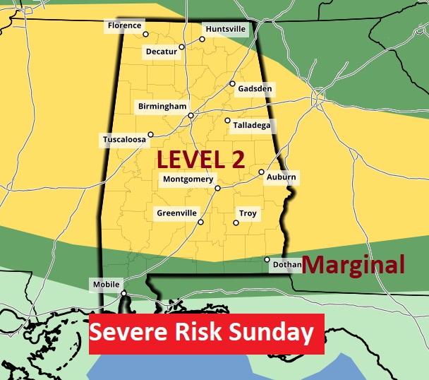
SPC has much of the state in a Level 2 severe weather risk. There will be some warnings and there may even be a Severe Thunderstorm Watch. Damaging wind gusts are the main threat.
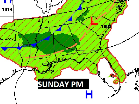
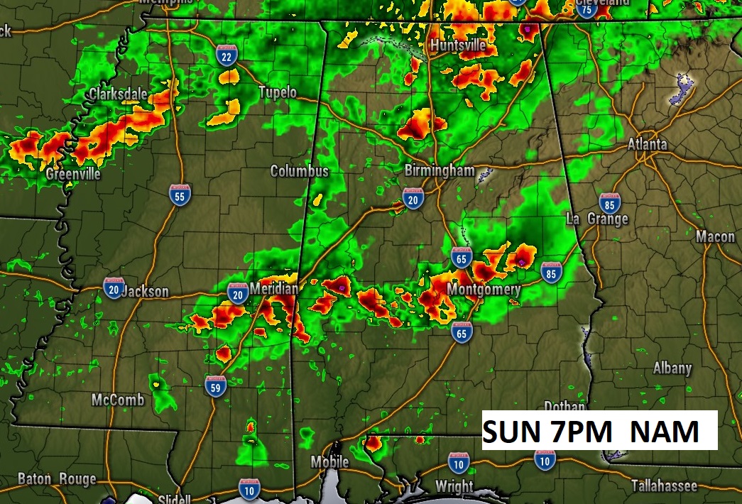
Storms will not only be more numerous Sunday, they will be stronger and more organized. There’s a good chance we’ll be dealing with those MCS thunderstorms clusters. Here’s a Future Radar sample early Sunday evening.
NEXT FEW DAYS: Scattered to numerous strong storms will be rather numerous through the Monday. Storms will be most numerous in the afternoon and evening hours. On Monday, clouds and storms may hold the highs down to the upper 80’s. Storms will thin out just a bit Tuesday through Thursday, and temperatures will rebound.
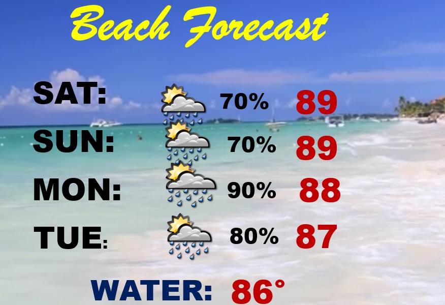
BEACH FORECAST: Friday was actually a pretty good day on most of the Beaches. But, I’m afraid the odds for better than normal rain chances are in the cards through the weekend and into early next week. Hot and Humid. Highs in the upper 80’s. Moderate rip current risk. Gulf water at a season high 86.
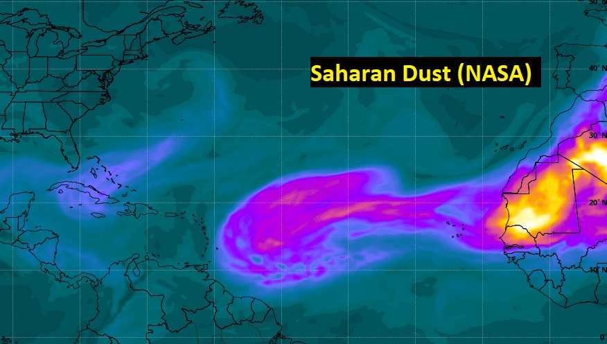
TROPICAL UPDATE: There’s nothing in the tropics, for now. The Atlantic Caribbean and Gulf of Mexico are quiet for now. Not many tropical waves from the African coast to the Yucatan.
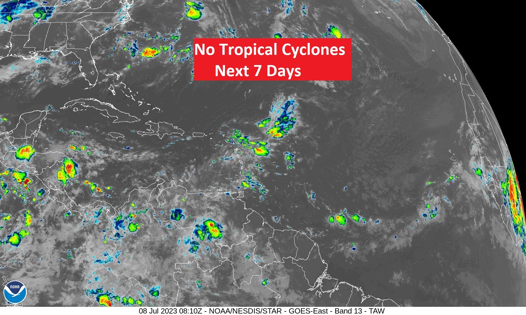
Saharan dust continues to hamper tropical development in much of the MDR…Main Development Region.
Thanks for reading this Blog this morning! There will NOT be a Blog Update on Sunday morning. I’ll have another update for you on MONDAY morning. Have a nice day!
–Rich