Good Morning! The two big stories Sunday was the Excessive Dangerous Heat and the Severe storms. Many counties were under warnings. Trees & powerlines down. Power outages. It was the hottest day of the summer with 99 degrees and a Heat Index of 117. Today. The The Excessive Heat Warning continues today, as school starts for thousands of kids. More schools start Tuesday, Wednesday & Thursday. Once again today, most of the state is in a Severe Risk. More warnings are likely. Big heat, big storms. Looks like a hot week ahead. Highs most days in the mid 90’s. More scattered random storms. Here’s my brief forecast discussion.
CLIMATE UPDATE: Sunday’s high at MGM was 99. (Record high 100 in 2007) Maximum Heat Index 117. The airport had No Rain. East MGM: .11”
TODAY: Excessive Heat Warning. High near 100. Dangerous Heat Index near 114. Scattered random storms. Some could be strong to severe with damaging wind gusts. Low tonight 77
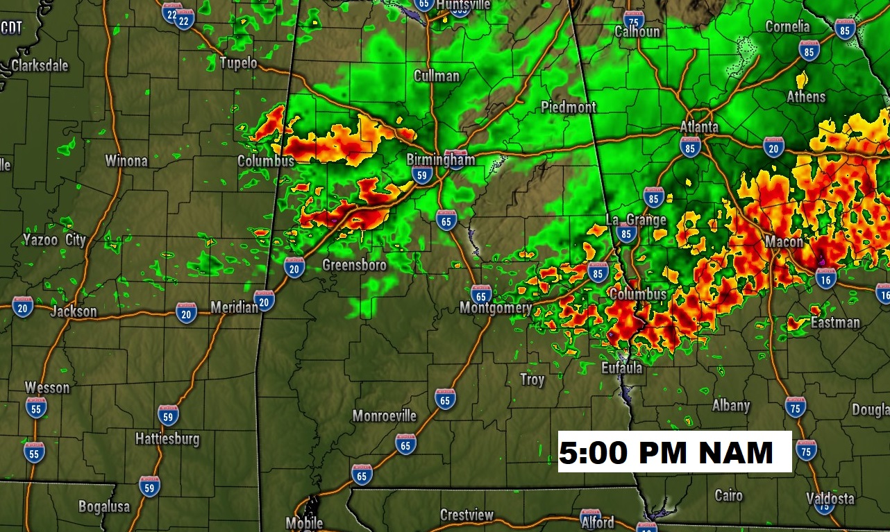
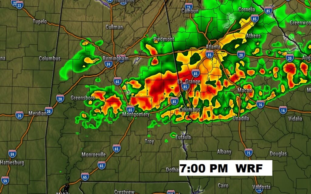
Future radar suggests another stormy late afternoon and evening across much of central and north Alabama.
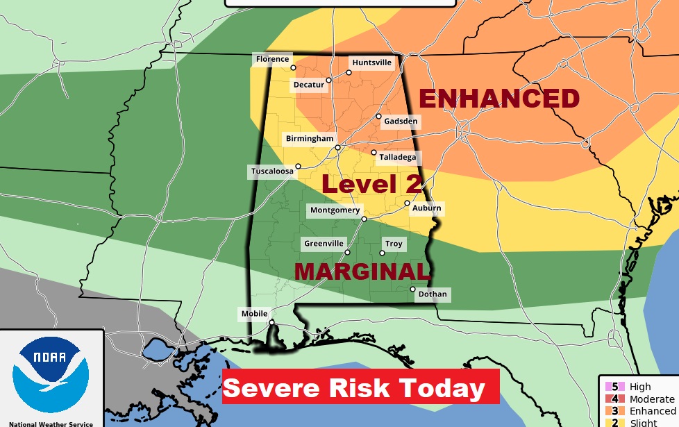
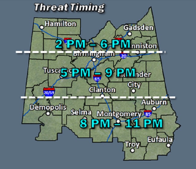
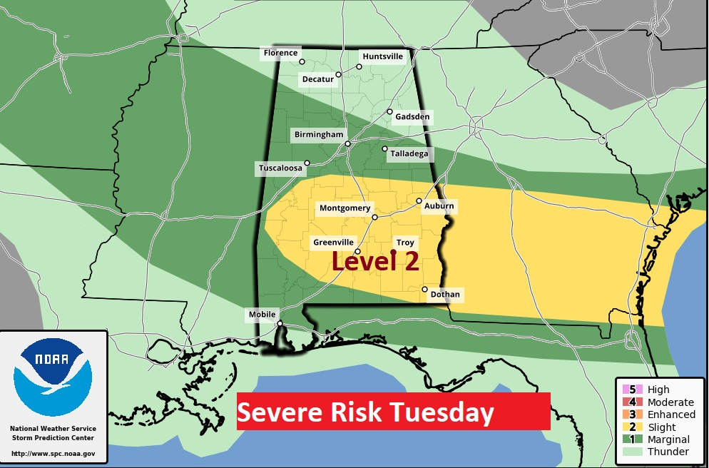
SPC has a large chunk of the state in a severe weather risk. In fact, from US 80/I-85 northward, there is a Level 2 threat. Northeast Alabama has an Enhanced Risk. Damaging wind gusts are the main risk. Large hail is also possible.
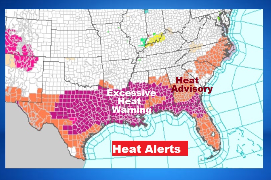
Excessive Heat Warning continues for multiple states from Texas to the Florida Atlantic coast.
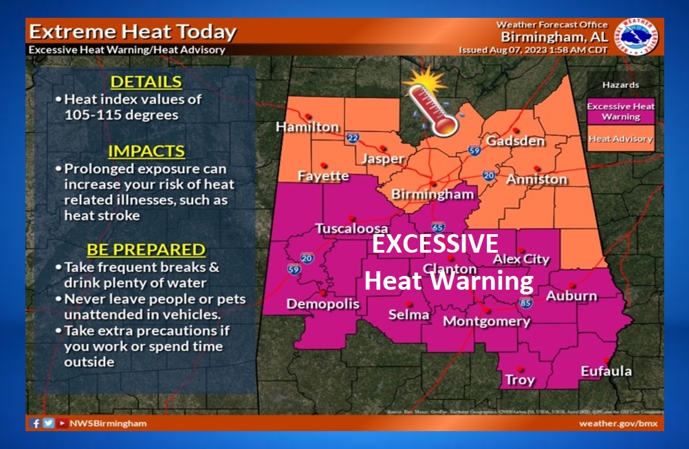
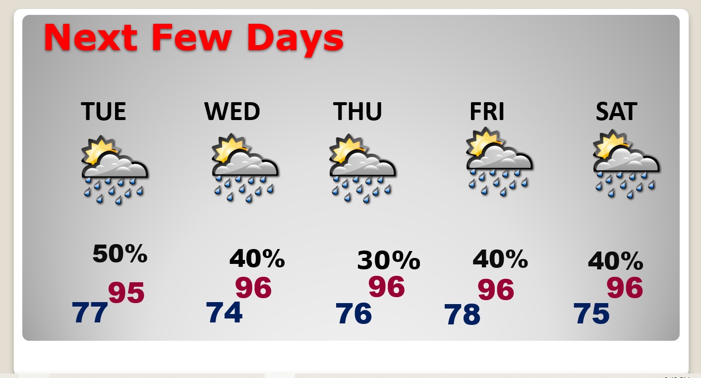
NEXT FEW DAYS: Tuesday will not be quite as hot. High in the mid 90’s. Heat index 100 to 105. Scattered random storms will be around each day. Daily highs well into the 90’s. Lows at night mid 70’s.
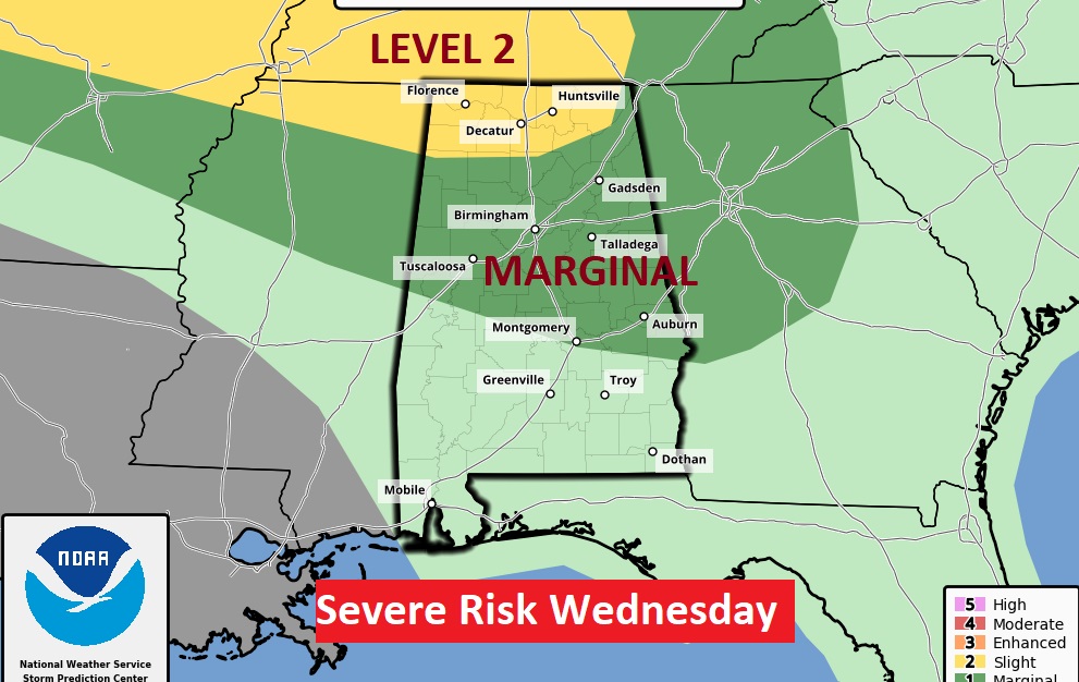
More Severe Storms Tuesday and Wednesday.
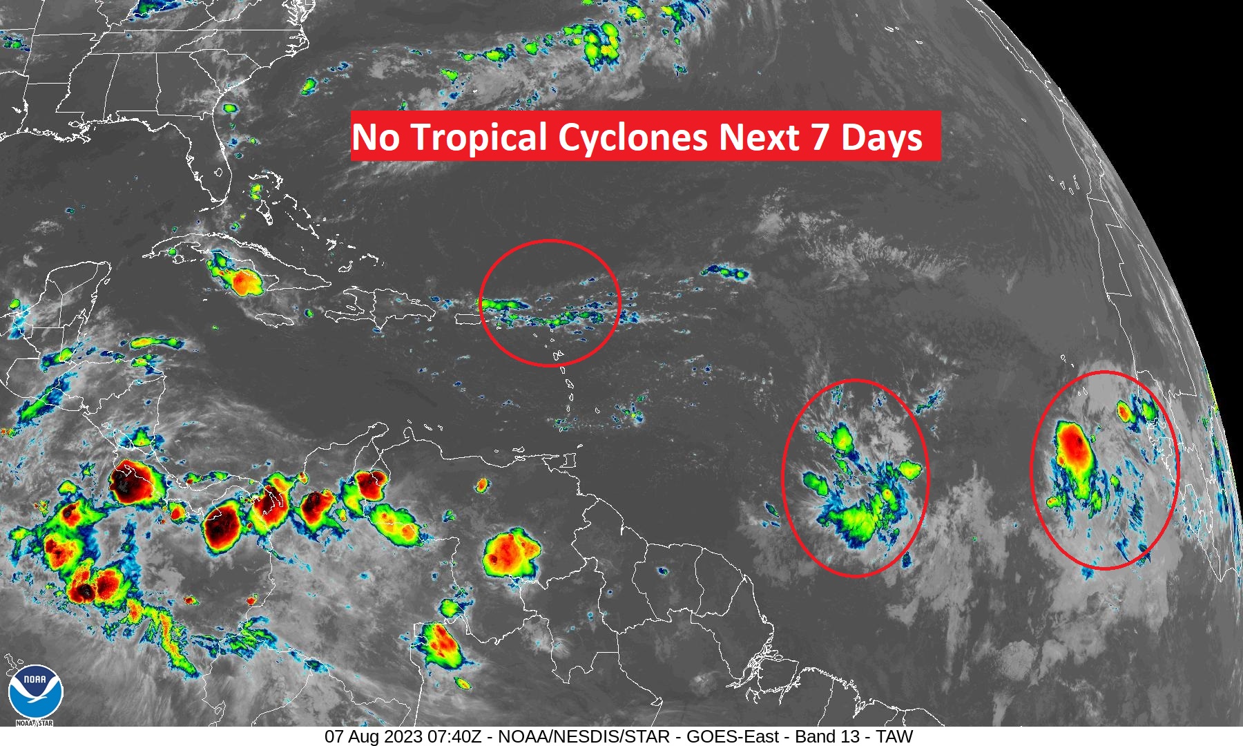
TROPICAL UPDATE: The tropics are quiet for now. We’re watching a series of tropical waves between Africa and the Islands,
Thanks for reading this Blog this morning! This morning we are LIVE on the radio from 6 to 9 on NewsTalk 93.1. Watch us on TV on CBS 8 and ABC 32. I’ll have another update for you in the morning. Have a nice day!
–Rich
