
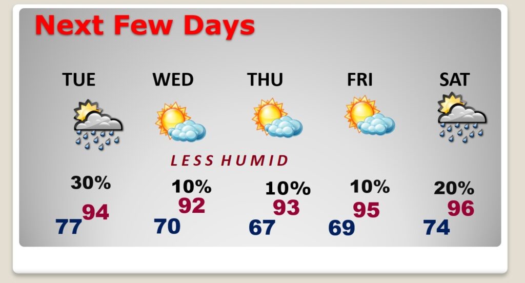
Good Morning! It’s yet another day with DANGEROUS Heat Indices. Excessive Heat Warning again. Potential Heat Index 113-118. Spotty Random Scattered PM Storms. Tuesday will be another extremely hot day with excessive Heat Indices. BUT, A frontal system will move through the state on Tuesday. On Wednesday, you’ll feel a BIG DIFFERENCE. Highs will be low several degrees. But, it’s the lower humidity will make such a big difference. Dewpoints will fall to the low 60’s. Get ready for a nice change. Finally. Plus, we’ll be storm-free Wednesday through Friday Nighttime lows will fall to the upper 60’s. Here’s my brief forecast discussion
CLIMATE DATA: Sunday’s numbers were excessive. High was 97 (morning low 75). Heat index reached 120. Highest of the summer. The Airport had .33”. My house in East Montgomery had 0.47”, with a Max Heat index 123.
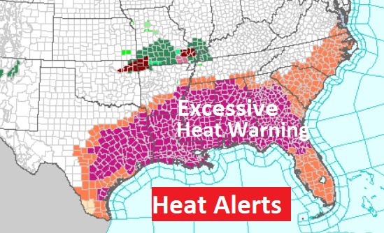
TODAY: Excessive Heat Warning continues. Hot and Humid again. Highs near 100 . Potential Heat Index 113-118. Spotty Random Scattered PM Storms. Low tonight 78.
Just awful. The Excessive Heat Warning covers several states from Texas to the Atlantic coast. Crazy, dangerous heat,
MID WEEK RELIEF!: Here’s what we’ve all been waiting to hear. A frontal system will move through the state on Tuesday. On Wednesday, you’ll feel a BIG DIFFERENCE. Highs will be low several degrees. But, it’s the lower humidity will make such a big difference. Dewpoints will fall to the low 60’s. (Sunday the dewpoint has 80 to 82!) Get ready. It will be a significant change.
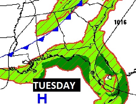
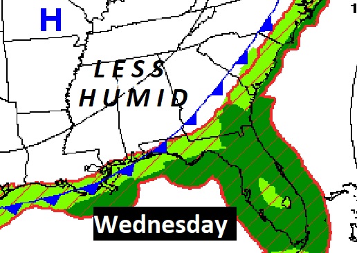
NEXT FEW DAYS: Tuesday will be dangerously hot and humid with heat indices 111 to 115. Scattered storms could put on quite a show ahead of the southward moving front. Wednesday will be MUCH NICER. High in the lower 90’s, but much lower humidity! Upper 60’s at night through Friday. Should be dry Wednesday through Friday. Perhaps some widely scattered storms Saturday.
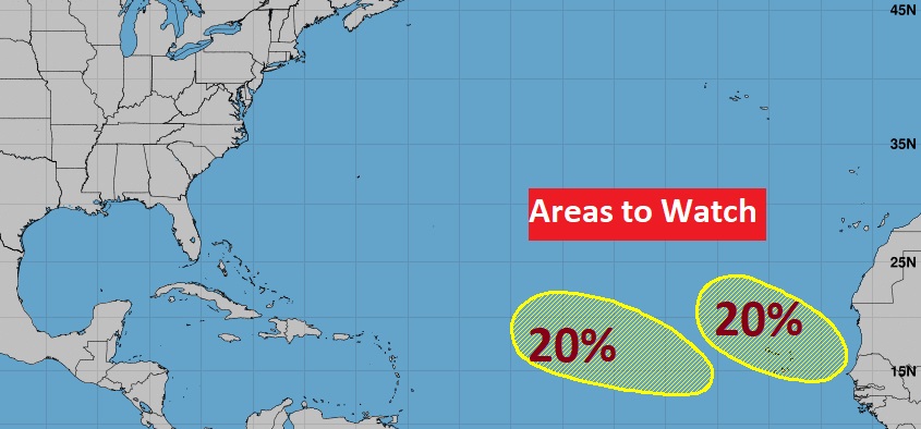
TROPICAL UPDATE: NHC is now mentoring two new Areas to Watch in the far eastern Tropical Atlantic. 20% chance of tropical Development next 7 days.
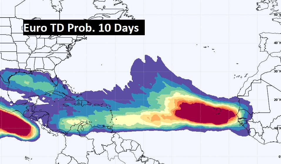
Check this out. The EURO model continues to advertise an huge uptick in tropical potential from the African coast to the southeastern US and the Gulf of Mexico over the next 10 days.
Thanks for reading this Blog this morning! This morning we are LIVE on the radio from 6 to 9 on NewsTalk 93.1. I’ll have another update for you in the morning. Have a nice day!
–Rich