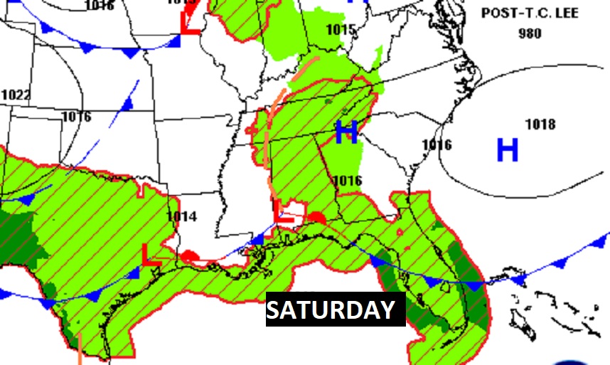
Good Morning! Even early this morning before dawn, radar is quite active. Be flexible with your plans today, Showers and maybe thunderstorms could affect your outdoor plans again today. Storms will not be as numerous on Sunday. Then, get ready for some nicer air. By Sunday night it will feel like Fall. Expect lower 60’s. Much of next week will be nice. Abundant sunshine. Comfortable humidity days and clear cooler nights. Do you remember this day in Alabama weather history?
TODAY: Limited sunshine. Scattered to numerous showers and a few thunderstorms, especially in the afternoon and evening. High 85. Low tonight 68.
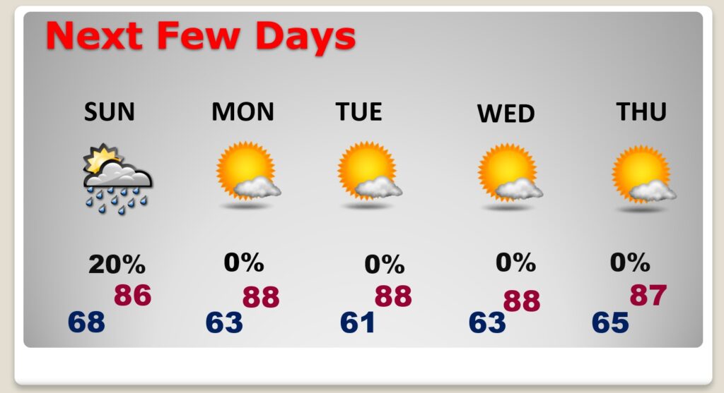
NEXT FEW DAYS: Not as many storms and more abundant on the sunshine Sunday. Cooler by Sunday night. Some nice comfortable nights are in our future. Mostly sunny Monday through Wednesday with highs in the 80’s and lower humidity. A great week ahead.
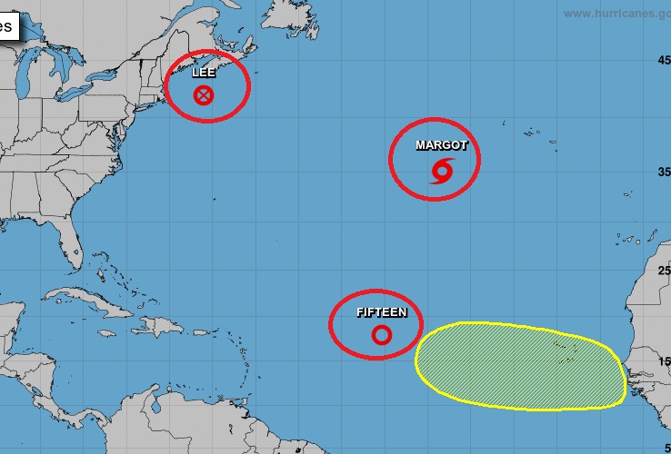
TROPICAL UPDATE: There are currently 4 features in the east Atlantic. Lee and Tropical Storm Margot. Plus, there’s Tropical Depression 15, which is likely to become Nigel. There’s an Area to Watch off of Africa.
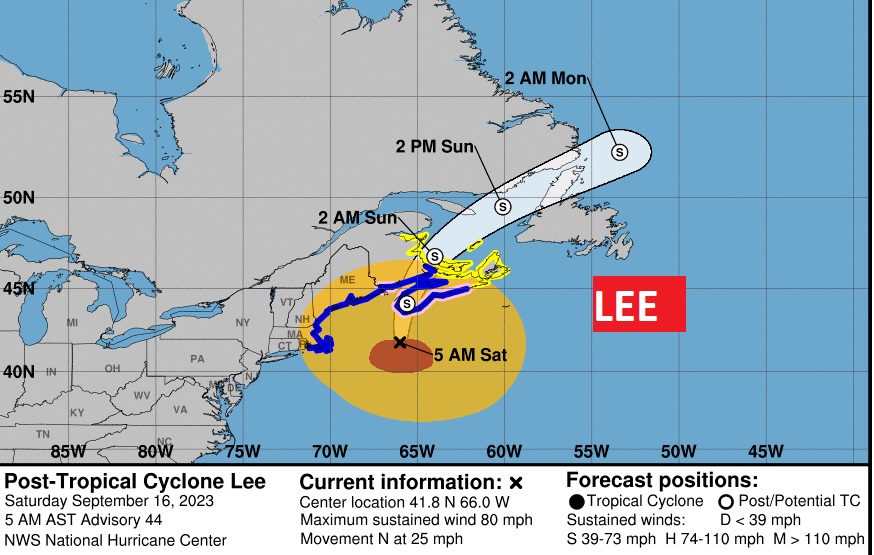
Lee is now a post Tropical Cyclone. It has lost it’s tropical characteristics. Although it will not make Landfall in the United states, Tropical storm warnings are in effect from the Mass. Coast through Maine. Significant impacts in New England. Wind, waves, rain. Looks like it’ll make landfall in Atlantic Canada over the weekend.
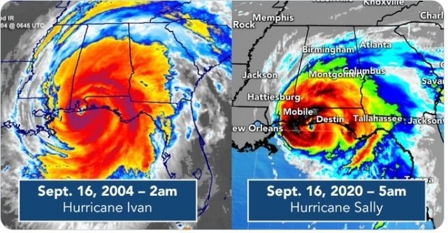
HISTORIC DAY IN ALABAMA HISTORY: Amazing day in Alabama Hurricane history. TWO significant Hurricanes made landfall on this exact date, both with landfalls near Gulf Shores. Cat 3, 120 mph Ivan made landfall at 2AM on September 16, 2004. Sixteen years later, Cat 2 103 mph hurricane Sally made landfall on the same day, same location, September 16th, 2020, 16 years later.
Thanks for reading this Blog this morning! There will NOT be a Blog Update on Sunday morning. I’ll have another update for you on MONDAY morning. Have a nice weekend!
–Rich
