
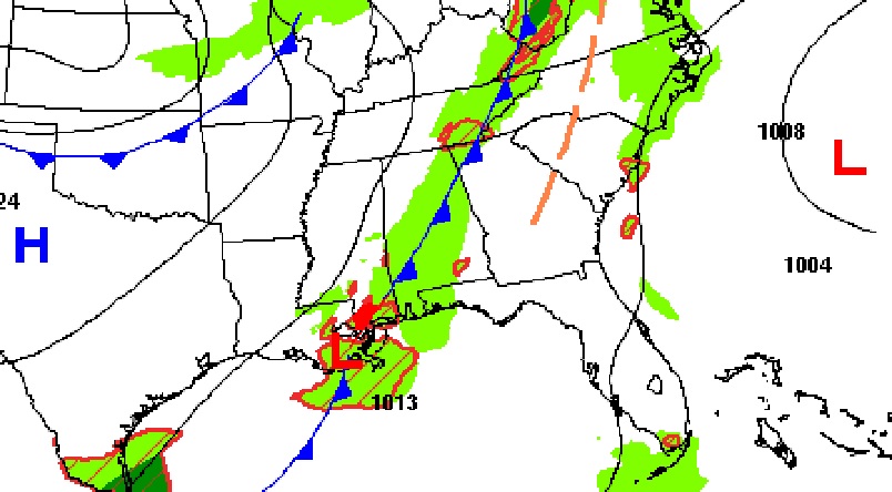
Good Morning! There’s rain on the radar this morning. It’s been a long time. An important Cold Front is moving through the state. Scattered showers ahead of the front will be around through this evening. It will turn breezy and much cooler behind the front. Highs will only be in the lower 70’s Saturday and Sunday. Get ready for much cooler Jacket Weather nights. We’ll be in the 40’s Saturday and Sunday night. We’ll be watching the Gulf of Mexico. The models continue to hint at potential tropical low pressure development. Nothing to worry about yet. Just watching. Here’s my brief forecast discussion.
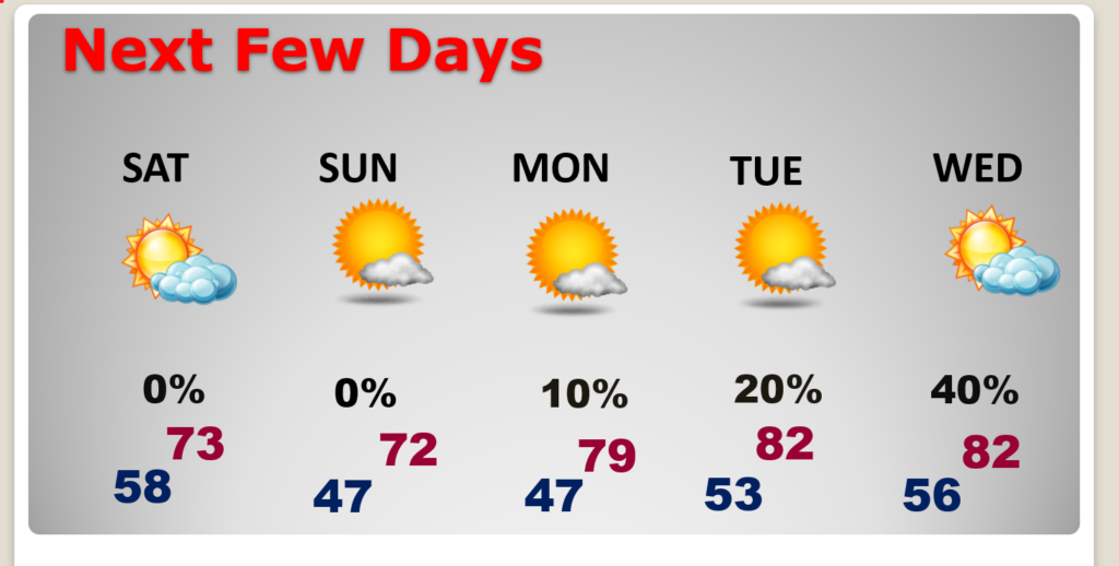
TODAY: Scattered showers at times today and into this evening. High 84. Becoming breezy behind the cold front this evening and tonight. Cooler tonight. Low 58.
NEXT FEW DAYS: The Cold front will bring a big change of reality. Much cooler Saturday and Sunday. Highs in the lower 70’s. Breezy Saturday. Clear, chilly, Jacket Weather nights. Lows in the 40’s Saturday and Sunday nights. A little warmer on Colobus Day Monday. Upper 70’s. Possible rain again by late next week as we monitor the Gulf.
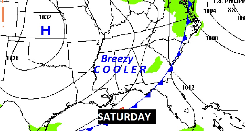
You’ll feel a big difference this weekend. Breezy and much cooler Saturday. Jacket weather nights ahead. You’ll be hearing about a RED FLAG warning on Saturday. That’s because were so dry and humidity and winds will be gusty. Wild fires are possible.
.
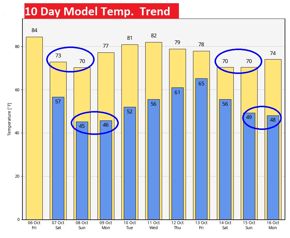
If you’re a fan of Fall Weather, you’ll love this 10 Day Model Temperature Trend Forecast. Not only cool this weekend. Perhaps next weekend, too.
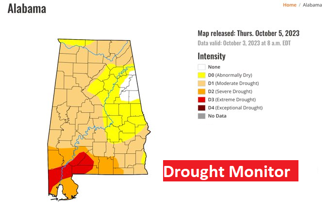
DROUGHT MONITOR: Our drought continues to expand. Now 96% of Alabama is in some level of drought, up from 78% last week. And now 78% of the state is in at least a moderate drought, and almost 20% of Alabama is in a severe or extreme drought, especially in SW Alabama.
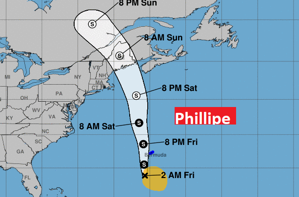
TROPICAL UPDATE: NHC continues to monitor Tropical Storm Phillipe. Phillipe could possibly interact with the New England coast by Sunday as a tropical depression or tropical storm.
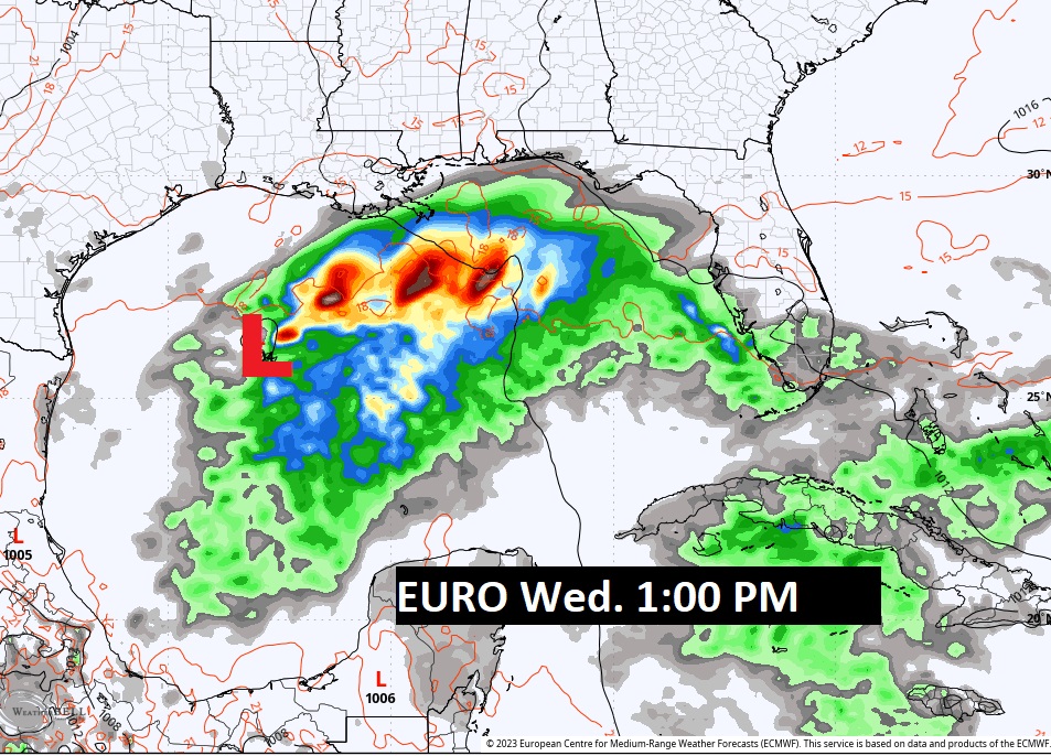
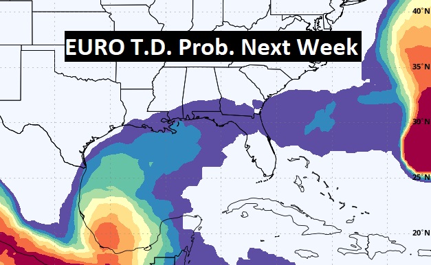
There are a few model hints that we could see some tropical in the Gulf of Mexico next week. Stay tuned. The next available name is Sean.
Thanks for reading this Blog this morning! This morning we are LIVE on the radio from 6 to 9 on NewsTalk 93.1. I’ll have another update for you in the morning. Have a nice day!
–Rich