
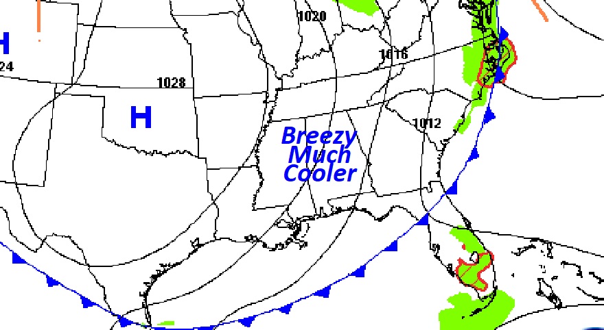
Good Morning! Colder air is flooding into the state, behind Friday’s cold front. Today will be refreshing. Sunshine, breezy and much cooler. The expected high today and Sunday will only reach the lower 70’s. Get ready for some jacket weather nights in the 40’s tonight and Sunday night. It will be the coldest nights since the first week of May. Monday and Tuesday will be a little warmer. Looks like a very nice start to the week. But, could there be some Gulf of Mexico tropical mischief later in the week? I’ll put in at least a small chance of rain by Wednesday night and a better chance Thursday. We’ll know more in the coming days.
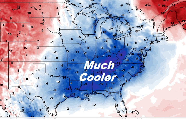
TODAY: Sunshine. Breezy. Much cooler. High today 72. (Yesterday’s high 89. Normal High 84) North wind 10 to 18. Clear, chilly, jacket weather tonight and tomorrow night. Low in the mid 40’s. Normal low 59.
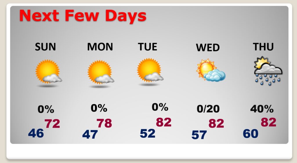
NEXT FEW DAYS: Sunny and cool Sunday. Low 70’s. A little warmer early next week. Upper 70’s Monday and lower 80’s Tuesday. But, could there be some Gulf of Mexico tropical mischief later in the week? I’ll put in at least a small chance of rain by Wednesday night and a better chance Thursday.
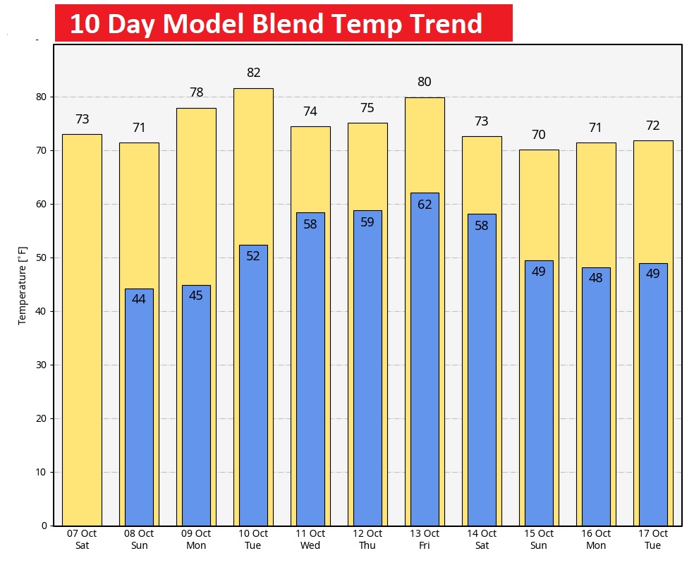
Here’s the 10 day temperature trend.
TROPICAL UPDATE: Phillipe is gone. Dissipated. NHC is now monitoring an Area to Watch in the far east Atlantic. 70% chance of development. The next available name is Sean.

Thanks for reading this Blog this morning! This morning we are LIVE on the radio from 6 to 9 on NewsTalk 93.1. I’ll have another update for you in the morning. Have a nice day!
–Rich