
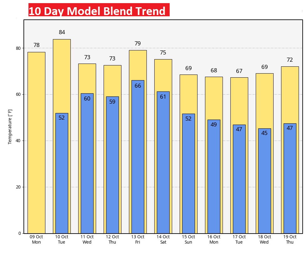
Good Morning! What an incredible taste of very cool pure fall air so early. This has been the coolest air we have experienced since late March. But now, temperatures are starting to moderate. We’ll be near 80 today, and mid 80’s on Tuesday. Nights won’t be quite as chilly. Our rain prospects are getting better Wednesday through Friday, as an approaching cold front merges with a Gulf Low. It’ll be the best chance of rain we’ve seen in awhile. Much cooler again next weekend. Here’s my brief forecast discussion.
THAT WEEKEND COOL-SNAP: This morning was the Coolest morning since March 30. Normal Montgomery low is 59. This morning we fell to 42 at MGM. That’s the normal Low in mid November. Not a record, though. The record was 35 from 1991. Elsewhere in the area, Selma 36, Alex City and Prattville 39. Troy 43.
TODAY: Sunshine. Comfortable Columbus day, after another very cool start. High 80. Clear and not as cool tonight. Low 52. (Normal is 59)
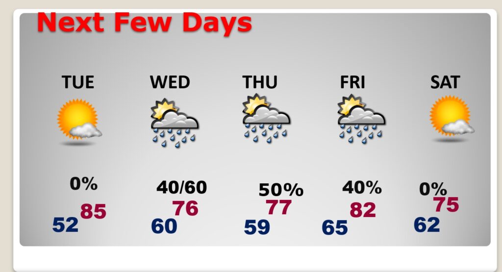
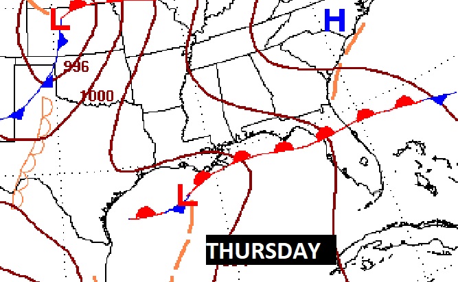
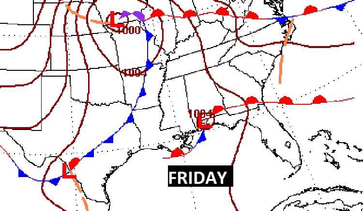
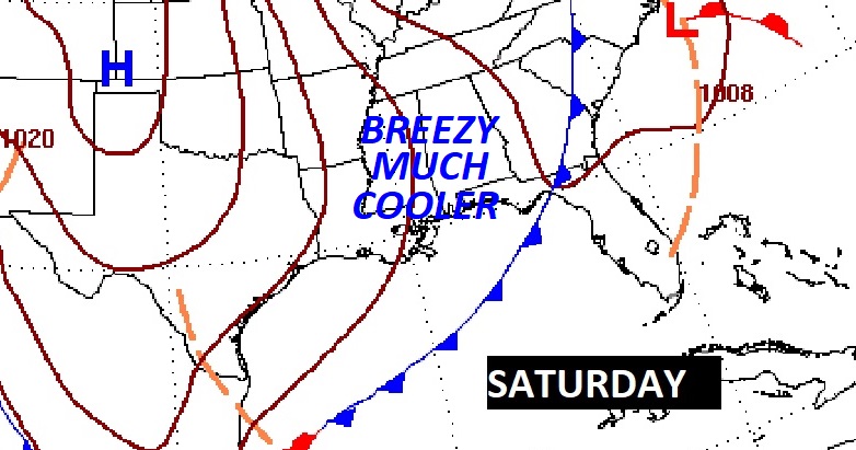
NEXT FEW DAYS: Temperatures are starting to moderate. Tonight, not nearly as cool with lower 50’s. Tuesday…warming trend continues. High 84. We’ll be watching a Gulf Disturbance this week, moving northeast from the SW Gulf . It will merge with an approaching Cold Front later in the week and become a rain maker for us. Much cooler again next weekend behind the cold front.
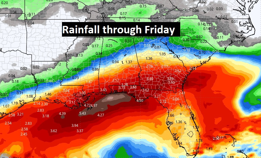
Here’s the expected rainfall through Friday. Notice the heaviest rain, by far, will be in the SE third of our state and closer to the coast. We’ll take whatever we can get, as the drought continues to expand.
After that weekend cool-snap We’re warming up today and tomorrow, but take a look at NEXT weekend. Another Cool Snap is on the way after some late week rain.
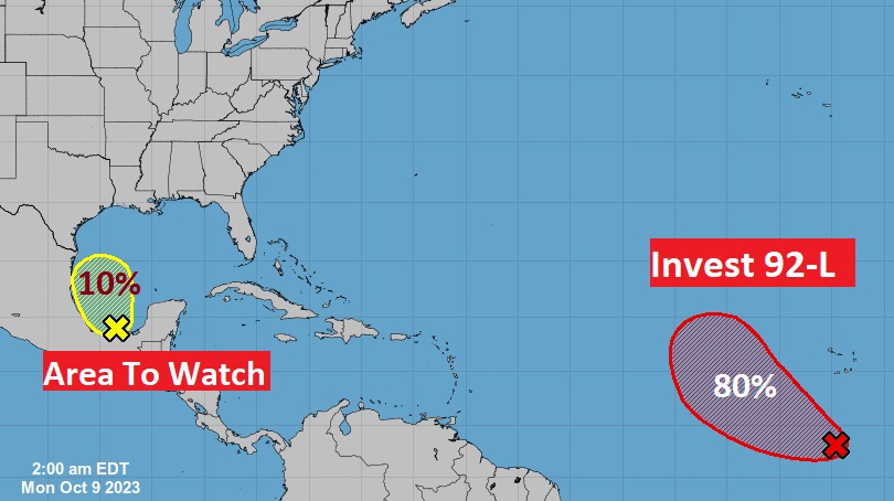
TROPICAL UPDATE: NHC is monitoring an Invest 92-L in the far east Atlantic. 80% chance of development. The next available name is Sean.
The is a new Area to Watch in the southwest Gulf. Any development of this system will be slow as it drifts NW. It will merge with an approaching Cold Front later in the week and become a rain maker for us.
Thanks for reading this Blog this morning! This morning we are LIVE on the radio from 6 to 9 on NewsTalk 93.1. I’ll have another update for you in the morning. Have a nice day!
–Rich