
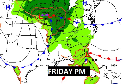
Good Morning! That Gulf Low brought drenching rains to central and South Alabama. Many cities and towns had more than 2-3+ inches. MGM broke it’s daily record for October 11th. The shower threat will end before mid-morning. Much of Today will be cloudy and rather windy. Winds could occasionally gust to 30 mph. Next, we’re tracking aa Cold Front which will bring the risk of scattered showers to the forecast on Friday. Much cooler air will take over Saturday night through Sunday and early next week. Highs will only be in the 60’s Sunday and Monday. 40’s at night. Here’s my brief forecast discussion.
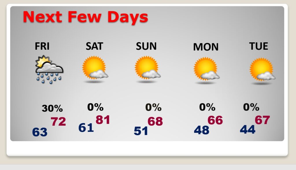
TODAY: The shower threat will end before mid-morning. Much of Today will be cloudy and rather windy. Winds could occasionally gust to 30 mph. Not as warm. High 69. Showers risk overnight tonight is very small. 20% or less.
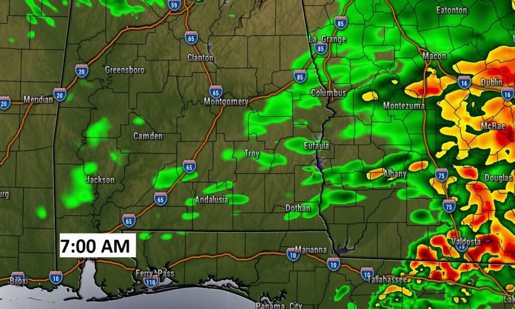
Future radar at 7:00AM, shows the shower risk tapering off.
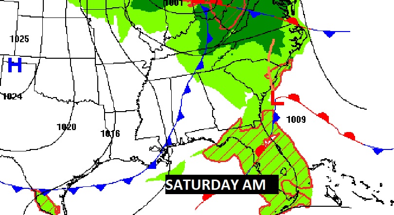
NEXT FEW DAYS: Saturday looks nice. Mostly sunny high 81. Much cooler air will take over Saturday night through Sunday and early next week. Highs Sunday and Monday will only be in the 60’s. 40’s at night.
TROPICAL UPDATE: In the Tropical Atlantic: Sean is now just a Tropical Depression. Also, now, NHC is tracking Invest 94-L.
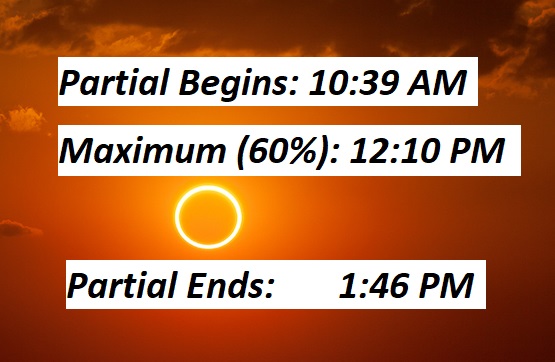
SOLAR ECLIPSE SATURDAY: Will clouds clear out in time for the Saturday’s Annular Solar Eclipse viewing? Hopefully. The Partial eclipse starts at 10:39. Eclipse Maximum in Montgomery 12:10 PM. End Partial Eclipse time: 1:46 PM. Do not look directly at the sun. View through protective glasses only.
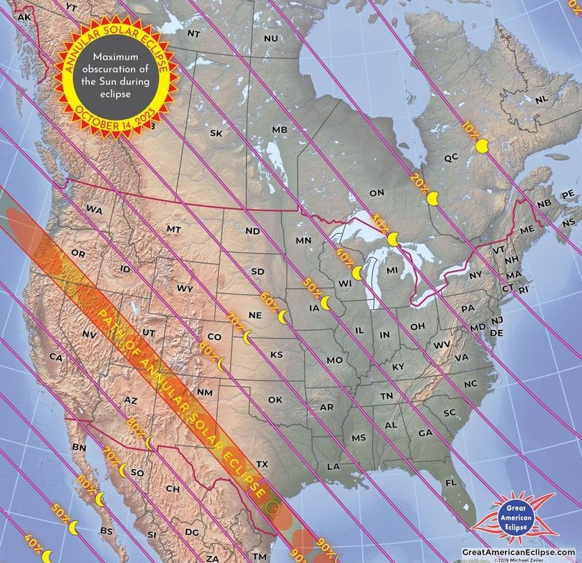
Montgomery will be close to the 60% coverage line.
Thanks for reading this Blog this morning! This morning we are LIVE on the radio from 6 to 9 on NewsTalk 93.1. I’ll have another update for you in the morning. Have a nice day!
–Rich