
Good Morning! A developing low in the Gulf will spread a shield of much needed rain into south and central Alabama today and tonight. South and southeast Alabama will get drenched with ample rainfall. Unfortunately, the northward extent of the rain into central Alabama is starting to look questionable. Most of the heaviest rain will be south of the US 80/I-85 corridor. The low will track NE across north Florida Thursday. We’ll keep the mention of spotty showers in the forecast Thursday, Thursday night and Friday, as a Cold Front approaches. The front will exit the area Saturday morning. Much cooler air will take over Saturday night through Sunday and early next week. Highs Sunday and Monday will only be in the 60’s. 40’s at night. Here’s my brief forecast discussion.
TODAY: Cloudy. Rain developing, especially this afternoon this evening and tonight. Not as warm. High 75. Low tonight 59. Becoming windy tonight. East winds 2-18 gusting as high as 30 mph.
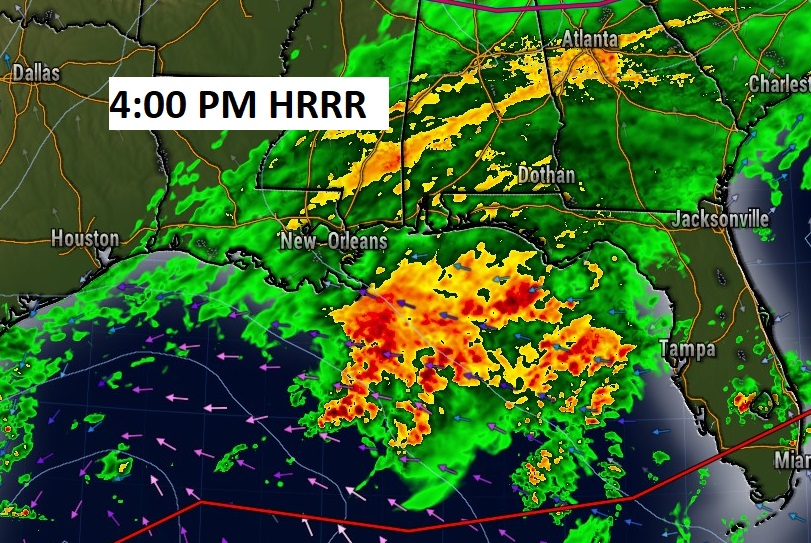
Future radar at 4:00 PM.
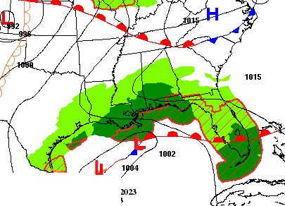
This non-tropical Gulf Low is not only bringing rain back to our forecast, but it will also have some impressive winds. Wind gust to Gale force near the coast by tonight and 50+ mph off the coast. Even 30 MPH wind gusts north to Montgomery this evening and tonight. #alwx

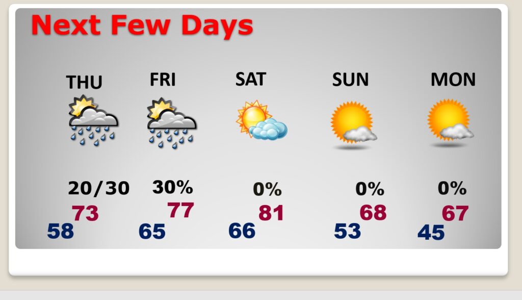
NEXT FEW DAYS: We’ll keep the mention of spotty showers in the forecast Thursday, Thursday night and Friday, as a Cold Front approaches. The front will exit the area Saturday morning. Saturday looks nice. Mostly sunny high 81. Much cooler air will take over Saturday night through Sunday and early next week. Highs Sunday and Monday will only be in the 60’s. 40’s at night.
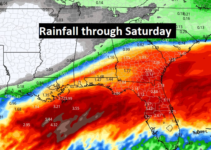
Here’s the expected rainfall through Saturday. Notice the heaviest rain, by far, will be in south and SE Alabama. Unfortunately, the northward extent of the rain into central Alabama is starting to look questionable. Most of the heaviest rain will be south of the US 80/I-85 corridor.
TROPICAL UPDATE: The system in the Gulf that was Invest 93-L is now deemed non-tropical by NHC.
NHC is also tracking Tropical Depression 19 in the Atlantic.
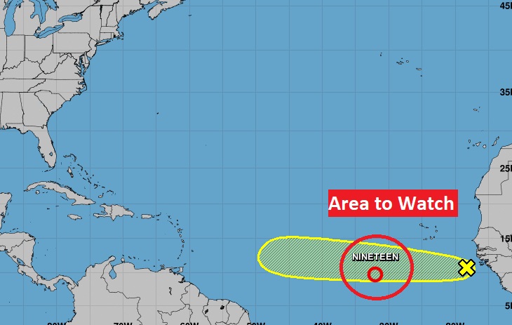
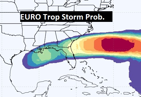
The EURO model continues to suggest that Low in the Gulf could have future tropical potential especially east of Florida. We’ll see.
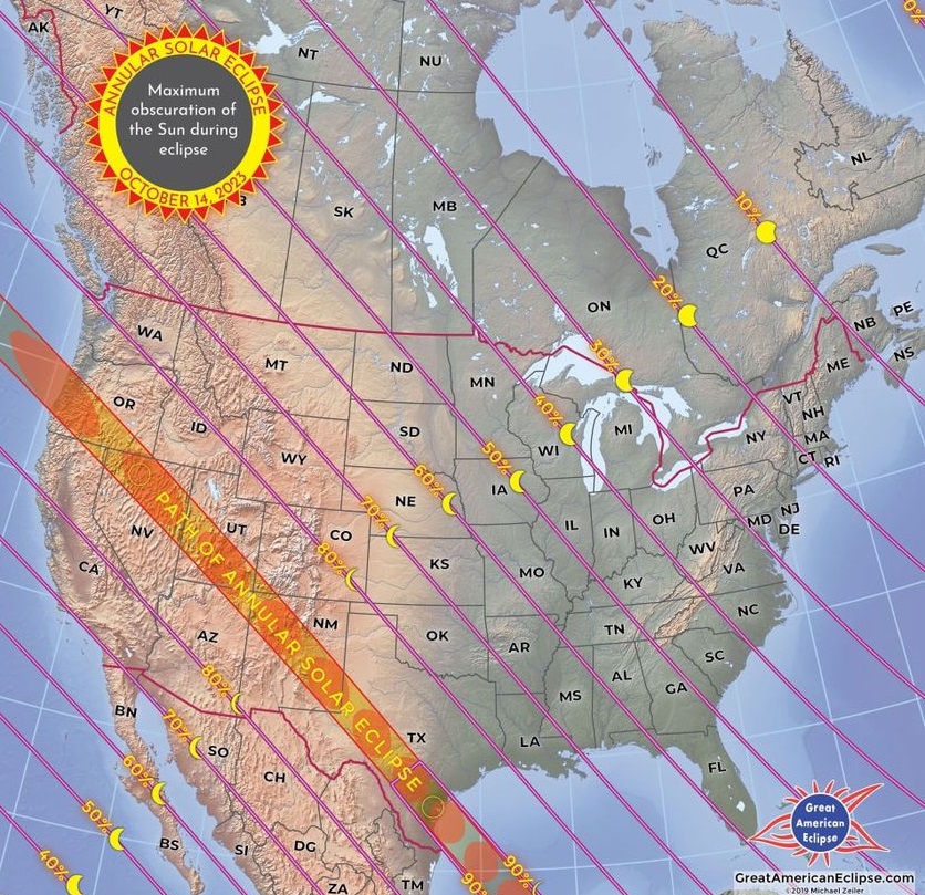
SOLAR ECLIPSE SATURDAY: Will clouds clear out in time for the Saturday’s Annular Solar Eclipse viewing? Probably. The Partial eclipse starts at 10:39. Eclipse Maximum in Montgomery 12:10 PM. End Partial Eclipse time: 1:46 PM. Do not look directly at the sun. View through protective glasses only.
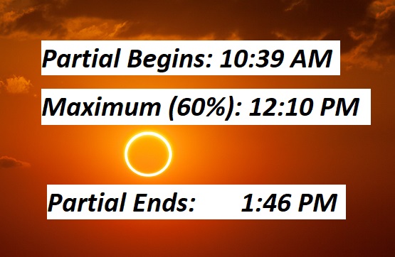
Montgomery will be close to the 60% coverage line.
Thanks for reading this Blog this morning! This morning we are LIVE on the radio from 6 to 9 on NewsTalk 93.1. I’ll have another update for you in the morning. Have a nice day!
–Rich