
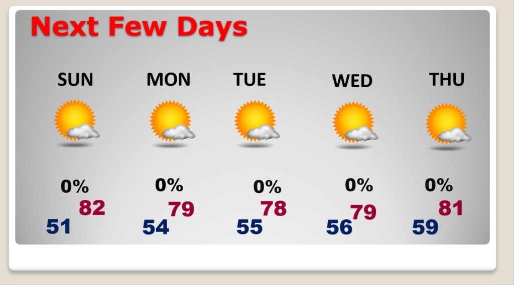
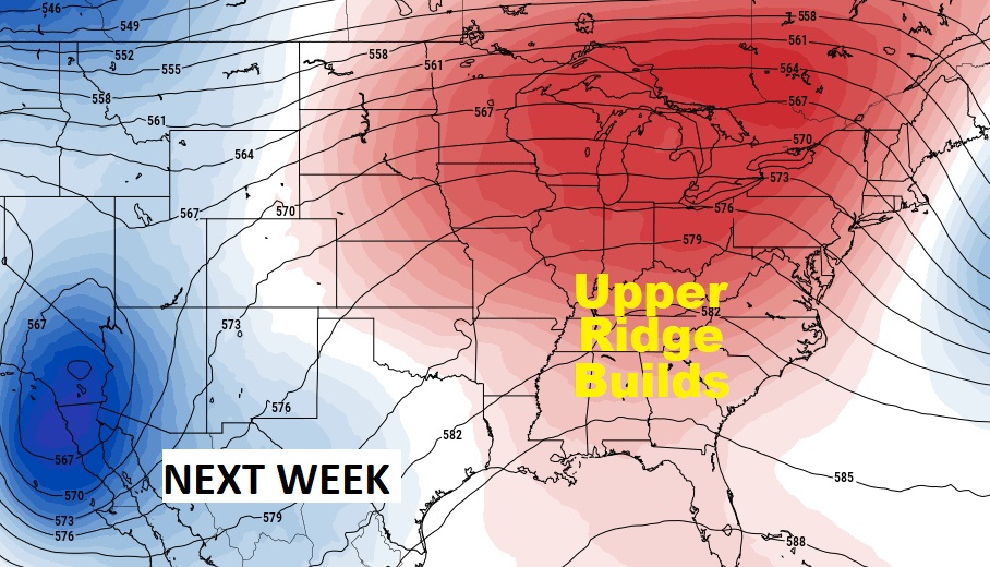
Good Morning! We’ve had great luck on our weekend weather for several weeks. This week will be no exception. Comfortable and dry. We’ll be near 80 today and Sunday, in not a little warmer. Sunshine will be abundant today. A weak dry southward moving front will help increase the clouds tonight and Sunday, but we should stay dry. A ridge of high pressure, which will develop over the Southeast US will set the stage for a quiet, comfortable, beautiful storm-free week ahead. We need rain, but there’s no rain in the forecast for the next 7 days.
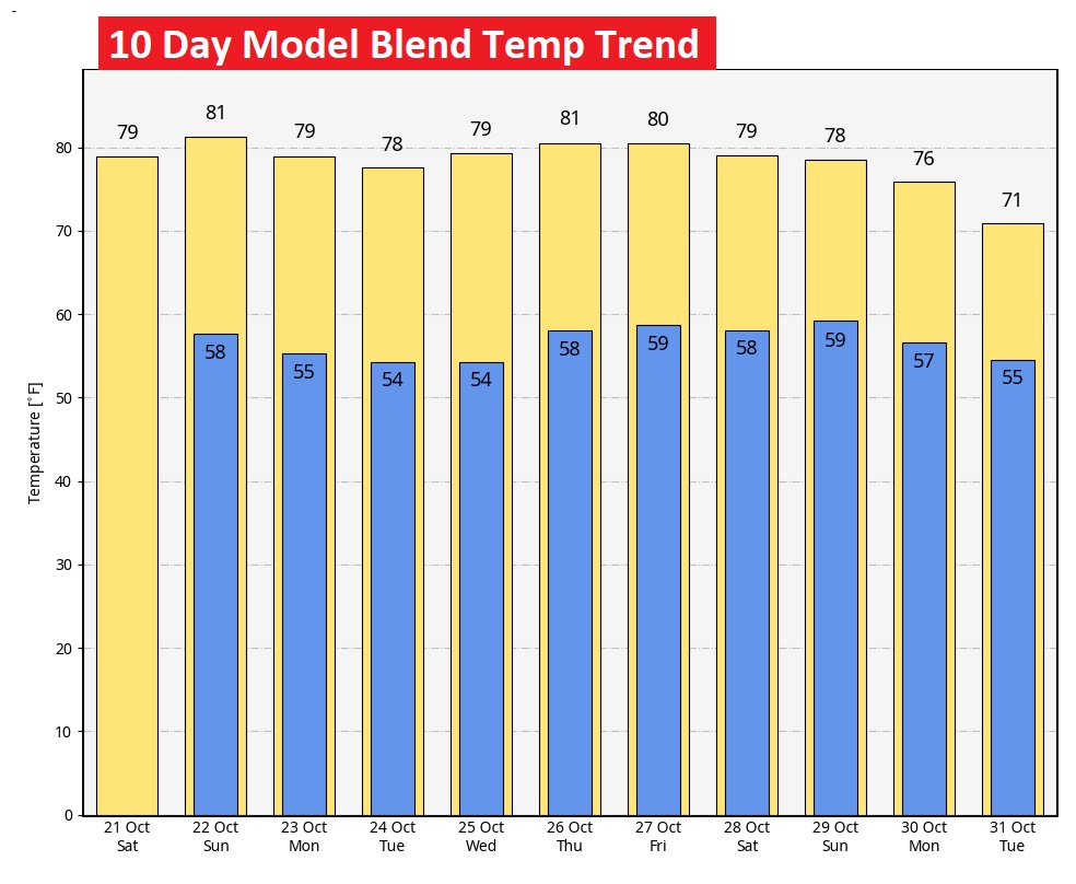
TODAY: Abundant sunshine. Comfortable. High near or above 80 again today. North wind 5 to 10. Clouds increase tonight. Mild for October. Low 58.
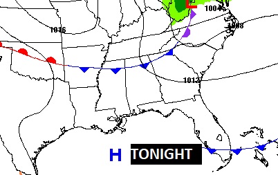
NEXT FEW DAYS: Normal high is 79, low 53. Expect a beautiful late October weekend. A weak dry southward moving front will help increase the clouds tonight and Sunday, but we should stay dry. A ridge of high pressure, which will develop over the Southeast US will set the stage for a quiet, comfortable, beautiful storm-free weekend.. Comfortable. Low 80’s Sunday. Upper 70’s early next week. We need rain, but it looks we will see another long, extended string of dry days.
. A ridge of high pressure, which will develop over the Southeast US will set the stage for a quiet, comfortable, beautiful storm-free week ahead.
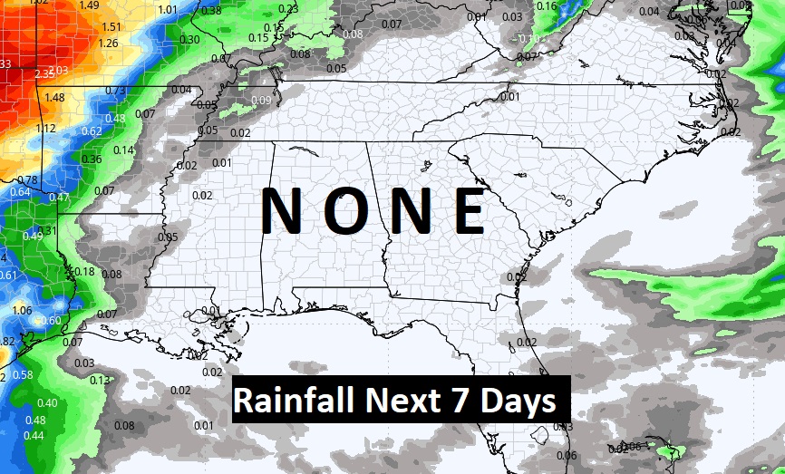
Rainfall for the next 7 Days….NONE.
Fortunately no Chilly Air in sight.
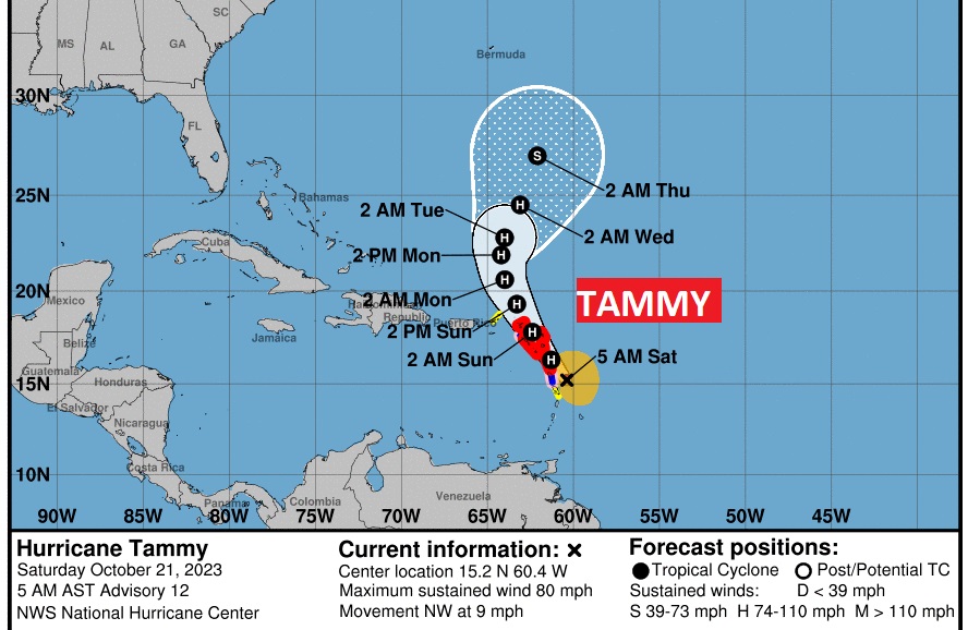
TROPICAL UPDATE: Hurricane warning for the northern Leeward Islands. 80 mph, Cat 1 Hurricane Tammy will have an encounter with the Leeward islands today, tonight and Sunday. NHC: On the forecast track, the center of Tammy will move near or over portions of the Leeward Islands through early Sunday, and then move north of the northern Leeward Islands by Sunday afternoon.
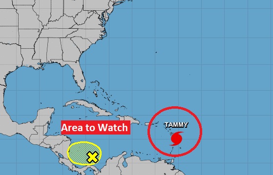
There is also that Area to Watch in the SW Caribbean.
Thanks for reading this Blog this morning! I’ll have another update for you Monday morning. Have a nice weekend!
–Rich