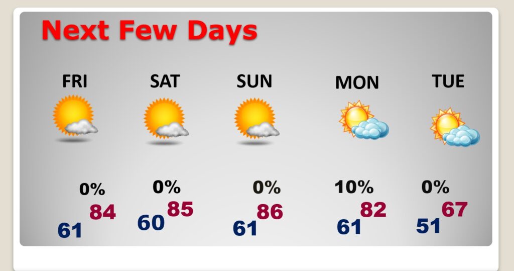
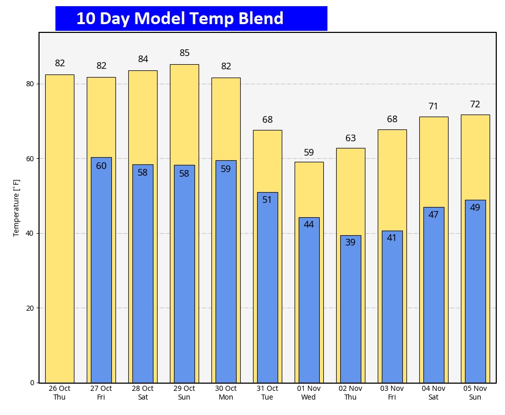
Good Morning! We’re stuck in a pattern. The big Upper High pressure dome is still in firm control. The 80+ degree weather will continue for the next few days, through the Weekend. In fact, we’ll be in the mid 80’s Friday through Sunday. There’s still no rain on the horizon, even though a Cold Front will sweep through the state Monday. Unfortunately, it looks like a dry front. But, it is an important front. It will, deliver the coldest air of the season. By Tuesday, some towns will not make it out of the 50’s with upper 30’s at night, for the first time. Here’s my brief forecast discussion.
TODAY: Mostly sunny. Comfortable. High near 84. SE wind 5 to 10 mph. Partly cloudy tonight. Low 61.
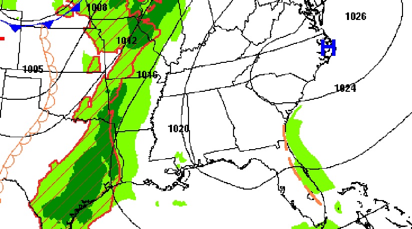
NEXT FEW DAYS: Expect a nice late October weather to continue. Comfortably warm. There’s no rain in the forecast for the next several days. That warmer than normal pattern will continue at least through Sunday. We’ll be in the mid 80’s over the weekend, with lower 60’s at night. An important Cold Front will sweep through the state Monday. Unfortunately, it looks like a dry front. It will, deliver the coldest air of the season.
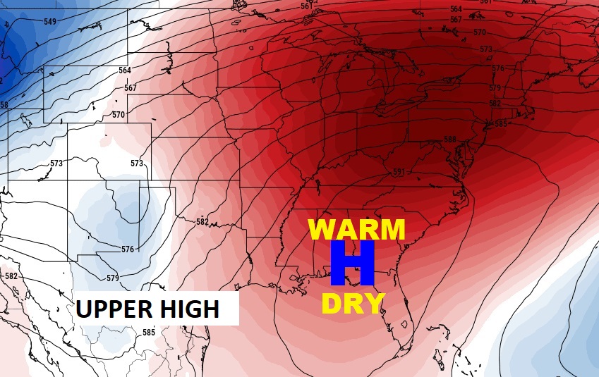
The upper High Pressure dome is still in firm control through the weekend. BUT, a significant change is on the way, You’ll feel the Big Chill by Halloween, as a trough of low pressure allows a significant shot of chilly air to flood Alabama.
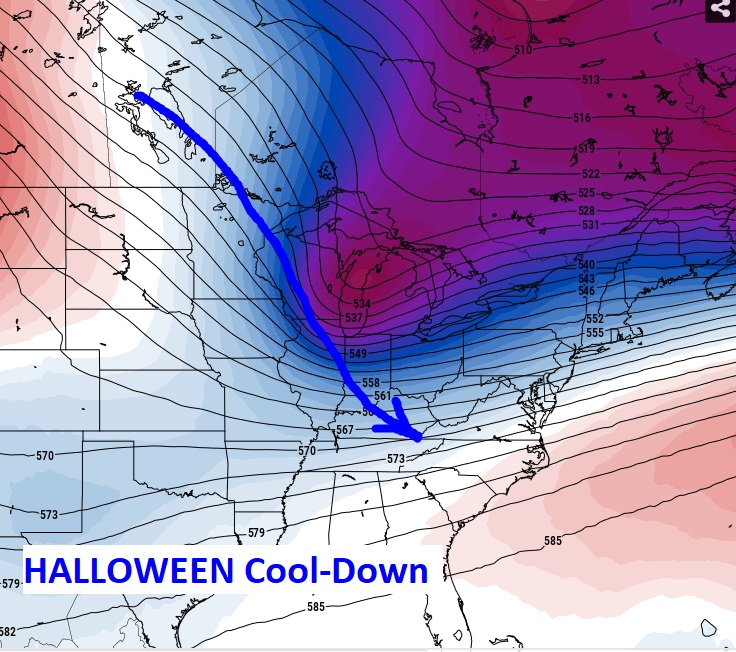
. By Tuesday, some towns will not make it out of the 50’s with upper 30’s at night, for the first time.
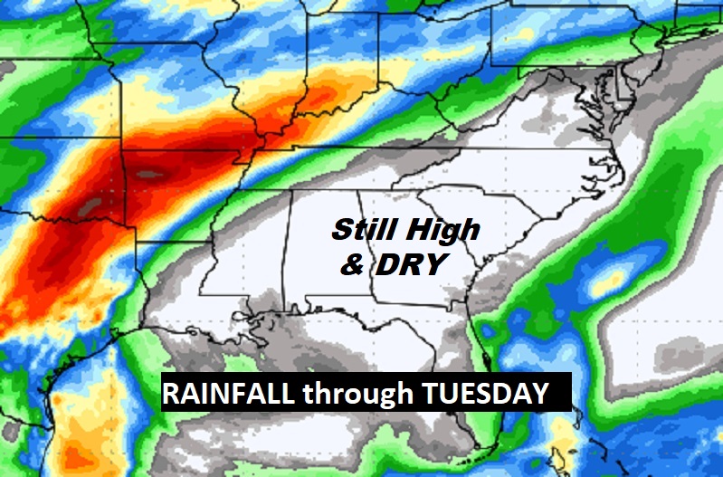
The drought continues to expand and there’s no rain on the horizon for several more days. A new Drought Monitor map comes out at 8AM this morning.
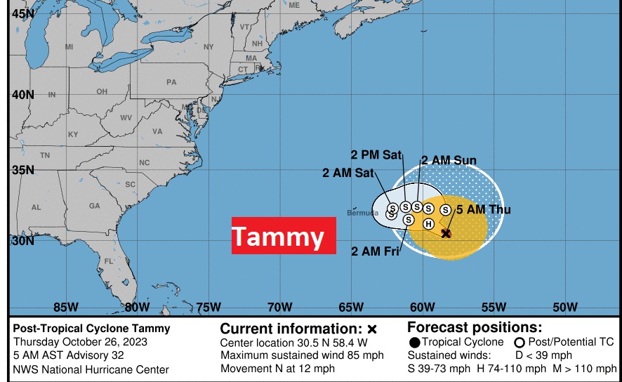
. TROPICAL UPDATE: Hurricane Tammy, with winds of 85 mph, continues moving just mill around in the Atlantic. It’s ultimate future remains uncertain.
Thanks for reading this Blog this morning! This morning we are LIVE on the radio from 6 to 9 on NewsTalk 93.1. I’ll have another update for you in the morning. Have a nice day!
–Rich
