
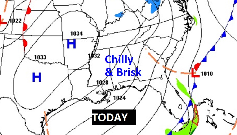
Good Morning! Welcome to November, on the coldest morning of the season so far. By Dawn we’ll be in the mid 30’s. Widespread frost is likely. It’s very likely we won’t make it out of the 50’s today. A stiff northwest wind will make it seem colder. A Freeze Warning is in effect tonight. By Dawn Thursday, we’ll be near 30. Some outlying area will, perhaps, reach the upper 20’s. Fortunately, this early cold snap won’t last too long. I think we’ll be near 70 Friday and well into the 70’s over the weekend and through Monday. Still storm-free and dry for several more days. Here’s my brief forecast discussion.
TODAY: A Cold first day of November. Brisk. Sunshine, but breezy. High 56 to 58. Northwest winds at 10 to 20 mph will add an extra bite. Freeze Warning tonight. Clear and COLD. Low near 30. First freeze of the season. Due to the fact we’re in a drought, with low humidity and gusty winds … A Red Flag Warning is in effect. No burning. The wild fire danger is high.
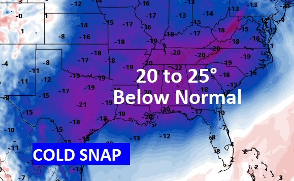
NEXT FEW DAYS: We’ll be near 30 by dawn Thursday. Not as chilly Thursday with low 60’s. Mid 30’s Thursday night. (Normal Hi/low 75/48) I think we’ll be near 70 Friday and well into the 70’s over the weekend and through Monday. Still storm-free and dry for several more days.
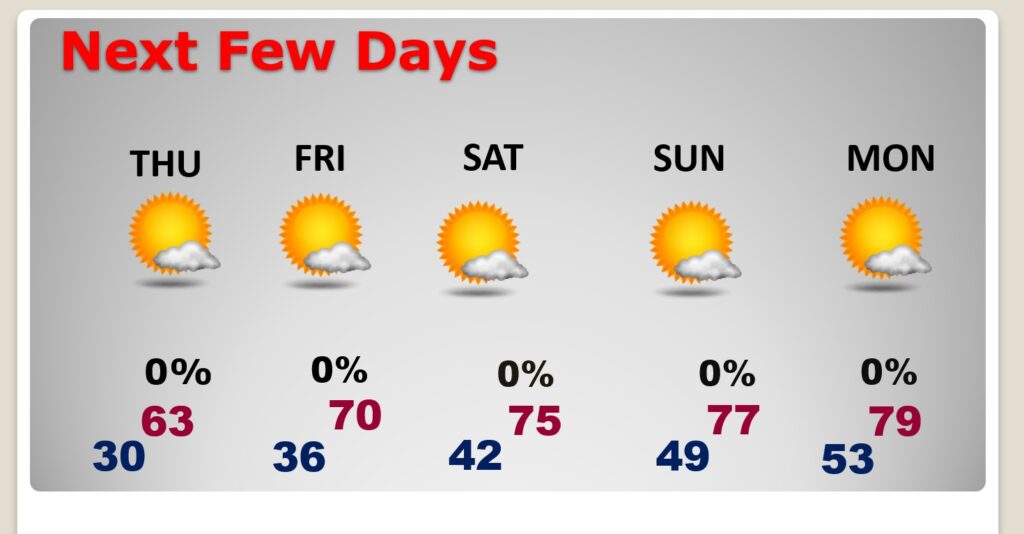
NICE weekend Warm up. Hang on. Comfortable, reasonable temperatures will return.
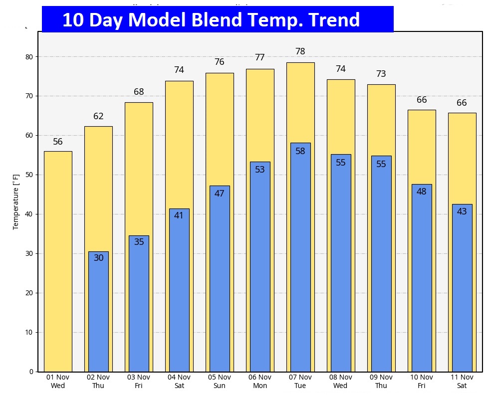
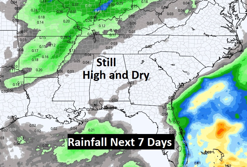
The Drought continues to expand and we’ll be High and Dry for at least the next 7 days.
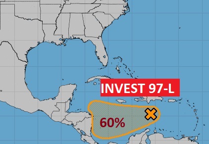
TROPICAL UPDATE: NHC is tracking Invest 97-L in the Caribbean. A tropical Depression could form in the west Caribbean later this week. 60% chance of development.
Thanks for reading this Blog this morning! This morning we are LIVE on the radio from 6 to 9 on NewsTalk 93.1. I’ll have another update for you in the morning. Have a nice day!
–Rich