
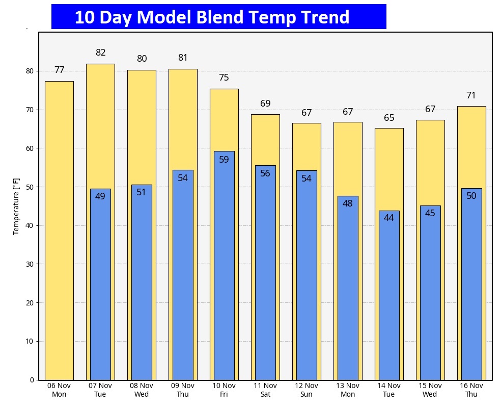
Good Morning! What a beautiful first weekend of November! Cool nights, but very comfortable days. This nice pattern will continue for the next few days. We’ll be above normal through the week ahead. Tuesday, Wednesday and Thursday we’ll be in the low to mid 80’s Not quite as warm Friday with scattered showers becoming likely. We should be dry and cooler on Veterans day Saturday. Most of the week ahead will be warm & dry. Here’s my brief forecast discussion.
TODAY: Sunshine. Warming trend construes. High near 80. (We made it to 80 Sunday) West wind at 5 to 10 mph. Clear tonight. Not quite as cool. Low near 50.
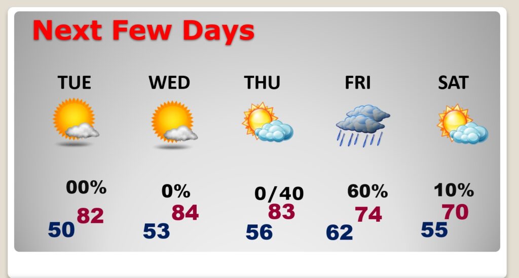
NEXT FEW DAYS: The Normal High is 74. We’ll be above normal through the week ahead Tuesday, Wednesday and Thursday we’ll be in the lower 80’s Not quite as warm Friday with showers likely. We should be dry and cooler on Veterans day, Saturday.
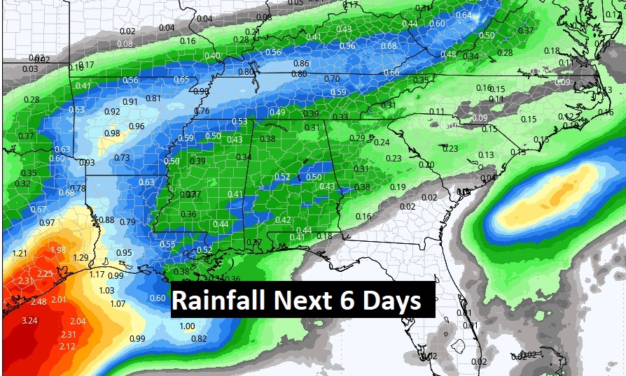
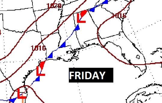
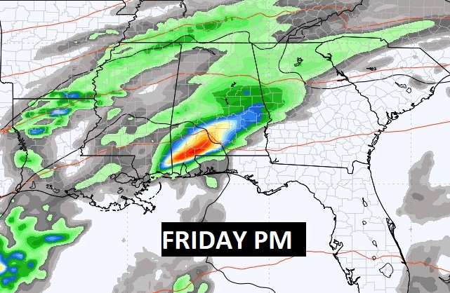
Models indicate the potential for some rainfall amounts by Friday.
No freezing temperatures expected or the next 10 days, but turning cooler by the weekend.
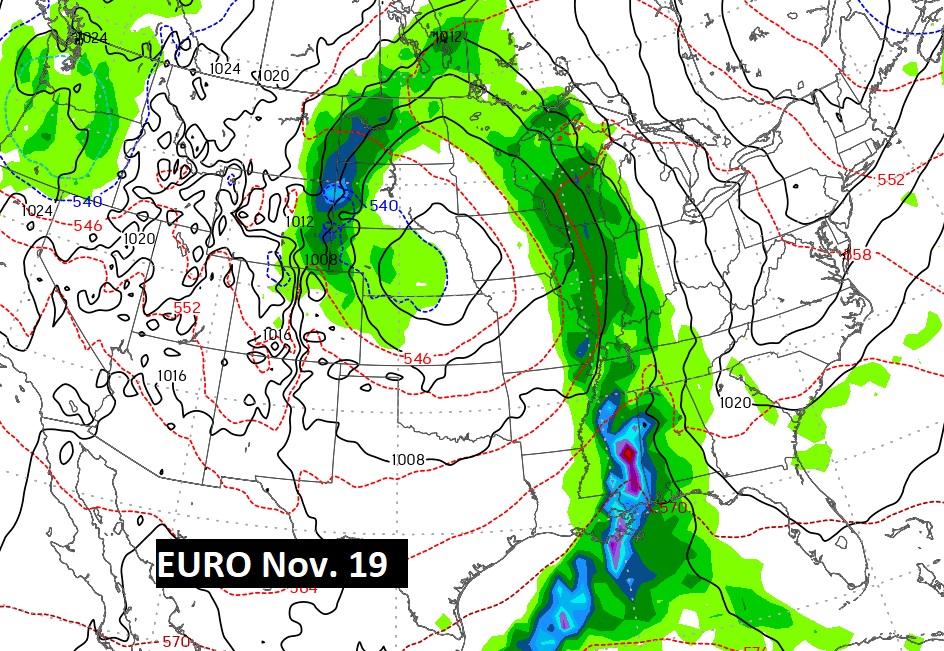
DISTANT: Both the GFS and EURO are advertising the potential for a “big deal” storm system as Thanksgiving Week begins. Severe? Maybe… Too far out.
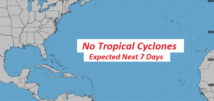
TROPICAL UPDATE: After months, finally nothing being tracked by NHC. Season ends November 30th.
Thanks for reading this Blog this morning! This morning we are LIVE on the radio from 6 to 9 on NewsTalk 93.1. I’ll have another update for you in the morning. Have a nice day!
–Rich